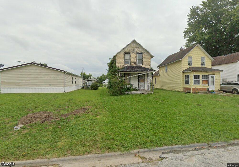
1623 Carroll St Keokuk, IA 52632
Estimated Value: $44,000 - $65,000
2
Beds
1
Bath
877
Sq Ft
$65/Sq Ft
Est. Value
About This Home
This home is located at 1623 Carroll St, Keokuk, IA 52632 and is currently estimated at $57,328, approximately $65 per square foot. 1623 Carroll St is a home with nearby schools including George Washington Elementary School, Hawthorne Elementary School, and Keokuk Middle School.
Ownership History
Date
Name
Owned For
Owner Type
Purchase Details
Closed on
Sep 16, 2024
Sold by
Davis David
Bought by
Dunek Brandy
Current Estimated Value
Purchase Details
Closed on
Aug 29, 2022
Sold by
Davis D L
Bought by
Davis David L
Purchase Details
Closed on
Aug 17, 2021
Sold by
Duncan Anthony L
Bought by
Davis D L
Purchase Details
Closed on
Mar 17, 2021
Sold by
Davis D L
Bought by
Duncan Anthony
Purchase Details
Closed on
May 18, 2017
Sold by
Schneider Raymond N and Schneider Angelica R
Bought by
Davis Dl
Create a Home Valuation Report for This Property
The Home Valuation Report is an in-depth analysis detailing your home's value as well as a comparison with similar homes in the area
Home Values in the Area
Average Home Value in this Area
Purchase History
| Date | Buyer | Sale Price | Title Company |
|---|---|---|---|
| Dunek Brandy | -- | None Listed On Document | |
| Davis David L | -- | -- | |
| Davis D L | $1,500 | None Available | |
| Duncan Anthony | $12,000 | None Available | |
| Davis Dl | -- | None Available |
Source: Public Records
Tax History Compared to Growth
Tax History
| Year | Tax Paid | Tax Assessment Tax Assessment Total Assessment is a certain percentage of the fair market value that is determined by local assessors to be the total taxable value of land and additions on the property. | Land | Improvement |
|---|---|---|---|---|
| 2024 | $324 | $12,650 | $5,330 | $7,320 |
| 2023 | $312 | $12,650 | $5,330 | $7,320 |
| 2022 | $336 | $11,170 | $5,330 | $5,840 |
| 2021 | $336 | $14,080 | $5,330 | $8,750 |
| 2020 | $332 | $13,870 | $5,650 | $8,220 |
| 2019 | $348 | $13,870 | $5,650 | $8,220 |
| 2018 | $336 | $13,080 | $0 | $0 |
| 2017 | $336 | $13,080 | $0 | $0 |
| 2016 | $330 | $13,080 | $0 | $0 |
| 2015 | $330 | $13,080 | $0 | $0 |
| 2014 | $336 | $13,080 | $0 | $0 |
Source: Public Records
Map
Nearby Homes
- 1527 Carroll St
- 1606 Des Moines St
- 1613 Des Moines St
- 1417 Ridge St
- 1329 Des Moines St
- 2017 Palean St
- 1922 Exchange St
- 1023 Palean St
- 1721 Johnson St
- 1821 Johnson St
- 1409 Johnson St
- 16 S 19th St
- 918 Carroll St
- 1829 Main St
- 902 Ridge St
- 913 Timea St
- 824 Carroll St
- 210 S 10th St
- 415 S 8th St
- 800 Bank St
- 1621 Carroll St
- 1627 Carroll St
- 1615 Carroll St
- 1618 Carroll St
- 1601 Carroll St
- 1622 Palean St
- 1628 Palean St
- 1616 Palean St
- 1612 Carroll St
- 1606 Carroll St
- 1702 Carroll St
- 614 S 16th St
- 1706 Palean St
- 712 S 17th St
- 1710 Carroll St Unit 3
- 1602 Palean St
- 1712 Carroll St
- 720 S 16th St
- 1716 Palean St
- 1721 Carroll St