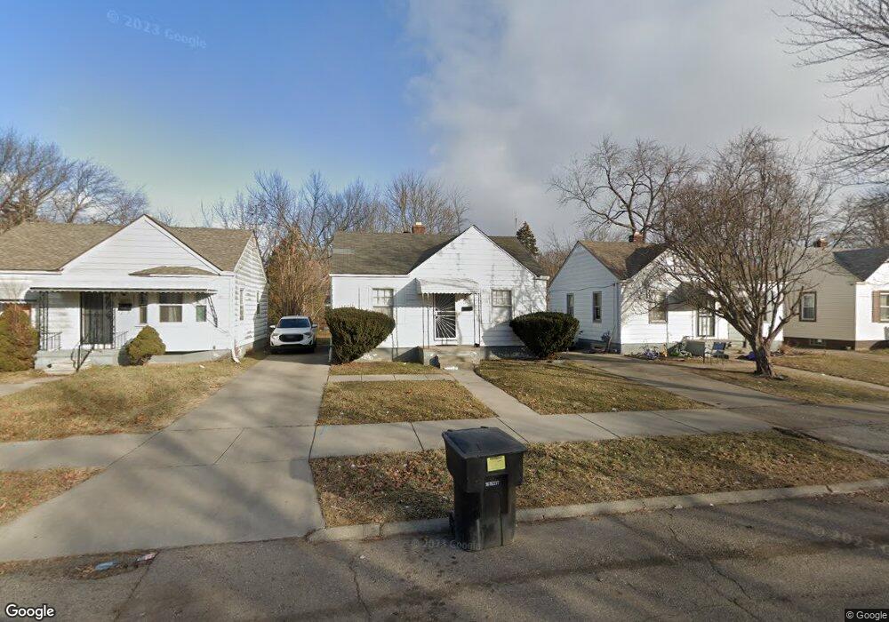
16237 Liberal St Detroit, MI 48205
Regent Park NeighborhoodEstimated Value: $57,000 - $210,292
--
Bed
1
Bath
672
Sq Ft
$154/Sq Ft
Est. Value
About This Home
This home is located at 16237 Liberal St, Detroit, MI 48205 and is currently estimated at $103,323, approximately $153 per square foot. 16237 Liberal St is a home located in Wayne County with nearby schools including Edward 'Duke' Ellington Conservatory of Music and Art, Charles L. Spain Elementary-Middle School, and Denby High School.
Ownership History
Date
Name
Owned For
Owner Type
Purchase Details
Closed on
Apr 21, 2021
Sold by
S Hagerman Mlc Rentals Llc
Bought by
Fields Antoinette
Current Estimated Value
Purchase Details
Closed on
Nov 16, 2017
Sold by
Sabree Eric R
Bought by
Hagerman S and Mlc Rentals Llc
Purchase Details
Closed on
Jul 23, 2014
Sold by
Midas Development Corp
Bought by
Liberal 16237 Llc
Create a Home Valuation Report for This Property
The Home Valuation Report is an in-depth analysis detailing your home's value as well as a comparison with similar homes in the area
Home Values in the Area
Average Home Value in this Area
Purchase History
| Date | Buyer | Sale Price | Title Company |
|---|---|---|---|
| Fields Antoinette | $17,250 | None Available | |
| Hagerman S | $1,900 | None Available | |
| Liberal 16237 Llc | $39,000 | None Available |
Source: Public Records
Tax History Compared to Growth
Tax History
| Year | Tax Paid | Tax Assessment Tax Assessment Total Assessment is a certain percentage of the fair market value that is determined by local assessors to be the total taxable value of land and additions on the property. | Land | Improvement |
|---|---|---|---|---|
| 2025 | $994 | $15,100 | $0 | $0 |
| 2024 | $994 | $12,100 | $0 | $0 |
| 2023 | $964 | $9,405 | $0 | $0 |
| 2022 | $1,062 | $9,400 | $0 | $0 |
| 2021 | $674 | $5,525 | $0 | $0 |
| 2020 | $674 | $5,600 | $0 | $0 |
| 2019 | $666 | $4,950 | $0 | $0 |
| 2018 | $602 | $4,700 | $0 | $0 |
| 2017 | $99 | $5,200 | $0 | $0 |
| 2016 | $747 | $6,700 | $0 | $0 |
| 2015 | $670 | $6,700 | $0 | $0 |
| 2013 | $744 | $7,444 | $0 | $0 |
| 2010 | -- | $21,825 | $1,058 | $20,767 |
Source: Public Records
Map
Nearby Homes
- 16221 Liberal St
- 16232 Manning St
- 16236 Liberal St
- 16274 Liberal St
- 16100 Liberal St
- 16121 Manning St
- 16077 Liberal St
- 16235 Tacoma St
- 16419 Novara St
- 16209 Tacoma St
- 16410 Novara St
- 16052 Tacoma St
- 16073 Tacoma St
- 16216 E State Fair St
- 19401 Kelly Rd
- 19605 Kelly Rd
- 16011 Tacoma St
- 19649 Kelly Rd
- 16446 E State Fair St
- 19249 Kelly Rd
- 16229 Liberal St
- 16245 Liberal St
- 16253 Liberal St
- 16211 Liberal St
- 16261 Liberal St
- 16240 Manning St
- 16267 Liberal St
- 16224 Manning St
- 16248 Manning St
- 16201 Liberal St
- 16214 Manning St
- 16256 Manning St
- 16244 Liberal St
- 16277 Liberal St
- 16220 Liberal St
- 16250 Liberal St
- 16266 Manning St
- 16204 Manning St
- 16260 Liberal St
- 16272 Manning St