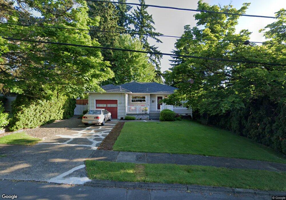
1625 Aerial Way SE Salem, OR 97302
Morningside NeighborhoodEstimated Value: $332,000 - $377,000
3
Beds
1
Bath
1,068
Sq Ft
$332/Sq Ft
Est. Value
About This Home
This home is located at 1625 Aerial Way SE, Salem, OR 97302 and is currently estimated at $355,045, approximately $332 per square foot. 1625 Aerial Way SE is a home located in Marion County with nearby schools including Morningside Elementary School, Leslie Middle School, and South Salem High School.
Ownership History
Date
Name
Owned For
Owner Type
Purchase Details
Closed on
Jan 14, 2004
Sold by
Schliecher Roger L and Schliecher Tasha D
Bought by
Keever Colleen C
Current Estimated Value
Home Financials for this Owner
Home Financials are based on the most recent Mortgage that was taken out on this home.
Original Mortgage
$105,600
Interest Rate
5.69%
Mortgage Type
Purchase Money Mortgage
Create a Home Valuation Report for This Property
The Home Valuation Report is an in-depth analysis detailing your home's value as well as a comparison with similar homes in the area
Home Values in the Area
Average Home Value in this Area
Purchase History
| Date | Buyer | Sale Price | Title Company |
|---|---|---|---|
| Keever Colleen C | $132,000 | Amerititle |
Source: Public Records
Mortgage History
| Date | Status | Borrower | Loan Amount |
|---|---|---|---|
| Previous Owner | Keever Colleen C | $105,600 |
Source: Public Records
Tax History Compared to Growth
Tax History
| Year | Tax Paid | Tax Assessment Tax Assessment Total Assessment is a certain percentage of the fair market value that is determined by local assessors to be the total taxable value of land and additions on the property. | Land | Improvement |
|---|---|---|---|---|
| 2025 | $2,999 | $157,340 | -- | -- |
| 2024 | $2,999 | $152,760 | -- | -- |
| 2023 | $2,911 | $148,320 | $0 | $0 |
| 2022 | $2,745 | $144,000 | $0 | $0 |
| 2021 | $2,666 | $139,810 | $0 | $0 |
| 2020 | $2,589 | $135,740 | $0 | $0 |
| 2019 | $2,498 | $131,790 | $0 | $0 |
| 2018 | $2,542 | $0 | $0 | $0 |
| 2017 | $2,294 | $0 | $0 | $0 |
| 2016 | $2,185 | $0 | $0 | $0 |
| 2015 | $2,202 | $0 | $0 | $0 |
| 2014 | $2,131 | $0 | $0 | $0 |
Source: Public Records
Map
Nearby Homes
- 1620 Marshall Dr SE
- 1655 Corina Dr SE
- 2010 Audubon Ave SE
- 3732 Village Center Dr SE
- 1299 Marshall Dr SE
- 2116 Audubon Ave SE
- 1290 Madrona Ave SE
- 3950 Bartholomew Place SE
- 1892 Cousteau Loop SE
- 1275 Oakhill Ave SE
- 1633 Leslie Wind Ln SE
- 4030 Cheshire Ln SE
- 4039 Village Center Dr SE
- 4072 Dornoch Ln SE
- 4059 Dornoch Ln SE
- 1714 Strong Rd SE
- 1702 Strong Rd SE
- 1710 Strong Rd SE
- 1792 Strong Rd SE
- 1720 Strong Rd SE
- 1645 Aerial Way SE
- 1595 Aerial Way SE
- 1635 Aerial Way SE
- 1630 Marshall Dr SE
- 1665 Aerial Way SE
- 1590 Marshall Dr SE
- 1650 Marshall Dr SE
- 1620 Aerial Way SE
- 1590 Aerial Way SE
- 1555 Aerial Way SE
- 1570 Marshall Dr SE
- 1630 Aerial Way SE
- 1670 Marshall Dr SE
- 1695 Aerial Way SE
- 1570 Aerial Way SE
- 1550 Marshall Dr SE
- 1640 Aerial Way SE
- 1535 Aerial Way SE
- 3575 Edward Dr SE
- 1540 Aerial Way SE