Estimated Value: $409,000 - $523,000
2
Beds
1
Bath
1,252
Sq Ft
$366/Sq Ft
Est. Value
About This Home
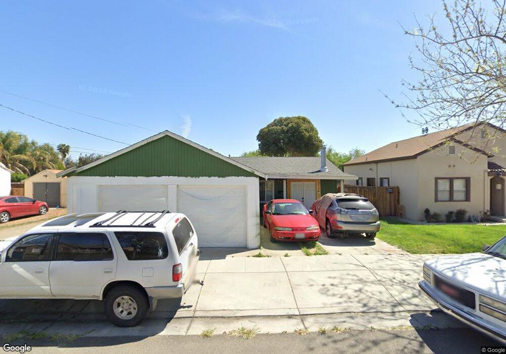
This home is located at 1626 Bessie Ave, Tracy, CA 95376 and is currently estimated at $458,054, approximately $365 per square foot. 1626 Bessie Ave is a home located in San Joaquin County with nearby schools including Central Elementary School, Monte Vista Middle School, and Tracy High School.
Ownership History
Date
Name
Owned For
Owner Type
Purchase Details
Closed on
Apr 9, 2024
Sold by
Brown Rechyl
Bought by
Rechyl Brown Revocable Trust and Brown
Current Estimated Value
Purchase Details
Closed on
Apr 29, 2022
Sold by
Brown Gordon Earn
Bought by
Brown Gordon Earn and Brown Rechyl Cantago
Purchase Details
Closed on
Apr 1, 2009
Sold by
Bank Of New York
Bought by
Brown Gordon Earl
Home Financials for this Owner
Home Financials are based on the most recent Mortgage that was taken out on this home.
Original Mortgage
$95,733
Interest Rate
4.76%
Mortgage Type
FHA
Purchase Details
Closed on
Sep 25, 2008
Sold by
Stone Timothy P and Stone Gabriela R
Bought by
The Bank Of New York
Purchase Details
Closed on
Jan 11, 1995
Sold by
Micu Samuel D and Micu Rachel D
Bought by
Stone Timothy P and Stone Gabriela R
Home Financials for this Owner
Home Financials are based on the most recent Mortgage that was taken out on this home.
Original Mortgage
$114,539
Interest Rate
9.29%
Mortgage Type
FHA
Create a Home Valuation Report for This Property
The Home Valuation Report is an in-depth analysis detailing your home's value as well as a comparison with similar homes in the area
Home Values in the Area
Average Home Value in this Area
Purchase History
| Date | Buyer | Sale Price | Title Company |
|---|---|---|---|
| Rechyl Brown Revocable Trust | -- | None Listed On Document | |
| Rechyl Brown Revocable Trust | -- | None Listed On Document | |
| Brown Gordon Earn | -- | -- | |
| Brown Gordon Earl | $97,500 | First American Title Company | |
| The Bank Of New York | $122,000 | Landsafe Title | |
| Stone Timothy P | $115,000 | Old Republic Title Company |
Source: Public Records
Mortgage History
| Date | Status | Borrower | Loan Amount |
|---|---|---|---|
| Previous Owner | Brown Gordon Earl | $95,733 | |
| Previous Owner | Stone Timothy P | $114,539 |
Source: Public Records
Tax History Compared to Growth
Tax History
| Year | Tax Paid | Tax Assessment Tax Assessment Total Assessment is a certain percentage of the fair market value that is determined by local assessors to be the total taxable value of land and additions on the property. | Land | Improvement |
|---|---|---|---|---|
| 2025 | $1,380 | $125,544 | $30,902 | $94,642 |
| 2024 | $1,271 | $123,084 | $30,297 | $92,787 |
| 2023 | $1,250 | $120,671 | $29,703 | $90,968 |
| 2022 | $1,223 | $118,306 | $29,121 | $89,185 |
| 2021 | $1,207 | $115,987 | $28,550 | $87,437 |
| 2020 | $1,199 | $114,799 | $28,258 | $86,541 |
| 2019 | $1,179 | $112,549 | $27,704 | $84,845 |
| 2018 | $1,158 | $110,343 | $27,161 | $83,182 |
| 2017 | $1,099 | $108,180 | $26,629 | $81,551 |
| 2016 | $1,110 | $106,060 | $26,107 | $79,953 |
| 2014 | $1,036 | $102,422 | $25,212 | $77,210 |
Source: Public Records
Map
Nearby Homes
- 1561 Bessie Ave
- 535 W Carlton Way
- 262 W Lowell Ave
- 242 W Lowell Ave
- 228 W Lowell Ave
- 1930 Wall St
- 1228 Bessie Ave
- 1792 Chester Dr
- 2192 Wildflower Ct
- 1212 Walnut St
- 1300 Richard Dr
- 2214 Morningside Ct
- 546 W Grant Line Rd
- 16 Pereira Ave
- 34 Pereira Ave
- 2840-2896 Holly Dr
- 37 W 12th St
- 1427 Audrey Dr
- 110 W 23rd St
- 1865 Newport Ct
- 1622 Bessie Ave
- 1640 Bessie Ave
- 447 W Carlton Way
- 495 W Carlton Way
- 485 W Carlton Way
- 1650 Bessie Ave
- 437 W Carlton Way
- 1639 Bessie Ave
- 1658 Bessie Ave
- 427 W Carlton Way
- 501 W Carlton Way
- 1627 Bessie Ave
- 1651 Wall St
- 1623 Bessie Ave
- 425 W Carlton Way
- 460 W Lowell Ave
- 1668 Bessie Ave
- 490 W Carlton Way
- 533 W Carlton Way
- 533 W Carlton Way