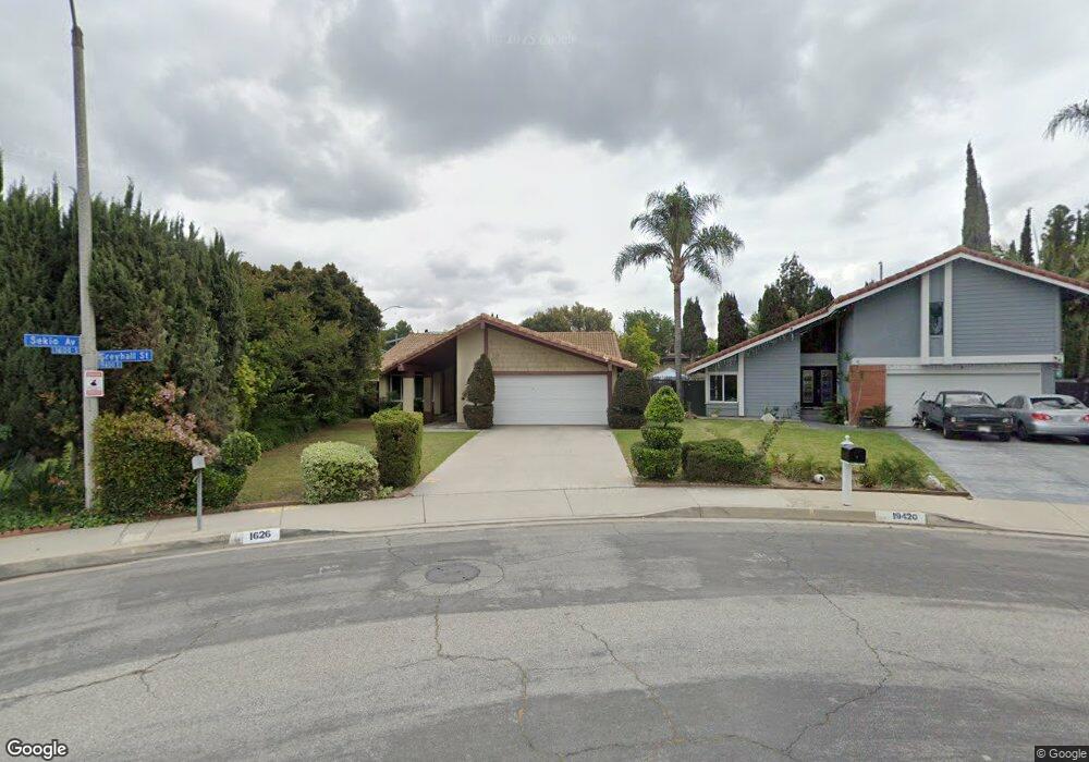
1626 Sekio Ave Rowland Heights, CA 91748
Estimated Value: $942,469 - $958,000
4
Beds
2
Baths
1,680
Sq Ft
$567/Sq Ft
Est. Value
About This Home
This home is located at 1626 Sekio Ave, Rowland Heights, CA 91748 and is currently estimated at $952,867, approximately $567 per square foot. 1626 Sekio Ave is a home located in Los Angeles County with nearby schools including Ybarra Academy For The Arts And Technology, John A. Rowland High School, and California University Preparatory School.
Ownership History
Date
Name
Owned For
Owner Type
Purchase Details
Closed on
May 28, 2025
Sold by
Wang Sandy C L and Wang Sandy Chun
Bought by
Sandy Chun Ling Wang Revocable Living Trust and Wang
Current Estimated Value
Purchase Details
Closed on
May 8, 2013
Sold by
Wang Sandy C L and Wang Sandy
Bought by
Wang Sandy C L
Home Financials for this Owner
Home Financials are based on the most recent Mortgage that was taken out on this home.
Original Mortgage
$317,800
Interest Rate
3.5%
Mortgage Type
New Conventional
Purchase Details
Closed on
Sep 13, 2006
Sold by
Sung Raymond T H and Wang Sandy
Bought by
Wang Sandy
Create a Home Valuation Report for This Property
The Home Valuation Report is an in-depth analysis detailing your home's value as well as a comparison with similar homes in the area
Home Values in the Area
Average Home Value in this Area
Purchase History
| Date | Buyer | Sale Price | Title Company |
|---|---|---|---|
| Sandy Chun Ling Wang Revocable Living Trust | -- | None Listed On Document | |
| Wang Sandy C L | -- | Ort | |
| Wang Sandy | -- | None Available |
Source: Public Records
Mortgage History
| Date | Status | Borrower | Loan Amount |
|---|---|---|---|
| Previous Owner | Wang Sandy C L | $317,800 |
Source: Public Records
Tax History Compared to Growth
Tax History
| Year | Tax Paid | Tax Assessment Tax Assessment Total Assessment is a certain percentage of the fair market value that is determined by local assessors to be the total taxable value of land and additions on the property. | Land | Improvement |
|---|---|---|---|---|
| 2025 | $5,100 | $389,007 | $193,267 | $195,740 |
| 2024 | $5,100 | $381,380 | $189,478 | $191,902 |
| 2023 | $4,934 | $373,903 | $185,763 | $188,140 |
| 2022 | $4,824 | $366,572 | $182,121 | $184,451 |
| 2021 | $4,739 | $359,385 | $178,550 | $180,835 |
| 2019 | $4,598 | $348,727 | $173,255 | $175,472 |
| 2018 | $4,368 | $341,890 | $169,858 | $172,032 |
| 2016 | $4,193 | $328,615 | $163,263 | $165,352 |
| 2015 | $4,125 | $323,680 | $160,811 | $162,869 |
| 2014 | $4,119 | $317,340 | $157,661 | $159,679 |
Source: Public Records
Map
Nearby Homes
- 1703 Hollandale Ave
- 19527 Cronin Dr
- 1560 Otterbein Ave Unit 8
- 1560 Otterbein Ave Unit 12
- 1560 S Otterbein Ave Unit 44
- 1560 S Otterbein Ave Unit 153
- 1560 S Otterbein Ave Unit 113
- 1560 S Otterbein Ave Unit 170
- 1953 Camwood Ave
- 1337 Brea Canyon Cutoff Rd
- 19717 Katrine Cir
- 1919 Brea Canyon Cut-Off Rd
- 18985 Radby St
- 1816 Nowell Ave
- 2147 Wind River Ln
- 1842 Bolanos Ave
- 2189 Wind River Ln
- 2366 Pepperdale Dr
- 20122 Candleflame Ct
- 2033 Bolanos Ave
- 19420 Greyhall St
- 1635 Nausika Ave
- 1618 Sekio Ave
- 1627 Nausika Ave
- 19416 Greyhall St
- 1621 Nausika Ave
- 19410 Greyhall St
- 1612 Sekio Ave
- 1619 Sekio Ave
- 19453 Pilario St
- 19447 Pilario St
- 1615 Nausika Ave
- 19396 Greyhall St
- 19459 Pilario St
- 19443 Pilario St
- 1634 Nausika Ave
- 1615 Sekio Ave
- 1626 Nausika Ave
- 19402 Bluffwood St
- 19408 Bluffwood St