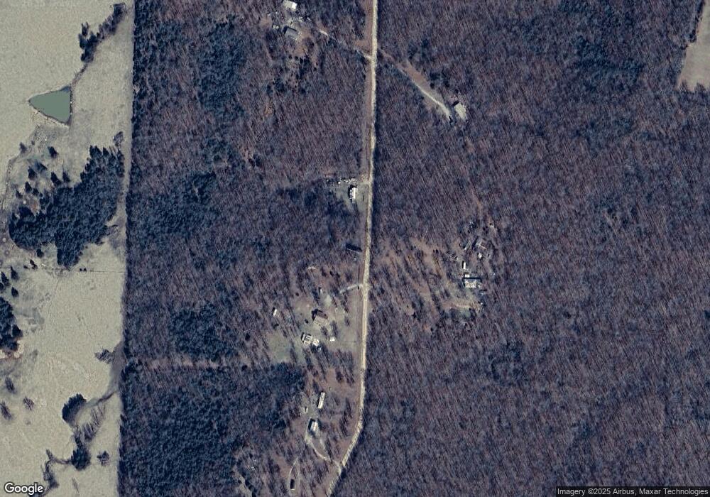
1626 Sierra Loop Pocahontas, AR 72455
Estimated Value: $108,000 - $170,000
Studio
2
Baths
1,500
Sq Ft
$91/Sq Ft
Est. Value
About This Home
This home is located at 1626 Sierra Loop, Pocahontas, AR 72455 and is currently estimated at $136,841, approximately $91 per square foot. 1626 Sierra Loop is a home located in Randolph County with nearby schools including Maynard Elementary School and Maynard High School.
Ownership History
Date
Name
Owned For
Owner Type
Purchase Details
Closed on
Oct 26, 2018
Sold by
Barron Eugenio and Barron Retha
Bought by
Warren Melvin and Warren Corey
Current Estimated Value
Home Financials for this Owner
Home Financials are based on the most recent Mortgage that was taken out on this home.
Original Mortgage
$101,242
Outstanding Balance
$88,477
Interest Rate
4.6%
Mortgage Type
New Conventional
Estimated Equity
$48,364
Purchase Details
Closed on
Jan 19, 2016
Bought by
Barron To Barron
Purchase Details
Closed on
Jul 29, 1999
Bought by
Verhaeghe To Barron
Create a Home Valuation Report for This Property
The Home Valuation Report is an in-depth analysis detailing your home's value as well as a comparison with similar homes in the area
Purchase History
| Date | Buyer | Sale Price | Title Company |
|---|---|---|---|
| Warren Melvin | $97,500 | None Available | |
| Barron To Barron | -- | -- | |
| Verhaeghe To Barron | $9,000 | -- |
Source: Public Records
Mortgage History
| Date | Status | Borrower | Loan Amount |
|---|---|---|---|
| Open | Warren Melvin | $101,242 |
Source: Public Records
Tax History
| Year | Tax Paid | Tax Assessment Tax Assessment Total Assessment is a certain percentage of the fair market value that is determined by local assessors to be the total taxable value of land and additions on the property. | Land | Improvement |
|---|---|---|---|---|
| 2025 | $9 | $13,455 | $810 | $12,645 |
| 2024 | $48 | $13,455 | $810 | $12,645 |
| 2023 | $123 | $13,455 | $810 | $12,645 |
| 2022 | $174 | $13,455 | $810 | $12,645 |
| 2021 | $174 | $13,455 | $810 | $12,645 |
| 2020 | $162 | $13,150 | $820 | $12,330 |
| 2019 | $160 | $13,150 | $820 | $12,330 |
| 2018 | $180 | $13,150 | $820 | $12,330 |
| 2017 | $198 | $14,490 | $865 | $13,625 |
| 2016 | $124 | $14,320 | $865 | $13,455 |
| 2015 | $104 | $14,320 | $865 | $13,455 |
| 2014 | $61 | $14,320 | $865 | $13,455 |
Source: Public Records
Map
Nearby Homes
- 1580 Sierra Loop
- 1566 Wallace Loop Rd
- 8673 Highway 251
- TBD Saienni Rd
- 0 Blackwell Den Rd
- 127 Hamil Rd
- 2866 Stokes Rd
- TBD Brakebill Rd
- 1815 Stubblefield Rd
- 0 Cokley Rd
- 0000 Cokley Rd
- 4018 Country Club Rd
- 808 Coyote Trail
- 339 Township Rd
- 320 Griffin Rd
- 85 Baker Den Rd
- TBD Springview Rd
- 5873 Highway 90 W
- 8771 Arkansas 115
- 16538 Arkansas 115
- 1254 Sierra Loop
- 1245 Sierra Loop
- 1625 Sierra Loop
- 1818 Sierra Loop
- 845 Sierra Loop
- 830 Sierra Loop
- 3049 Sierra Loop
- 1102 Wallace Loop Rd
- 968 Wallace Loop Rd
- 1192 Wallace Loop Rd
- 627 Sierra Loop
- 3428 Sierra Loop
- 1396 Wallace Loop Rd
- 2115 Sierra Loop
- 432 Wallace Loop Rd
- 2080 Sierra Loop
- 1763 Wallace Loop Rd
Your Personal Tour Guide
Ask me questions while you tour the home.
