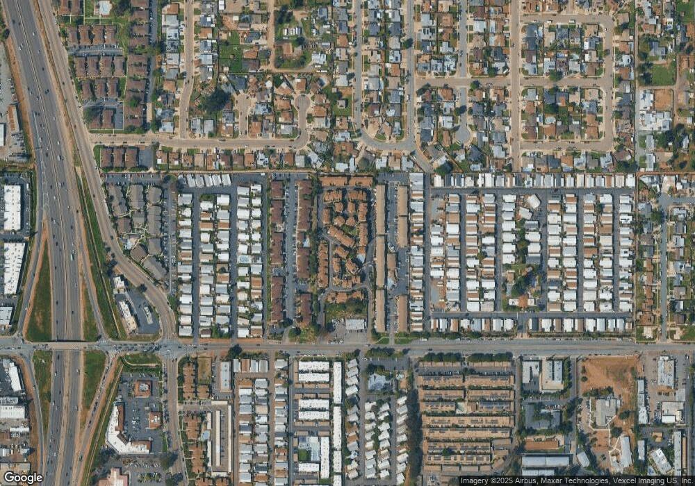
1626 Stone Edge Cir El Cajon, CA 92021
Bostonia NeighborhoodEstimated Value: $493,000 - $528,000
2
Beds
2
Baths
1,138
Sq Ft
$445/Sq Ft
Est. Value
About This Home
This home is located at 1626 Stone Edge Cir, El Cajon, CA 92021 and is currently estimated at $506,314, approximately $444 per square foot. 1626 Stone Edge Cir is a home located in San Diego County with nearby schools including Magnolia Elementary School, Greenfield Middle School, and Santana High School.
Ownership History
Date
Name
Owned For
Owner Type
Purchase Details
Closed on
May 11, 2019
Sold by
Lane Randall A and Lane Geri L
Bought by
The Lane Family Trust
Current Estimated Value
Purchase Details
Closed on
Oct 2, 2000
Sold by
Michelle Bates
Bought by
Lane Randy and Lane Geri
Home Financials for this Owner
Home Financials are based on the most recent Mortgage that was taken out on this home.
Original Mortgage
$141,780
Outstanding Balance
$51,595
Interest Rate
7.89%
Mortgage Type
VA
Estimated Equity
$454,719
Purchase Details
Closed on
Sep 25, 1997
Sold by
Johnson Todd K
Bought by
Bates Michelle
Home Financials for this Owner
Home Financials are based on the most recent Mortgage that was taken out on this home.
Original Mortgage
$89,760
Interest Rate
7.31%
Mortgage Type
VA
Purchase Details
Closed on
Aug 6, 1987
Purchase Details
Closed on
May 31, 1983
Create a Home Valuation Report for This Property
The Home Valuation Report is an in-depth analysis detailing your home's value as well as a comparison with similar homes in the area
Home Values in the Area
Average Home Value in this Area
Purchase History
| Date | Buyer | Sale Price | Title Company |
|---|---|---|---|
| The Lane Family Trust | -- | None Available | |
| Lane Randall A | -- | None Available | |
| Lane Randy | $139,000 | Lawyers Title | |
| Bates Michelle | $88,000 | Stewart Title | |
| -- | $70,000 | -- | |
| -- | $67,800 | -- |
Source: Public Records
Mortgage History
| Date | Status | Borrower | Loan Amount |
|---|---|---|---|
| Open | Lane Randy | $141,780 | |
| Previous Owner | Bates Michelle | $89,760 |
Source: Public Records
Tax History Compared to Growth
Tax History
| Year | Tax Paid | Tax Assessment Tax Assessment Total Assessment is a certain percentage of the fair market value that is determined by local assessors to be the total taxable value of land and additions on the property. | Land | Improvement |
|---|---|---|---|---|
| 2025 | $2,489 | $209,438 | $64,864 | $144,574 |
| 2024 | $2,489 | $205,333 | $63,593 | $141,740 |
| 2023 | $2,421 | $201,308 | $62,347 | $138,961 |
| 2022 | $2,378 | $197,362 | $61,125 | $136,237 |
| 2021 | $2,347 | $193,493 | $59,927 | $133,566 |
| 2020 | $2,323 | $191,510 | $59,313 | $132,197 |
| 2019 | $2,296 | $187,755 | $58,150 | $129,605 |
| 2018 | $2,256 | $184,074 | $57,010 | $127,064 |
| 2017 | $594 | $180,466 | $55,893 | $124,573 |
| 2016 | $2,134 | $176,929 | $54,798 | $122,131 |
| 2015 | $2,116 | $174,272 | $53,975 | $120,297 |
| 2014 | $2,073 | $170,859 | $52,918 | $117,941 |
Source: Public Records
Map
Nearby Homes
- 1673 Stone Edge Cir
- 260 E Bradley Ave Unit SPC 51
- 260 E Bradley Ave
- 450 E Bradley Ave
- 450 E Bradley Ave Unit 157
- 450 E Bradley Ave Unit 36
- 450 E Bradley Ave Unit 127
- 450 E Bradley Ave Unit 106
- 450 E Bradley Ave Unit 144
- 450 E Bradley Ave Unit 116
- 321 Sun Ct
- 411 Danny St
- 255 E Bradley Ave Unit 116
- 255 E Bradley Ave Unit 56
- 255 E Bradley Ave Unit 108
- 255 E Bradley Ave Unit 23
- 255 E Bradley Ave Unit 35
- 255 E Bradley Ave Unit SPC 79
- 255 E Bradley Ave Unit 14
- 351 E Bradley Ave Unit 19
- 1517 Stone Edge Cir
- 1510 Stone Edge Cir
- 382 Lucy Ln Unit 20
- 364 Lucy Ln
- 1644 Stone Edge Cir
- 393 Lucy Ln
- 379 Stone Edge Dr
- 331 Stone Edge Ct
- 365 Stone Edge Ct
- 1505 Stone Edge Cir Unit 16
- 1542 Stone Edge Cir
- 398 Stone Edge Dr
- 334 Stone Edge Dr Unit 28
- 1631 Stone Edge Cir
- 1643 Stone Edge Cir
- 1679 Stone Edge Cir
- 335 Lucy Ln
- 376 Lucy Ln
- 352 Lucy Ln
- 313 Lucy Ln
