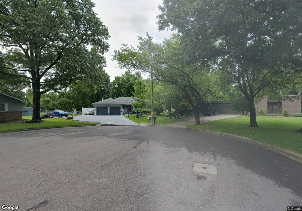
1626 Trowman Way Emporia, KS 66801
Estimated Value: $263,000 - $309,000
4
Beds
4
Baths
1,724
Sq Ft
$167/Sq Ft
Est. Value
About This Home
This home is located at 1626 Trowman Way, Emporia, KS 66801 and is currently estimated at $287,119, approximately $166 per square foot. 1626 Trowman Way is a home located in Lyon County with nearby schools including Village Elementary School, Emporia Middle School, and Emporia High School.
Ownership History
Date
Name
Owned For
Owner Type
Purchase Details
Closed on
Mar 1, 2018
Sold by
Dougherty John A
Bought by
Felts Michael B
Current Estimated Value
Home Financials for this Owner
Home Financials are based on the most recent Mortgage that was taken out on this home.
Original Mortgage
$80,000
Outstanding Balance
$67,992
Interest Rate
4.04%
Mortgage Type
New Conventional
Estimated Equity
$219,127
Purchase Details
Closed on
Oct 1, 2003
Bought by
Dougherty John and Cotterman Deborah R
Create a Home Valuation Report for This Property
The Home Valuation Report is an in-depth analysis detailing your home's value as well as a comparison with similar homes in the area
Home Values in the Area
Average Home Value in this Area
Purchase History
| Date | Buyer | Sale Price | Title Company |
|---|---|---|---|
| Felts Michael B | $100,000 | -- | |
| Dougherty John | $175,000 | -- |
Source: Public Records
Mortgage History
| Date | Status | Borrower | Loan Amount |
|---|---|---|---|
| Open | Felts Michael B | $80,000 |
Source: Public Records
Tax History Compared to Growth
Tax History
| Year | Tax Paid | Tax Assessment Tax Assessment Total Assessment is a certain percentage of the fair market value that is determined by local assessors to be the total taxable value of land and additions on the property. | Land | Improvement |
|---|---|---|---|---|
| 2025 | $5,223 | $33,419 | $4,147 | $29,272 |
| 2024 | $5,223 | $31,924 | $4,147 | $27,777 |
| 2023 | $5,116 | $30,958 | $3,428 | $27,530 |
| 2022 | $4,330 | $27,081 | $4,023 | $23,058 |
| 2021 | $3,675 | $23,181 | $4,023 | $19,158 |
| 2020 | $3,713 | $22,506 | $3,864 | $18,642 |
| 2019 | $3,713 | $22,506 | $3,864 | $18,642 |
| 2018 | $3,503 | $21,172 | $3,864 | $17,308 |
| 2017 | $3,605 | $21,701 | $3,864 | $17,837 |
| 2016 | $3,145 | $18,952 | $3,925 | $15,027 |
| 2015 | -- | $19,826 | $4,024 | $15,802 |
| 2014 | -- | $19,090 | $3,067 | $16,023 |
Source: Public Records
Map
Nearby Homes
- 1702 Trowman Way
- 1707 Trowman Way
- 1720 Trowman Way
- 1225 Presby Dr
- 1327 Lawrence St
- 1304 Chestnut St
- 1405 Lincoln St
- 1242 Lawrence St
- 1516 West St
- 1218 Garfield St
- 930 Huntington Rd
- 1225 West St
- 1545 W 20th Park Place
- 1614 W 12th Ave
- 1615 E Wilman Ct
- 1216 West St
- 1105 Washington St
- 1427 Neosho St
- 922 Chestnut St
- 916 Garfield St
- 1625 Trowman Way
- 1707 Yucca Ln
- 1120 W 15th Ave
- 1708 Trowman Way
- 1114 W 15th Ave
- 1106 W 15th Ave
- 1701 Trowman Way
- 1711 Yucca Ln
- 1102 W 15th Ave
- 1208 W 15th Ave
- 1714 Trowman Way
- 1713 Trowman Way
- 1701 Yucca Ln
- 1713 Yucca Ln
- 1726 Old Manor Rd
- 1306 W 15th Ave
- 1719 Trowman Way
- 1702 Yucca Ln
- 1720 Old Manor Rd
- 1710 Yucca Ln