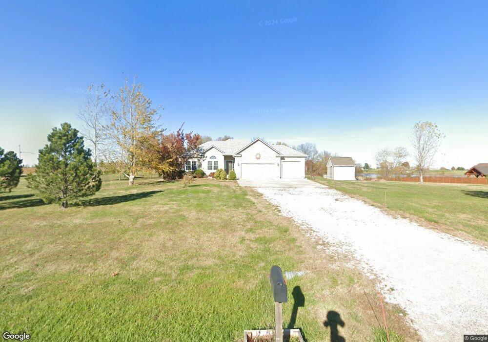
16260 Hollie Cir Leavenworth, KS 66048
Estimated Value: $465,000 - $514,000
4
Beds
3
Baths
1,580
Sq Ft
$309/Sq Ft
Est. Value
About This Home
This home is located at 16260 Hollie Cir, Leavenworth, KS 66048 and is currently estimated at $487,495, approximately $308 per square foot. 16260 Hollie Cir is a home located in Leavenworth County with nearby schools including Lansing Elementary School, Lansing Middle 6-8, and Lansing High 9-12.
Ownership History
Date
Name
Owned For
Owner Type
Purchase Details
Closed on
Feb 28, 2011
Sold by
Wyatt Homes Inc
Bought by
Hollister Eric and Hollister Carrie
Current Estimated Value
Home Financials for this Owner
Home Financials are based on the most recent Mortgage that was taken out on this home.
Original Mortgage
$275,805
Outstanding Balance
$188,700
Interest Rate
4.7%
Mortgage Type
VA
Estimated Equity
$298,795
Create a Home Valuation Report for This Property
The Home Valuation Report is an in-depth analysis detailing your home's value as well as a comparison with similar homes in the area
Home Values in the Area
Average Home Value in this Area
Purchase History
| Date | Buyer | Sale Price | Title Company |
|---|---|---|---|
| Hollister Eric | $270,288 | Mccaffree-Short Title Co Inc |
Source: Public Records
Mortgage History
| Date | Status | Borrower | Loan Amount |
|---|---|---|---|
| Open | Hollister Eric | $275,805 |
Source: Public Records
Tax History Compared to Growth
Tax History
| Year | Tax Paid | Tax Assessment Tax Assessment Total Assessment is a certain percentage of the fair market value that is determined by local assessors to be the total taxable value of land and additions on the property. | Land | Improvement |
|---|---|---|---|---|
| 2025 | $5,708 | $52,244 | $8,408 | $43,836 |
| 2024 | $5,292 | $50,234 | $10,357 | $39,877 |
| 2023 | $5,292 | $48,772 | $10,357 | $38,415 |
| 2022 | $5,276 | $46,816 | $7,783 | $39,033 |
| 2021 | $4,639 | $40,710 | $7,783 | $32,927 |
| 2020 | $4,342 | $37,478 | $7,783 | $29,695 |
| 2019 | $4,350 | $37,478 | $7,783 | $29,695 |
| 2018 | $3,830 | $33,062 | $7,783 | $25,279 |
| 2017 | $3,692 | $32,050 | $7,783 | $24,267 |
| 2016 | $3,687 | $32,050 | $7,783 | $24,267 |
| 2015 | $3,516 | $30,705 | $7,794 | $22,911 |
| 2014 | $3,388 | $30,130 | $7,794 | $22,336 |
Source: Public Records
Map
Nearby Homes
- 16430 Dana Ln
- 00000 Gilman Rd
- 24450 171st St
- Lot 6 163rd St
- 25770 Tonganoxie Dr
- 25030 177th Terrace
- 17860 Clearview Dr
- 25055 Woodridge Cir
- 1221 S Desoto Rd
- 15280 Roger Rd
- 833 Rock Creek Dr
- 875 Clearview Dr
- 000 4-H Rd
- 705 Rock Creek Dr
- 811 4-H Rd
- 15331 Price Rd
- 922 Southfork St
- 115 W Gilman Rd
- 722 Bittersweet Rd
- 624 S Bittersweet Ln
- 16220 Hollie Cir
- 24802 163rd St
- 16261 Hollie Cir
- 16221 Hollie Cir
- 24830 163rd St
- 16260 Leo Cir
- 16220 Leo Cir
- 24902 163rd St
- 24673 163rd St
- 24747 163rd St
- 16261 Leo Cir
- 24785 163rd St
- 16221 Leo Cir
- 24649 163rd St
- 24964 160th Ct
- 16291 Nicole Ln
- 16261 Nicole Ln
- 16211 Nicole Ln
- 16287 Nicole Ln
- 00000 Hollie Cir