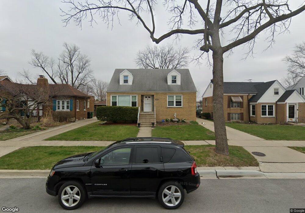
1627 Newcastle Ave Westchester, IL 60154
Estimated Value: $367,132 - $447,000
3
Beds
2
Baths
1,602
Sq Ft
$254/Sq Ft
Est. Value
About This Home
This home is located at 1627 Newcastle Ave, Westchester, IL 60154 and is currently estimated at $407,033, approximately $254 per square foot. 1627 Newcastle Ave is a home located in Cook County with nearby schools including Westchester Primary School, Westchester Intermediate School, and Westchester Middle School.
Ownership History
Date
Name
Owned For
Owner Type
Purchase Details
Closed on
Apr 13, 2012
Sold by
Chicago Title Land Trust Company
Bought by
Wade Thomas A and Wade Frances V
Current Estimated Value
Purchase Details
Closed on
May 10, 2011
Sold by
Ferganus Walter E
Bought by
Chicago Title Land Trust Company and Trust #8002356967
Purchase Details
Closed on
Feb 27, 2009
Sold by
Wade Thomas A
Bought by
Ferganus Walter E
Create a Home Valuation Report for This Property
The Home Valuation Report is an in-depth analysis detailing your home's value as well as a comparison with similar homes in the area
Home Values in the Area
Average Home Value in this Area
Purchase History
| Date | Buyer | Sale Price | Title Company |
|---|---|---|---|
| Wade Thomas A | -- | Chicago Title Land Trust Co | |
| Chicago Title Land Trust Company | -- | Chicago Title Land Trust Co | |
| Ferganus Walter E | $198,000 | None Available |
Source: Public Records
Tax History Compared to Growth
Tax History
| Year | Tax Paid | Tax Assessment Tax Assessment Total Assessment is a certain percentage of the fair market value that is determined by local assessors to be the total taxable value of land and additions on the property. | Land | Improvement |
|---|---|---|---|---|
| 2024 | $7,086 | $27,000 | $4,690 | $22,310 |
| 2023 | $6,281 | $27,000 | $4,690 | $22,310 |
| 2022 | $6,281 | $20,586 | $4,020 | $16,566 |
| 2021 | $6,079 | $20,586 | $4,020 | $16,566 |
| 2020 | $5,940 | $20,586 | $4,020 | $16,566 |
| 2019 | $6,853 | $24,258 | $3,685 | $20,573 |
| 2018 | $6,763 | $24,258 | $3,685 | $20,573 |
| 2017 | $6,634 | $24,258 | $3,685 | $20,573 |
| 2016 | $6,228 | $21,354 | $3,350 | $18,004 |
| 2015 | $6,148 | $21,354 | $3,350 | $18,004 |
| 2014 | $5,283 | $21,354 | $3,350 | $18,004 |
| 2013 | $4,929 | $22,239 | $3,350 | $18,889 |
Source: Public Records
Map
Nearby Homes
- 1907 Suffolk Ave
- 1932 Newcastle Ave
- 1623 Manchester Ave
- 1900 Manchester Ave
- 1601 Bristol Ave
- 1500 Bristol Ave
- 2128 Hull Ave
- 1840 Gardner Rd
- 1433 Bristol Ave
- 10072 Drury Ln
- 1247 S Mannheim Rd Unit 3
- 10531 Camelot St
- 10567 Waterford Dr
- 10524 Camelot St
- 1119 Newcastle Ave
- 1860 Buckingham Ave
- 1016 Hull Ave
- 1811 Downing Ave
- 920 Suffolk Ave
- 10630 W Cermak Rd Unit 2E
- 1623 Newcastle Ave
- 1631 Newcastle Ave
- 1615 Newcastle Ave
- 1637 Newcastle Ave
- 1626 Portsmouth Ave
- 1622 Portsmouth Ave
- 1641 Newcastle Ave
- 1611 Newcastle Ave
- 1616 Portsmouth Ave
- 1636 Portsmouth Ave
- 1647 Newcastle Ave
- 1612 Portsmouth Ave
- 1642 Portsmouth Ave
- 1604 Portsmouth Ave
- 1646 Portsmouth Ave
- 1651 Newcastle Ave
- 1600 Portsmouth Ave
- 1652 Portsmouth Ave
- 1657 Newcastle Ave
- 1656 Portsmouth Ave