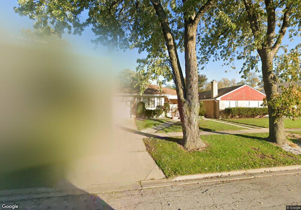
1627 Norfolk Ave Westchester, IL 60154
Estimated Value: $326,000 - $361,000
3
Beds
2
Baths
1,200
Sq Ft
$292/Sq Ft
Est. Value
About This Home
This home is located at 1627 Norfolk Ave, Westchester, IL 60154 and is currently estimated at $350,902, approximately $292 per square foot. 1627 Norfolk Ave is a home located in Cook County with nearby schools including Westchester Primary School, Westchester Intermediate School, and Westchester Middle School.
Ownership History
Date
Name
Owned For
Owner Type
Purchase Details
Closed on
Mar 11, 2010
Sold by
Oconnor Marni Jonell
Bought by
Lazaro Richard
Current Estimated Value
Home Financials for this Owner
Home Financials are based on the most recent Mortgage that was taken out on this home.
Original Mortgage
$171,830
Outstanding Balance
$115,411
Interest Rate
5.25%
Mortgage Type
FHA
Estimated Equity
$235,491
Create a Home Valuation Report for This Property
The Home Valuation Report is an in-depth analysis detailing your home's value as well as a comparison with similar homes in the area
Home Values in the Area
Average Home Value in this Area
Purchase History
| Date | Buyer | Sale Price | Title Company |
|---|---|---|---|
| Lazaro Richard | $175,000 | First American Title |
Source: Public Records
Mortgage History
| Date | Status | Borrower | Loan Amount |
|---|---|---|---|
| Open | Lazaro Richard | $171,830 |
Source: Public Records
Tax History Compared to Growth
Tax History
| Year | Tax Paid | Tax Assessment Tax Assessment Total Assessment is a certain percentage of the fair market value that is determined by local assessors to be the total taxable value of land and additions on the property. | Land | Improvement |
|---|---|---|---|---|
| 2024 | $6,216 | $27,000 | $4,690 | $22,310 |
| 2023 | $5,354 | $27,000 | $4,690 | $22,310 |
| 2022 | $5,354 | $20,970 | $4,020 | $16,950 |
| 2021 | $5,209 | $20,969 | $4,020 | $16,949 |
| 2020 | $5,155 | $20,969 | $4,020 | $16,949 |
| 2019 | $4,907 | $20,800 | $3,685 | $17,115 |
| 2018 | $4,841 | $20,800 | $3,685 | $17,115 |
| 2017 | $4,765 | $20,800 | $3,685 | $17,115 |
| 2016 | $4,363 | $17,458 | $3,350 | $14,108 |
| 2015 | $4,271 | $17,458 | $3,350 | $14,108 |
| 2014 | $4,188 | $17,458 | $3,350 | $14,108 |
| 2013 | $3,823 | $17,837 | $3,350 | $14,487 |
Source: Public Records
Map
Nearby Homes
- 1623 Manchester Ave
- 1601 Bristol Ave
- 1900 Manchester Ave
- 1840 Gardner Rd
- 1907 Suffolk Ave
- 1500 Bristol Ave
- 1433 Bristol Ave
- 1932 Newcastle Ave
- 2128 Hull Ave
- 10072 Drury Ln
- 1119 Newcastle Ave
- 2320 S 22nd Ave
- 1247 S Mannheim Rd Unit 3
- 923 Manchester Ave
- 920 Suffolk Ave
- 2237 S 22nd Ave
- 10531 Camelot St
- 10524 Camelot St
- 2428 S 19th Ave
- 10567 Waterford Dr
- 1631 Norfolk Ave
- 1637 Norfolk Ave
- 1617 Norfolk Ave
- 1617 Norfolk Ave
- 1626 Manchester Ave
- 1632 Manchester Ave
- 1622 Manchester Ave
- 1643 Norfolk Ave
- 1611 Norfolk Ave
- 1636 Manchester Ave
- 1616 Manchester Ave
- 1647 Norfolk Ave
- 1642 Manchester Ave
- 1605 Norfolk Ave
- 1612 Manchester Ave
- 1646 Manchester Ave
- 1606 Manchester Ave
- 1653 Norfolk Ave
- 1601 Norfolk Ave
- 1652 Manchester Ave