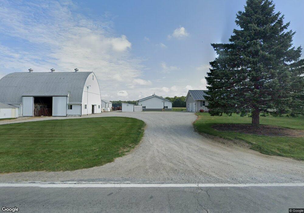
1627 State Route 100 Bucyrus, OH 44820
Estimated Value: $308,000 - $1,385,335
3
Beds
3
Baths
2,508
Sq Ft
$338/Sq Ft
Est. Value
About This Home
This home is located at 1627 State Route 100, Bucyrus, OH 44820 and is currently estimated at $846,668, approximately $337 per square foot. 1627 State Route 100 is a home located in Crawford County with nearby schools including Hannah Crawford Elementary School (PK-2), Hannah Crawford Elementary School (3 - 5), and William Crawford Intermediate School.
Ownership History
Date
Name
Owned For
Owner Type
Purchase Details
Closed on
Feb 28, 2023
Sold by
Hudson Craig J and Hudson Karen S
Bought by
Hudson Family Trust
Current Estimated Value
Purchase Details
Closed on
Aug 13, 2018
Sold by
Burkhart Doris B
Bought by
Hudson Karen S and Hudson Craig J
Purchase Details
Closed on
Dec 29, 2010
Sold by
Burkhart Floyd E and Burkhart Doris B
Bought by
Burkhart Floyd E and Burkhart Doris B
Create a Home Valuation Report for This Property
The Home Valuation Report is an in-depth analysis detailing your home's value as well as a comparison with similar homes in the area
Home Values in the Area
Average Home Value in this Area
Purchase History
| Date | Buyer | Sale Price | Title Company |
|---|---|---|---|
| Hudson Family Trust | -- | -- | |
| Hudson Karen S | -- | None Available | |
| Burkhart Doris B | -- | None Available | |
| Burkhart Floyd E | -- | None Available |
Source: Public Records
Tax History Compared to Growth
Tax History
| Year | Tax Paid | Tax Assessment Tax Assessment Total Assessment is a certain percentage of the fair market value that is determined by local assessors to be the total taxable value of land and additions on the property. | Land | Improvement |
|---|---|---|---|---|
| 2024 | $8,553 | $246,950 | $112,640 | $134,310 |
| 2023 | $8,621 | $148,390 | $58,550 | $89,840 |
| 2022 | $6,227 | $148,390 | $58,550 | $89,840 |
| 2021 | $6,430 | $148,390 | $58,550 | $89,840 |
| 2020 | $6,942 | $168,100 | $78,260 | $89,840 |
| 2019 | $7,253 | $168,100 | $78,260 | $89,840 |
| 2018 | $7,285 | $168,100 | $78,260 | $89,840 |
| 2017 | $7,209 | $179,070 | $104,260 | $74,810 |
| 2016 | $7,243 | $179,070 | $104,260 | $74,810 |
| 2015 | $7,079 | $179,070 | $104,260 | $74,810 |
| 2014 | $5,175 | $128,530 | $53,720 | $74,810 |
| 2013 | $5,175 | $128,530 | $53,720 | $74,810 |
Source: Public Records
Map
Nearby Homes
- 1294 Ohio 100
- 4520 Marion Ave
- 2208 State Route 19
- 1465 Oakridge Dr
- 111 Kincora Dr
- 1267 N Dundee Trail
- 1320 E Southern Ave
- 948 S Highland Ave
- 318 Charlotte St
- 419 Short St
- 1220 E Warren St
- 5395 Bucyrus St
- 1211 S Sandusky Ave
- 924 E Warren St
- 1021 S Sandusky Ave
- 346 Hopley Ave
- 444 Woodlawn Ave
- 583 Rogers St
- 900 S Spring St
- 708 S Sandusky Ave
- 1574 State Route 100
- 1574 State Route 100
- 1564 Ohio 100
- 1692 State Route 100
- 1695 State Route 100
- 1564 State Route 100
- 1564 St Rt 100
- 1715 State Route 100
- 3943 Shearer Rd
- 1727 State Route 100
- 1737 State Route 100
- 1724 State Route 100
- 1747 State Route 100
- 1681 Diebler Rd
- 1755 State Route 100
- 1758 State Route 100
- 1753 Diebler Rd
- 1650 Diebler Rd
- 1457 State Route 100
- 1827 State Route 100