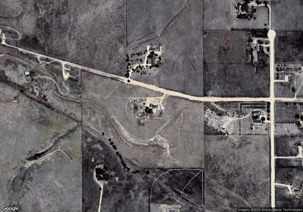
16275 Eaglenest Dr Colorado Springs, CO 80930
Estimated Value: $570,000 - $922,000
3
Beds
3
Baths
935
Sq Ft
$744/Sq Ft
Est. Value
About This Home
This home is located at 16275 Eaglenest Dr, Colorado Springs, CO 80930 and is currently estimated at $695,996, approximately $744 per square foot. 16275 Eaglenest Dr is a home located in El Paso County with nearby schools including Ellicott Elementary School, Ellicott Middle School, and Ellicott Senior High School.
Ownership History
Date
Name
Owned For
Owner Type
Purchase Details
Closed on
Nov 30, 2016
Sold by
Webb Ronald D
Bought by
Martin Robert Guy and Martin Suzannah B
Current Estimated Value
Home Financials for this Owner
Home Financials are based on the most recent Mortgage that was taken out on this home.
Original Mortgage
$182,858
Outstanding Balance
$147,655
Interest Rate
3.52%
Mortgage Type
New Conventional
Estimated Equity
$548,342
Purchase Details
Closed on
Dec 2, 2000
Sold by
Webb Teresa L
Bought by
Webb Ronald D
Home Financials for this Owner
Home Financials are based on the most recent Mortgage that was taken out on this home.
Original Mortgage
$105,000
Interest Rate
11.27%
Purchase Details
Closed on
May 1, 1979
Bought by
Martin Suzannah B
Create a Home Valuation Report for This Property
The Home Valuation Report is an in-depth analysis detailing your home's value as well as a comparison with similar homes in the area
Home Values in the Area
Average Home Value in this Area
Purchase History
| Date | Buyer | Sale Price | Title Company |
|---|---|---|---|
| Martin Robert Guy | $177,000 | Land Title Guarantee | |
| Webb Ronald D | -- | -- | |
| Martin Suzannah B | -- | -- |
Source: Public Records
Mortgage History
| Date | Status | Borrower | Loan Amount |
|---|---|---|---|
| Open | Martin Robert Guy | $182,858 | |
| Previous Owner | Webb Ronald D | $105,000 |
Source: Public Records
Tax History Compared to Growth
Tax History
| Year | Tax Paid | Tax Assessment Tax Assessment Total Assessment is a certain percentage of the fair market value that is determined by local assessors to be the total taxable value of land and additions on the property. | Land | Improvement |
|---|---|---|---|---|
| 2025 | $1,874 | $55,580 | -- | -- |
| 2024 | $1,650 | $37,380 | $11,510 | $25,870 |
| 2023 | $1,650 | $37,380 | $11,510 | $25,870 |
| 2022 | $992 | $18,230 | $8,630 | $9,600 |
| 2021 | $935 | $18,760 | $8,880 | $9,880 |
| 2020 | $811 | $15,370 | $7,960 | $7,410 |
| 2019 | $804 | $15,370 | $7,960 | $7,410 |
| 2018 | $705 | $12,950 | $7,210 | $5,740 |
| 2017 | $769 | $12,950 | $7,210 | $5,740 |
| 2016 | $795 | $13,290 | $7,430 | $5,860 |
| 2015 | $791 | $13,290 | $7,430 | $5,860 |
| 2014 | $741 | $12,300 | $7,210 | $5,090 |
Source: Public Records
Map
Nearby Homes
- 625 Slocum Rd
- 740 Donald Rd
- 1155 Donald Rd
- 1355 Houseman Rd
- 15530 Amo Rd
- 2105 Slocum Rd
- 1185 N Curtis Rd
- 75 N Curtis Rd Unit 45
- 2115 Terri Lee Dr
- 0 Kennedy Rd
- 2120 Terri Lee Dr
- 9475 N Curtis Rd
- 2265 Terri Lee Dr
- 905 Engleby Dr
- 2550 Slocum Rd
- 2955 Hoofprint Rd
- 2940 Hoofprint Rd
- 18070 Good Life View
- 14655 Davis Rd
- 3250 Slocum Rd
- 16220 Eaglenest Dr
- 16025 Eaglenest Dr
- 720 Hawk Dr
- 860 Hawk Dr
- 16130 State Highway 94
- 805 Hawk Dr
- 725 Hawk Dr
- 645 Hawk Dr
- 16520 State Highway 94
- 16580 State Highway 94
- 16650 Eaglenest Dr
- 15810 State Highway 94
- 16660 State Highway 94
- 730 Slocum Rd
- 650 Slocum Rd
- 530 Slocum Rd
- 0 N Enoch Rd
- 990 Slocum Rd
- 810 Slocum Rd
- 860 Slocum Rd
