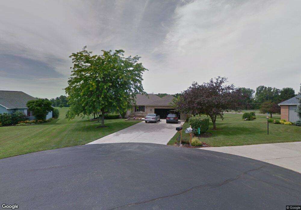
16284 Maureen Dr Kenton, OH 43326
Estimated Value: $276,000 - $345,000
3
Beds
2
Baths
2,116
Sq Ft
$148/Sq Ft
Est. Value
About This Home
This home is located at 16284 Maureen Dr, Kenton, OH 43326 and is currently estimated at $312,920, approximately $147 per square foot. 16284 Maureen Dr is a home located in Hardin County with nearby schools including Kenton Elementary School, Kenton Middle School, and Kenton High School.
Ownership History
Date
Name
Owned For
Owner Type
Purchase Details
Closed on
Apr 14, 2022
Sold by
Thiel Jeremiah J and Thiel Rhonda K
Bought by
Johnson Jordan T and Johnson Angelica R
Current Estimated Value
Purchase Details
Closed on
Oct 26, 2006
Sold by
Barrett William H and Barrett Sandra E
Bought by
Thiel Jeremiah J and Snider Rhonda K
Home Financials for this Owner
Home Financials are based on the most recent Mortgage that was taken out on this home.
Original Mortgage
$185,000
Interest Rate
7.55%
Mortgage Type
Adjustable Rate Mortgage/ARM
Purchase Details
Closed on
Apr 23, 1999
Bought by
Barrett William H and Barrett S
Purchase Details
Closed on
Mar 31, 1998
Bought by
Evilsizer Marshall A and Evilsizer D
Purchase Details
Closed on
Feb 9, 1990
Create a Home Valuation Report for This Property
The Home Valuation Report is an in-depth analysis detailing your home's value as well as a comparison with similar homes in the area
Home Values in the Area
Average Home Value in this Area
Purchase History
| Date | Buyer | Sale Price | Title Company |
|---|---|---|---|
| Johnson Jordan T | -- | Mckinley Paul N | |
| Thiel Jeremiah J | $185,000 | None Available | |
| Barrett William H | $152,000 | -- | |
| Evilsizer Marshall A | $135,000 | -- | |
| -- | $10,500 | -- |
Source: Public Records
Mortgage History
| Date | Status | Borrower | Loan Amount |
|---|---|---|---|
| Previous Owner | Thiel Jeremiah J | $185,000 |
Source: Public Records
Tax History Compared to Growth
Tax History
| Year | Tax Paid | Tax Assessment Tax Assessment Total Assessment is a certain percentage of the fair market value that is determined by local assessors to be the total taxable value of land and additions on the property. | Land | Improvement |
|---|---|---|---|---|
| 2024 | $3,395 | $79,060 | $6,940 | $72,120 |
| 2023 | $3,395 | $79,060 | $6,940 | $72,120 |
| 2022 | $3,070 | $67,890 | $3,410 | $64,480 |
| 2021 | $3,082 | $67,890 | $3,410 | $64,480 |
| 2020 | $2,663 | $67,890 | $3,410 | $64,480 |
| 2019 | $2,067 | $54,780 | $3,250 | $51,530 |
| 2018 | $2,069 | $54,780 | $3,250 | $51,530 |
| 2017 | $1,977 | $54,780 | $3,250 | $51,530 |
| 2016 | $1,913 | $54,040 | $3,170 | $50,870 |
| 2015 | $1,884 | $54,040 | $3,170 | $50,870 |
| 2014 | $1,907 | $54,040 | $3,170 | $50,870 |
| 2013 | $2,163 | $58,580 | $3,170 | $55,410 |
Source: Public Records
Map
Nearby Homes
- 11896 Parklane Dr
- 920 Cooper St
- 115 Scioto St
- 1 C Ct
- 79 Broadway St
- 39 Grape St
- 13450 State Route 292
- 530 E Franklin St
- 510 Decatur St
- 508 Decatur St
- 513 E Franklin St
- 509 E Carrol St
- 324 Stone Hedge Ln Unit 324
- 121 S High St
- 639 S Main St
- 104 Oak Ln Unit 15
- 727 S Detroit St
- 0 N Barron St
- 320 Letson Ave
- 503 Jennings St
- 16268 Maureen Dr
- 16296 Maureen Dr
- 16283 Maureen Dr
- 16295 Maureen Dr
- 16315 Maureen Dr
- 16350 Maureen Dr
- 12287 Pamela Dr
- 12353 Lora Dr
- 12354 Lora Dr
- 16391 Lindsey Dr
- 12257 Pamela Dr
- 16388 Lindsey Dr
- 16382 Maureen Dr
- 16381 Maureen Dr
- 12327 Pamela Dr
- 12270 Pamela Dr
- 12306 Pamela Dr
- 16406 Maureen Dr
- 12381 Barbara Dr