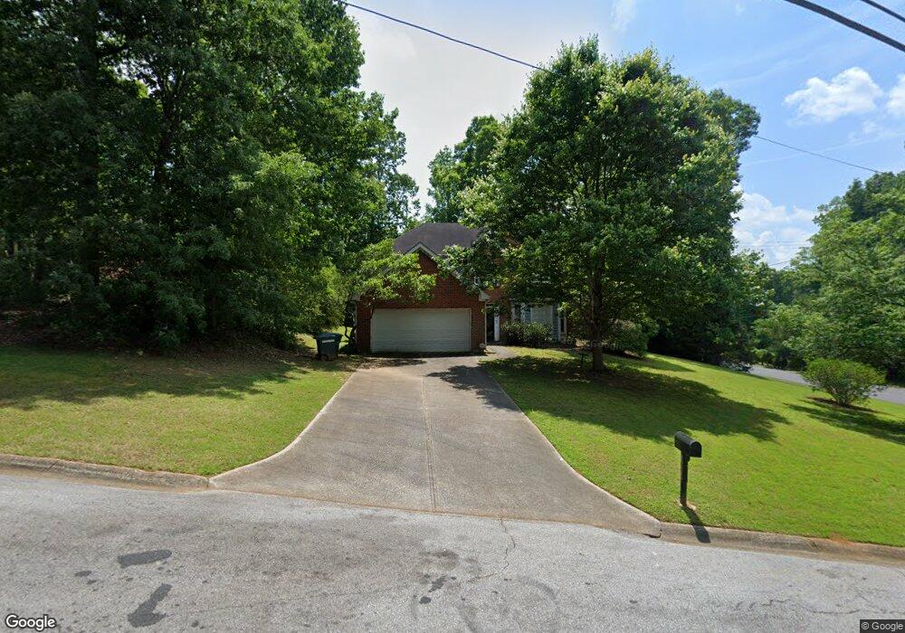
1629 Rocky Top Dr SW Unit 1 Lilburn, GA 30047
Estimated Value: $361,000 - $465,000
3
Beds
3
Baths
1,761
Sq Ft
$230/Sq Ft
Est. Value
About This Home
This home is located at 1629 Rocky Top Dr SW Unit 1, Lilburn, GA 30047 and is currently estimated at $404,359, approximately $229 per square foot. 1629 Rocky Top Dr SW Unit 1 is a home located in Gwinnett County with nearby schools including Head Elementary School, Five Forks Middle School, and Brookwood High School.
Ownership History
Date
Name
Owned For
Owner Type
Purchase Details
Closed on
Apr 29, 2005
Sold by
Maguire Lincoln G
Bought by
Guyton Chamundi B
Current Estimated Value
Home Financials for this Owner
Home Financials are based on the most recent Mortgage that was taken out on this home.
Original Mortgage
$221,474
Outstanding Balance
$115,096
Interest Rate
5.99%
Mortgage Type
VA
Estimated Equity
$289,263
Create a Home Valuation Report for This Property
The Home Valuation Report is an in-depth analysis detailing your home's value as well as a comparison with similar homes in the area
Home Values in the Area
Average Home Value in this Area
Purchase History
| Date | Buyer | Sale Price | Title Company |
|---|---|---|---|
| Guyton Chamundi B | $225,000 | -- |
Source: Public Records
Mortgage History
| Date | Status | Borrower | Loan Amount |
|---|---|---|---|
| Open | Guyton Chamundi B | $221,474 |
Source: Public Records
Tax History Compared to Growth
Tax History
| Year | Tax Paid | Tax Assessment Tax Assessment Total Assessment is a certain percentage of the fair market value that is determined by local assessors to be the total taxable value of land and additions on the property. | Land | Improvement |
|---|---|---|---|---|
| 2025 | $3,774 | $135,360 | $36,200 | $99,160 |
| 2024 | $3,727 | $126,880 | $36,200 | $90,680 |
| 2023 | $3,727 | $125,000 | $32,600 | $92,400 |
| 2022 | $3,454 | $115,560 | $32,600 | $82,960 |
| 2021 | $2,787 | $81,680 | $23,000 | $58,680 |
| 2020 | $2,509 | $68,000 | $21,000 | $47,000 |
| 2019 | $2,428 | $68,000 | $21,000 | $47,000 |
| 2018 | $2,301 | $62,460 | $17,850 | $44,610 |
| 2016 | $2,361 | $64,000 | $21,000 | $43,000 |
| 2015 | $2,174 | $57,720 | $17,400 | $40,320 |
| 2014 | $2,187 | $57,720 | $17,400 | $40,320 |
Source: Public Records
Map
Nearby Homes
- 3868 Buckland Dr SW
- 1640 Killian Hill Rd SW
- 3725 Hunting Ridge Dr SW
- 1725 Spindle Top Ct SW
- 1535 Pathfinder Way SW Unit 1
- 1776 Bear Cave SW
- 3663 Stonelake Ct SW Unit 1
- 1732 Beauregard Dr SW
- 4070 Runnymede Dr SW
- 4107 Signal Ridge SW
- 1905 Embassy Walk Ln
- 4000 Embassy Way
- 3728 Kelin Ct SW
- 4353 Pond Edge Rd
- 4166 Signal Ridge SW
- 0 River Club Dr Unit 7650571
- 0 Rocky Top Dr SW Unit 8595446
- 0 Rocky Top Dr SW Unit 8392400
- 0 Rocky Top Dr SW Unit 8112379
- 0 Rocky Top Dr SW Unit 8563754
- 0 Rocky Top Dr SW
- 1639 Rocky Top Dr SW
- 1649 Rocky Top Dr SW Unit 1
- 1634 Rocky Top Dr SW
- 1644 Rocky Top Dr SW
- 1624 Rocky Top Dr SW
- 1618 Stony Creek Way SW
- 1654 Rocky Top Dr SW
- 3860 Yellowstone Way SW
- 1614 Rocky Top Dr SW
- 1664 Rocky Top Dr SW
- 1669 Rocky Top Dr SW
- 0 Riverbank Dr SW Unit 7532087
- 0 Riverbank Dr SW Unit 7419560
- 0 Riverbank Dr SW Unit 7407676
- 0 Riverbank Dr SW Unit 7397118