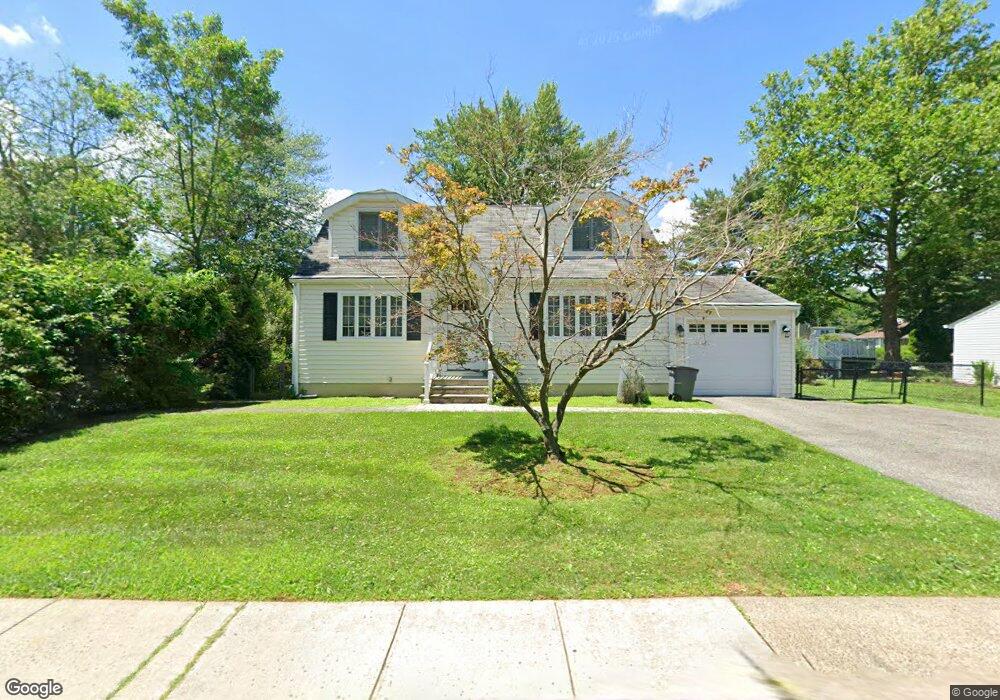
163 Ehrhardt Rd Pearl River, NY 10965
Estimated Value: $595,000 - $664,000
4
Beds
2
Baths
1,478
Sq Ft
$431/Sq Ft
Est. Value
About This Home
This home is located at 163 Ehrhardt Rd, Pearl River, NY 10965 and is currently estimated at $637,342, approximately $431 per square foot. 163 Ehrhardt Rd is a home located in Rockland County with nearby schools including Pearl River High School.
Ownership History
Date
Name
Owned For
Owner Type
Purchase Details
Closed on
May 6, 1998
Sold by
Edmonson Walter E and Edmonson Amelia
Bought by
Livant Ruth
Current Estimated Value
Home Financials for this Owner
Home Financials are based on the most recent Mortgage that was taken out on this home.
Original Mortgage
$100,000
Outstanding Balance
$19,454
Interest Rate
7.05%
Mortgage Type
Purchase Money Mortgage
Estimated Equity
$617,888
Create a Home Valuation Report for This Property
The Home Valuation Report is an in-depth analysis detailing your home's value as well as a comparison with similar homes in the area
Home Values in the Area
Average Home Value in this Area
Purchase History
| Date | Buyer | Sale Price | Title Company |
|---|---|---|---|
| Livant Ruth | $190,000 | Chicago Title Insurance Co |
Source: Public Records
Mortgage History
| Date | Status | Borrower | Loan Amount |
|---|---|---|---|
| Open | Livant Ruth | $100,000 |
Source: Public Records
Tax History
| Year | Tax Paid | Tax Assessment Tax Assessment Total Assessment is a certain percentage of the fair market value that is determined by local assessors to be the total taxable value of land and additions on the property. | Land | Improvement |
|---|---|---|---|---|
| 2022 | $2,359 | $146,300 | $39,200 | $107,100 |
| 2021 | $9,798 | $146,300 | $39,200 | $107,100 |
| 2020 | $7,717 | $146,300 | $39,200 | $107,100 |
| 2019 | $2,145 | $146,300 | $39,200 | $107,100 |
| 2018 | $2,652 | $146,300 | $39,200 | $107,100 |
| 2017 | $6,869 | $146,300 | $39,200 | $107,100 |
| 2016 | $6,638 | $146,300 | $39,200 | $107,100 |
| 2015 | -- | $146,300 | $39,200 | $107,100 |
| 2014 | -- | $146,300 | $39,200 | $107,100 |
Source: Public Records
Map
Nearby Homes
- 7 Staubitz Ave
- 6 Lombardi Rd
- 135 Standish Dr
- 166 E Crooked Hill Rd Unit 166
- 452 Somerset Dr Unit F
- 352 Holt Dr
- 258 Holt Dr
- 124 Braunsdorf Rd
- 34 Mountainview Ave
- 84 Townline Rd
- 86 Braunsdorf Rd
- 22 Hovenkamp Ave
- 10 Cottage Ave
- 90 S Middletown Rd
- 210 Rockland Rd
- 21 Bridge Rd
- 6 Pelham Ct
- 97 E Park Ave
- 55 Kinsley Grove
- 146 N Lincoln St
- 173 Ehrhardt Rd
- 155 Ehrhardt Rd
- 45 Pauline Terrace
- 362 Manor Blvd
- 37 Pauline Terrace
- 356 Manor Blvd
- 172 Ehrhardt Rd
- 145 Ehrhardt Rd
- 181 Ehrhardt Rd
- 178 Ehrhardt Rd
- 31 Pauline Terrace
- 350 Manor Blvd
- 46 Pauline Terrace
- 139 Ehrhardt Rd
- 361 Manor Blvd
- 185 Ehrhardt Rd
- 38 Pauline Terrace
- 182 Ehrhardt Rd
- 355 Manor Blvd
- 342 Manor Blvd
Your Personal Tour Guide
Ask me questions while you tour the home.