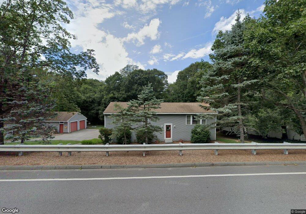
163 Marlboro St Hudson, MA 01749
Estimated Value: $574,000 - $681,000
3
Beds
3
Baths
1,344
Sq Ft
$474/Sq Ft
Est. Value
About This Home
This home is located at 163 Marlboro St, Hudson, MA 01749 and is currently estimated at $636,533, approximately $473 per square foot. 163 Marlboro St is a home located in Middlesex County with nearby schools including David J. Quinn Middle School, Hudson High School, and First Steps Children's Center.
Ownership History
Date
Name
Owned For
Owner Type
Purchase Details
Closed on
Feb 29, 2024
Sold by
Murphy Cheryl L
Bought by
Murphy 2024 Ret and Murphy
Current Estimated Value
Purchase Details
Closed on
Oct 4, 2021
Sold by
Murphy Michael F Est and Murphy
Bought by
Murphy Cheryl L
Purchase Details
Closed on
Sep 14, 2021
Sold by
Murphy Jason
Bought by
Murphy Cheryl L
Purchase Details
Closed on
Nov 20, 1975
Bought by
Murphy Michael F
Create a Home Valuation Report for This Property
The Home Valuation Report is an in-depth analysis detailing your home's value as well as a comparison with similar homes in the area
Home Values in the Area
Average Home Value in this Area
Purchase History
| Date | Buyer | Sale Price | Title Company |
|---|---|---|---|
| Murphy 2024 Ret | -- | None Available | |
| Murphy 2024 Ret | -- | None Available | |
| Murphy 2024 Ret | -- | None Available | |
| Murphy 2024 Ret | -- | None Available | |
| Murphy Cheryl L | -- | None Available | |
| Murphy Cheryl L | -- | None Available | |
| Murphy Cheryl L | $250,000 | None Available | |
| Murphy Michael F | -- | -- |
Source: Public Records
Tax History Compared to Growth
Tax History
| Year | Tax Paid | Tax Assessment Tax Assessment Total Assessment is a certain percentage of the fair market value that is determined by local assessors to be the total taxable value of land and additions on the property. | Land | Improvement |
|---|---|---|---|---|
| 2025 | $8,886 | $640,200 | $218,100 | $422,100 |
| 2024 | $8,292 | $592,300 | $198,400 | $393,900 |
| 2023 | $7,729 | $529,400 | $190,800 | $338,600 |
| 2022 | $7,316 | $461,300 | $173,200 | $288,100 |
| 2021 | $6,951 | $419,000 | $165,300 | $253,700 |
| 2020 | $6,385 | $384,400 | $162,000 | $222,400 |
| 2019 | $6,192 | $363,600 | $162,000 | $201,600 |
| 2018 | $5,782 | $330,400 | $154,100 | $176,300 |
| 2017 | $5,810 | $332,000 | $146,800 | $185,200 |
| 2016 | $5,590 | $323,300 | $146,800 | $176,500 |
| 2015 | $5,117 | $296,300 | $146,800 | $149,500 |
| 2014 | $4,757 | $273,100 | $128,900 | $144,200 |
Source: Public Records
Map
Nearby Homes
- 48 Jewell Rd Unit Lot 6
- 46 Jewell Rd Unit Lot 5
- 44 Jewell Rd Unit Lot 4
- 30 Jewell Rd Unit Lot 2
- 36 Jewell Rd Unit Lot 3
- 1 Rotherham Way Unit B
- 0 Washington St
- 656 Bolton St
- 243 Washington St
- 129 Fort Meadow Dr
- 18 Collins Dr
- 3 Townsend Rd
- 135 Broad St Unit 2B3
- 44 Stevens Rd
- 114 Lodi Rd
- 18 Amory Rd
- 13 Wilshire Way Unit 13
- 57 Paquin Dr
- 56 Forest Ave
- 30 Harriman Rd
- 169 Marlboro St
- 159 Marlboro St
- 170 Marlboro St
- 157 Marlboro St
- 166 Marlboro St
- 173 Marlboro St
- 158 Marlboro St
- 174 Marlboro St
- 177 Marlboro St
- 101 2nd St
- 152 Marlboro St
- 152 Marlboro St
- 239 Reservoir St
- 24 Wakefield Rd
- 230 Reservoir St
- 226 Marlboro St
- 36 Otsego Dr Unit 36
- 29 Wakefield Rd
- 229 Reservoir St
- 16 Wakefield Rd