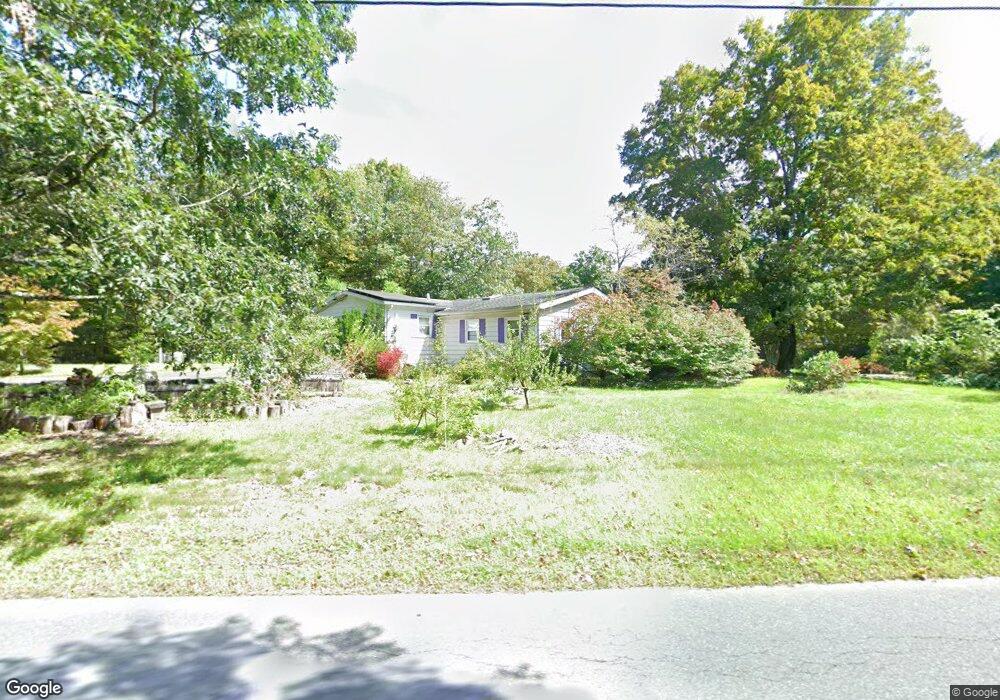
163 Sylvester Rd Florence, MA 01062
Florence NeighborhoodEstimated Value: $404,000 - $524,000
3
Beds
2
Baths
1,680
Sq Ft
$283/Sq Ft
Est. Value
About This Home
This home is located at 163 Sylvester Rd, Florence, MA 01062 and is currently estimated at $475,252, approximately $282 per square foot. 163 Sylvester Rd is a home located in Hampshire County with nearby schools including Northampton High School.
Ownership History
Date
Name
Owned For
Owner Type
Purchase Details
Closed on
Jan 9, 2006
Sold by
Laflamme Linda M and Laflamme Thomas E
Bought by
Friedland Eric J and Kays Laura B
Current Estimated Value
Home Financials for this Owner
Home Financials are based on the most recent Mortgage that was taken out on this home.
Original Mortgage
$190,400
Interest Rate
6.28%
Mortgage Type
Purchase Money Mortgage
Purchase Details
Closed on
Jun 30, 1999
Sold by
Foote Brian E and Foote Traci S
Bought by
Laflamme Linda M and Laflamme Thomas E
Purchase Details
Closed on
Oct 31, 1996
Sold by
Labbee Charles A and Labbee Lisa A
Bought by
Foote Brian E and Foote Traci S
Create a Home Valuation Report for This Property
The Home Valuation Report is an in-depth analysis detailing your home's value as well as a comparison with similar homes in the area
Home Values in the Area
Average Home Value in this Area
Purchase History
| Date | Buyer | Sale Price | Title Company |
|---|---|---|---|
| Friedland Eric J | $238,000 | -- | |
| Laflamme Linda M | $171,400 | -- | |
| Foote Brian E | $137,000 | -- |
Source: Public Records
Mortgage History
| Date | Status | Borrower | Loan Amount |
|---|---|---|---|
| Open | Foote Brian E | $189,000 | |
| Closed | Friedland Eric J | $190,400 | |
| Previous Owner | Foote Brian E | $220,000 | |
| Previous Owner | Foote Brian E | $75,900 |
Source: Public Records
Tax History Compared to Growth
Tax History
| Year | Tax Paid | Tax Assessment Tax Assessment Total Assessment is a certain percentage of the fair market value that is determined by local assessors to be the total taxable value of land and additions on the property. | Land | Improvement |
|---|---|---|---|---|
| 2025 | $5,369 | $385,400 | $99,800 | $285,600 |
| 2024 | $5,702 | $375,400 | $95,600 | $279,800 |
| 2023 | $5,349 | $337,700 | $86,500 | $251,200 |
| 2022 | $4,578 | $255,900 | $81,500 | $174,400 |
| 2021 | $4,313 | $248,300 | $78,100 | $170,200 |
| 2020 | $4,171 | $248,300 | $78,100 | $170,200 |
| 2019 | $4,032 | $232,100 | $90,600 | $141,500 |
| 2018 | $3,926 | $230,400 | $90,600 | $139,800 |
| 2017 | $3,845 | $230,400 | $90,600 | $139,800 |
| 2016 | $3,723 | $230,400 | $90,600 | $139,800 |
| 2015 | $3,700 | $234,200 | $95,600 | $138,600 |
| 2014 | $3,604 | $234,200 | $95,600 | $138,600 |
Source: Public Records
Map
Nearby Homes
- 7 Pine Valley Rd
- 20-11 Sylvester Rd
- 0 W Farms Rd
- 832 Westhampton Rd
- 1007 Westhampton Rd
- 39 Matthew Dr
- 8 Tara Cir
- 138 Overlook Dr
- 383 Westhampton Rd
- 269 Ryan Rd
- 815 Burts Pit Rd
- 200 Easthampton Rd
- 1260 Westhampton Rd
- 137 Emerson Way
- 167 Emerson Way
- 100 Emerson Way
- 634 Burts Pit Rd
- 12 Pine Hill Rd
- 384 Spring St
- 98 Park Hill Rd
- 165 Sylvester Rd
- 183 Sylvester Rd
- 207 Sylvester Rd
- 125 Sylvester Rd
- 203 Sylvester Rd
- 138 Sylvester Rd
- 205 Sylvester Rd
- 198 Sylvester Rd
- 95 Sylvester Rd
- 231 Sylvester Rd
- 83 Sylvester Rd
- 71 Sylvester Rd
- 249 Sylvester Rd
- 59 Sylvester Rd
- 64 Sylvester Rd
- 255 Sylvester Rd
- 54 Sylvester Rd
- 51 Sylvester Rd
- 33 Sylvester Rd
- 88 Sylvester Rd