Estimated Value: $626,000 - $700,703
5
Beds
5
Baths
3,685
Sq Ft
$182/Sq Ft
Est. Value
About This Home
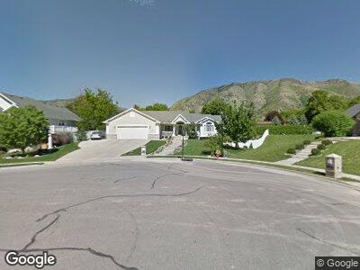
This home is located at 1630 Camelot Dr, Logan, UT 84341 and is currently estimated at $669,926, approximately $181 per square foot. 1630 Camelot Dr is a home with nearby schools including Greenville School, Cedar Ridge School, and Cedar Ridge Middle School.
Ownership History
Date
Name
Owned For
Owner Type
Purchase Details
Closed on
Aug 17, 2006
Sold by
Ivie Randy B and Ivie Sherri
Bought by
Larson Todd K and Larson Diana D
Current Estimated Value
Home Financials for this Owner
Home Financials are based on the most recent Mortgage that was taken out on this home.
Original Mortgage
$177,000
Interest Rate
6.76%
Mortgage Type
New Conventional
Create a Home Valuation Report for This Property
The Home Valuation Report is an in-depth analysis detailing your home's value as well as a comparison with similar homes in the area
Home Values in the Area
Average Home Value in this Area
Purchase History
| Date | Buyer | Sale Price | Title Company |
|---|---|---|---|
| Larson Todd K | -- | American Secure Title |
Source: Public Records
Mortgage History
| Date | Status | Borrower | Loan Amount |
|---|---|---|---|
| Open | Larson Todd K | $162,600 | |
| Closed | Larson Todd K | $176,500 | |
| Closed | Larson Todd K | $177,000 | |
| Previous Owner | Ivie Randy B | $232,000 |
Source: Public Records
Tax History Compared to Growth
Tax History
| Year | Tax Paid | Tax Assessment Tax Assessment Total Assessment is a certain percentage of the fair market value that is determined by local assessors to be the total taxable value of land and additions on the property. | Land | Improvement |
|---|---|---|---|---|
| 2024 | $3,040 | $395,980 | $0 | $0 |
| 2023 | $2,843 | $346,480 | $0 | $0 |
| 2022 | $2,975 | $346,480 | $0 | $0 |
| 2021 | $2,891 | $521,970 | $90,000 | $431,970 |
| 2020 | $2,619 | $443,568 | $90,000 | $353,568 |
| 2019 | $2,743 | $443,567 | $90,000 | $353,567 |
| 2018 | $2,375 | $372,450 | $65,000 | $307,450 |
| 2017 | $2,296 | $189,475 | $0 | $0 |
| 2016 | $2,332 | $189,475 | $0 | $0 |
| 2015 | $1,823 | $147,615 | $0 | $0 |
| 2014 | $1,780 | $147,615 | $0 | $0 |
| 2013 | -- | $141,565 | $0 | $0 |
Source: Public Records
Map
Nearby Homes
- 1553 N 1525 E
- 1580 E 1630 N
- 1560 E 1580 N
- 1564 N 1600 E
- 1480 N 1525 E
- 1315 E 1550 N
- 1520 N 1600 E
- 1368 N 1275 E Unit 9
- 1729 Gateway Dr
- 1235 N 1380 E
- 1731 E 1460 N
- 1107 E 1625 N
- 1513 E 1260 N
- 1720 N 1850 E
- 1450 E 1260 N
- 1809 E 1815 N
- 1869 Southpointe Ct
- 1776 E 1400 N
- 1411 E 1220 N
- 1586 N Sharptail Cir
- 1630 Camelot Dr
- 1650 Camelot Dr
- 1649 N 1515 E
- 1635 N 1515 E
- 1620 Camelot Dr
- 1663 N 1515 E
- 1621 N 1515 E
- 1670 Camelot Dr
- 1625 Camelot Dr
- 1645 Camelot Dr
- 1677 N 1515 E
- 1654 N 1515 E
- 1531 E 1630 N
- 105 Bristol Rd
- 95 Bristol Rd
- 1620 N 1515 E
- 1668 N 1515 E
- 1695 N 1515 E
- 1680 Camelot Dr Unit 3
- 85 Bristol Rd