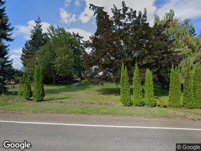
1630 Eastside Rd Hood River, OR 97031
Estimated Value: $1,270,317 - $1,687,000
5
Beds
4
Baths
5,600
Sq Ft
$264/Sq Ft
Est. Value
About This Home
This home is located at 1630 Eastside Rd, Hood River, OR 97031 and is currently estimated at $1,478,659, approximately $264 per square foot. 1630 Eastside Rd is a home located in Hood River County with nearby schools including Mid Valley Elementary School, Wyeast Middle School, and Hood River Valley High School.
Ownership History
Date
Name
Owned For
Owner Type
Purchase Details
Closed on
Jan 30, 2017
Sold by
Musemeche Todd P
Bought by
Douglas Nathaneal B and Douglas Kristi L
Current Estimated Value
Home Financials for this Owner
Home Financials are based on the most recent Mortgage that was taken out on this home.
Original Mortgage
$736,250
Interest Rate
3.37%
Mortgage Type
Adjustable Rate Mortgage/ARM
Purchase Details
Closed on
Jun 10, 2015
Sold by
Davis Robert A
Bought by
Musemeche Todd P
Create a Home Valuation Report for This Property
The Home Valuation Report is an in-depth analysis detailing your home's value as well as a comparison with similar homes in the area
Home Values in the Area
Average Home Value in this Area
Purchase History
| Date | Buyer | Sale Price | Title Company |
|---|---|---|---|
| Douglas Nathaneal B | $775,000 | Old Republic Title Company | |
| Musemeche Todd P | $570,000 | Amerititle |
Source: Public Records
Mortgage History
| Date | Status | Borrower | Loan Amount |
|---|---|---|---|
| Open | Douglas Kristi L | $707,000 | |
| Closed | Douglas Nathaneal B | $736,250 |
Source: Public Records
Tax History Compared to Growth
Tax History
| Year | Tax Paid | Tax Assessment Tax Assessment Total Assessment is a certain percentage of the fair market value that is determined by local assessors to be the total taxable value of land and additions on the property. | Land | Improvement |
|---|---|---|---|---|
| 2024 | $7,159 | $541,390 | $186,800 | $354,590 |
| 2023 | $7,159 | $525,630 | $181,360 | $344,270 |
| 2022 | $6,624 | $510,330 | $69,970 | $440,360 |
| 2021 | $6,386 | $495,470 | $67,940 | $427,530 |
| 2020 | $6,166 | $481,040 | $65,960 | $415,080 |
| 2019 | $5,698 | $467,030 | $64,040 | $402,990 |
| 2018 | $5,749 | $453,430 | $62,180 | $391,250 |
| 2017 | $3,743 | $291,620 | $60,380 | $231,240 |
| 2016 | $3,634 | $283,130 | $58,620 | $224,510 |
| 2015 | $2,662 | $203,550 | $56,910 | $146,640 |
| 2014 | $2,640 | $197,630 | $55,250 | $142,380 |
| 2013 | -- | $191,880 | $53,640 | $138,240 |
Source: Public Records
Map
Nearby Homes
- 0 Gravenstein Dr
- 1841 4th St
- 1826 3rd St
- 817 Devon Ct
- 910 Samantha St
- 3391 Avalon Dr
- 3465 Avalon Dr
- 3 E Point Ct
- 1008 June St
- 1011 May St
- 1802 Belmont Ave
- 1610 22nd St
- 317 Sherman Ave Unit 2
- 3643 Lois Dr
- 2915 Fir Mountain Rd
- 2668 Dock Rd
- 2455 Belmont Dr
- 0 S Lot Windy Rd
- 0 N Lot Windy Rd
- 4 E Port Marina Dr Unit 304
- 1630 Eastside Rd
- 1595 Eastside Rd
- 1595 Eastside Rd
- 1580 Eastside Rd
- 1636 Eastside Rd
- 1720 Eastside Rd
- 1485 Eastside Rd
- 2580 Lacey Dr
- 2740 Blossom Hill Dr
- 1480 Eastside Rd
- 2355 Lacey Dr
- 1775 Eastside Rd
- 1771 Eastside Rd
- 2600 Blossom Hill Dr
- 2399 Lacey Dr
- 2660 Blossom Hill Dr
- 1830 Eastside Rd
- 2371 Old Dalles Dr
- 1430 Eastside Rd
- 2401 Stricker Rd