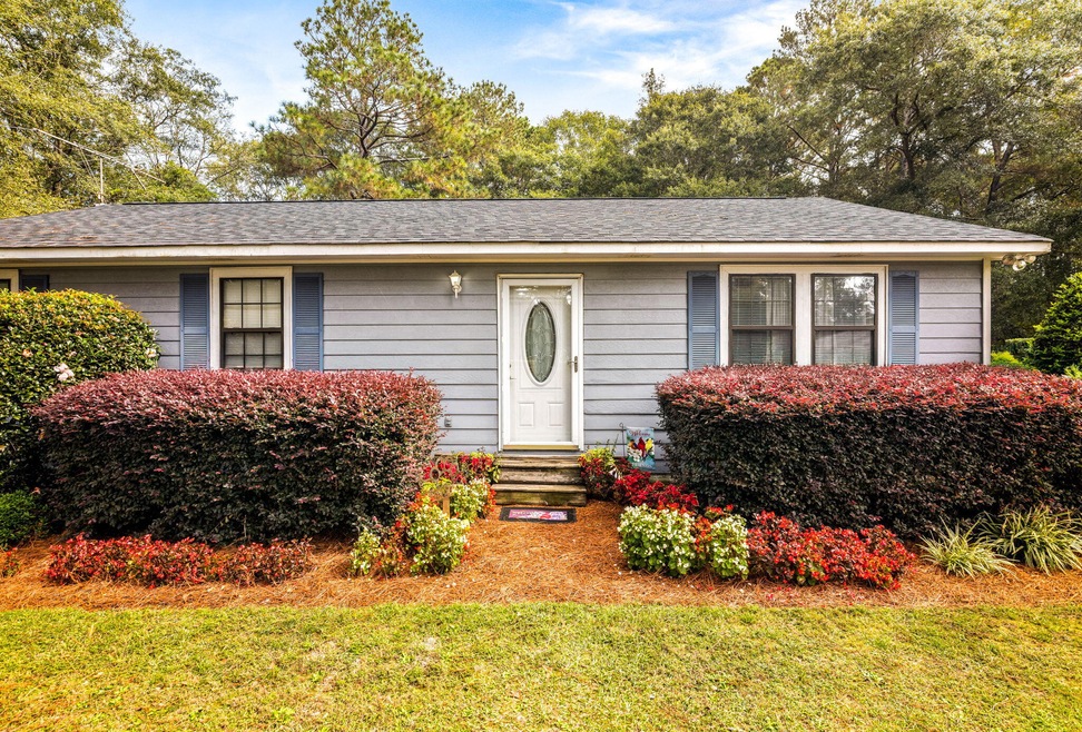
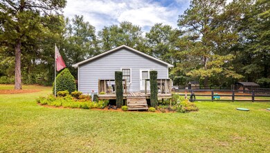
1631 Swint Rd Harlem, GA 30814
Estimated payment $1,471/month
About This Home
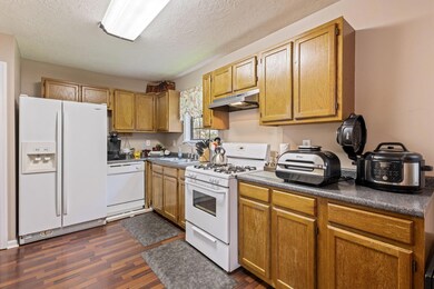
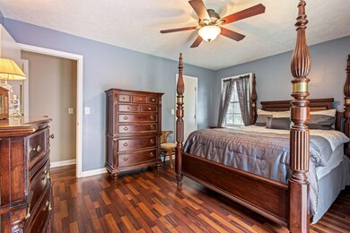
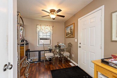
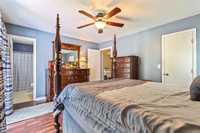
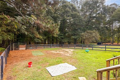
1631 Swint Road, Harlem, GA 30814 3 Beds | 2 Baths | 1,288 Sq Ft | 2.5 Acre Lot | Columbia County Welcome to this charming single-level home in the heart of Harlem, GA. Featuring 3 bedrooms and 2 baths on a private 2.5-acre lot, this well-maintained property is perfect for first-time buyers or anyone seeking affordable Columbia County living with room to grow. Inside you'll find a bright living area, functional kitchen, and comfortable bedrooms ready for your personal touch. The large yard offers endless potential—garden, play space, or future workshop. Highlights: 1,288 sq ft ranch-style layout for easy one-level living Spacious 2.5-acre lot with privacy and mature surroundings Quick access to I-20, Fort Gordon (≈20 min), and Augusta (≈25 min) Close to shopping and dining: Harlem Java House, Jersey Mike's, Southern Branches, and Lucky Lady Pecans & Gifts, Kroger and Walmart (Grovetown minutes away) Columbia County Schools: North Harlem Elementary (1.7 mi), Harlem Middle (1.7 mi), Harlem High (2.5 mi) Nearby major employers: Amazon, John Deere, and Club Car Enjoy the peace of country life just minutes from modern conveniences. Whether you're buying your first home or downsizing to something simpler, 1631 Swint Road offers the ideal balance of comfort, space, and location. Schedule your private showing today!
Listing Agent
Sherry Shaufelberger
EXP Realty, LLC License #324370 Listed on: 11/04/2025
Map
Home Details
Home Type
Single Family
Year Built
1990
Lot Details
0
Listing Details
- Property Type: Residential
- Year Built: 1990
- Special Features: None
- Property Sub Type: Detached
MLS Schools
- Elementary School: Euchee Creek
- High School: Harlem
Home Values in the Area
Average Home Value in this Area
Tax History
| Year | Tax Paid | Tax Assessment Tax Assessment Total Assessment is a certain percentage of the fair market value that is determined by local assessors to be the total taxable value of land and additions on the property. | Land | Improvement |
|---|---|---|---|---|
| 2025 | $1,906 | $79,967 | $27,180 | $52,787 |
| 2024 | $1,441 | $57,694 | $15,660 | $42,034 |
| 2023 | $1,441 | $57,382 | $15,660 | $41,722 |
| 2022 | $1,335 | $51,400 | $15,660 | $35,740 |
| 2021 | $1,389 | $51,133 | $15,020 | $36,113 |
| 2020 | $1,377 | $49,637 | $14,765 | $34,872 |
| 2019 | $1,333 | $48,033 | $14,765 | $33,268 |
| 2018 | $1,348 | $48,411 | $14,140 | $34,271 |
| 2017 | $1,311 | $46,931 | $14,140 | $32,791 |
| 2016 | $1,086 | $40,309 | $12,168 | $28,141 |
| 2015 | $1,068 | $39,569 | $12,168 | $27,401 |
| 2014 | $1,018 | $37,244 | $10,918 | $26,326 |
Property History
| Date | Event | Price | List to Sale | Price per Sq Ft |
|---|---|---|---|---|
| 11/16/2025 11/16/25 | Pending | -- | -- | -- |
| 11/04/2025 11/04/25 | For Sale | $250,000 | -- | $194 / Sq Ft |
Purchase History
| Date | Type | Sale Price | Title Company |
|---|---|---|---|
| Deed | $57,000 | -- |
Mortgage History
| Date | Status | Loan Amount | Loan Type |
|---|---|---|---|
| Open | $58,200 | VA |
Source: Hive MLS
MLS Number: 548941
APN: 040-090
Disclaimer: Certain information contained herein is derived from information provided by parties other than Homes.com. All information provided is deemed reliable, but is not guaranteed to be accurate and should be independently verified.
![]() IDX information is provided exclusively for personal, non-commercial use, and may not be used for any purpose other than to identify prospective properties consumers may be interested in purchasing.
IDX information is provided exclusively for personal, non-commercial use, and may not be used for any purpose other than to identify prospective properties consumers may be interested in purchasing.
Information is deemed reliable but not guaranteed.
- 1675 Swint Rd
- 1584 Swint Rd
- 1518 Swint Rd
- 1590 Swint Rd
- 1566 Swint Rd
- 1548 Swint Rd
- 1536 Swint Rd
- 1560 Swint Rd
- 1530 Swint Rd
- 1524 Swint Rd
- 1578 Swint Rd
- 1572 Swint Rd
- 1554 Swint Rd
- 1542 Swint Rd
- 1633 Old Appling Harlem Hwy
- 1571 Powell Church Rd
- 1564 Powell Church Rd
- A 000 Wrightsboro Rd
- 0 Wrightsboro Rd
- 365 Shagbark Way