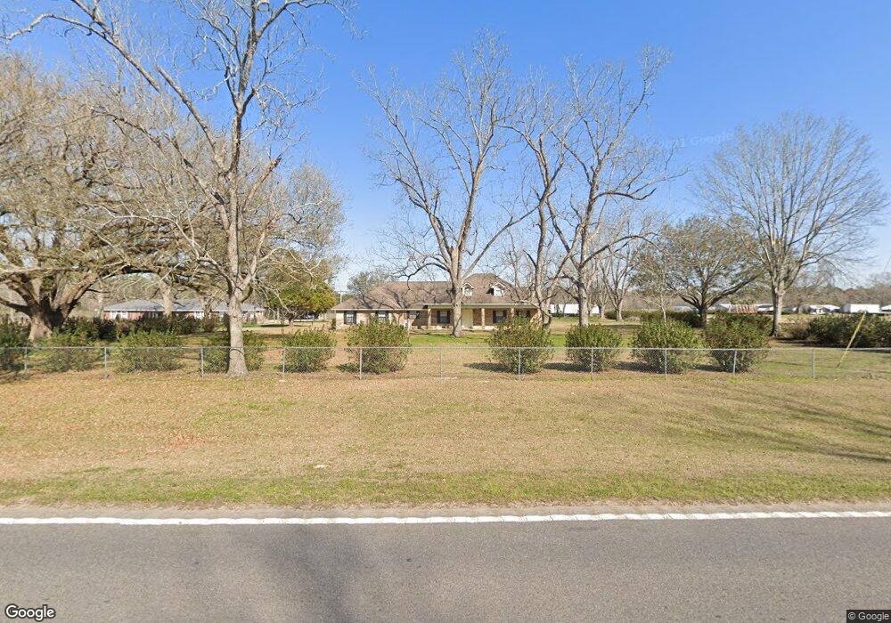
16310 Highway 613 Moss Point, MS 39562
Estimated Value: $239,204 - $290,000
Studio
3
Baths
1,806
Sq Ft
$148/Sq Ft
Est. Value
About This Home
This home is located at 16310 Highway 613, Moss Point, MS 39562 and is currently estimated at $267,801, approximately $148 per square foot. 16310 Highway 613 is a home located in Jackson County with nearby schools including East Central Lower Elementary School, East Central Upper Elementary School, and East Central Middle School.
Ownership History
Date
Name
Owned For
Owner Type
Purchase Details
Closed on
Mar 13, 2017
Bought by
Lane Cecily and Lane Jimmy
Current Estimated Value
Home Financials for this Owner
Home Financials are based on the most recent Mortgage that was taken out on this home.
Original Mortgage
$147,773
Outstanding Balance
$121,499
Interest Rate
4.21%
Estimated Equity
$146,302
Create a Home Valuation Report for This Property
The Home Valuation Report is an in-depth analysis detailing your home's value as well as a comparison with similar homes in the area
Purchase History
| Date | Buyer | Sale Price | Title Company |
|---|---|---|---|
| Lane Cecily | -- | -- |
Source: Public Records
Mortgage History
| Date | Status | Borrower | Loan Amount |
|---|---|---|---|
| Open | Lane Cecily | $147,773 | |
| Closed | Lane Cecily | -- |
Source: Public Records
Tax History
| Year | Tax Paid | Tax Assessment Tax Assessment Total Assessment is a certain percentage of the fair market value that is determined by local assessors to be the total taxable value of land and additions on the property. | Land | Improvement |
|---|---|---|---|---|
| 2025 | $2,481 | $20,878 | $1,709 | $19,169 |
| 2024 | $2,481 | $17,897 | $1,662 | $16,235 |
| 2023 | $2,148 | $17,897 | $1,662 | $16,235 |
| 2022 | $2,088 | $17,897 | $1,662 | $16,235 |
| 2021 | $2,098 | $17,993 | $1,662 | $16,331 |
| 2020 | $1,970 | $16,305 | $1,539 | $14,766 |
| 2019 | $1,948 | $16,305 | $1,539 | $14,766 |
| 2018 | $1,986 | $16,305 | $1,539 | $14,766 |
| 2017 | $2,020 | $16,305 | $1,539 | $14,766 |
| 2016 | $1,940 | $16,305 | $1,539 | $14,766 |
| 2015 | $1,792 | $99,870 | $10,260 | $89,610 |
| 2014 | $1,825 | $15,536 | $1,539 | $13,997 |
| 2013 | $1,764 | $15,536 | $1,539 | $13,997 |
Source: Public Records
Map
Nearby Homes
- 0 R B Dickerson Rd
- 0 Ms-613 Hwy Unit 4116583
- 0 Ms-613 Hwy Unit 4107607
- 0 Ms-613 Hwy Unit 4107612
- 0 Ms-613 Hwy Unit 4116582
- 26.1 Acres Brinkman Rd E
- 17500 Goff Farm Rd
- 0 Grafe Homestead Rd Unit 4137349
- -0- Rayford Shumock Rd
- 7201 Bentwood Dr
- 0 Rayford Shumock Rd Unit 24406728
- 0 Rayford Shumock Rd Unit 4121875
- 17920 Rayford Shumock Rd
- 01 Dap Rd E
- 0 Dap Rd E
- 7805 Songbird Ln
- 14004 Ann Rd
- 14015 Lily Orchard Rd
- 14208 Lily Orchard Rd
- 0 Perry St
- 16308 Highway 613
- 16301 Highway 613
- 16313 Highway 613
- 16237 Highway 613
- 16437 Highway 613
- 16500 Highway 613
- 7809 Murrays Nursery Rd
- 16320 Honeysuckle Rd
- 16316 Honeysuckle Rd
- 16308 Honeysuckle Rd
- 7521 Horace Shumock Rd
- 16417 Honeysuckle Rd
- 16026 Highway 613
- 7812 Murrays Nursery Rd
- 7817 Murrays Nursery Rd
- 7500 Big Point Rd
- 0 Horace Shumock
- 16024 Highway 613
- 7829 Murrays Nursery Rd
- 7833 Murrays Nursery Rd
Your Personal Tour Guide
Ask me questions while you tour the home.