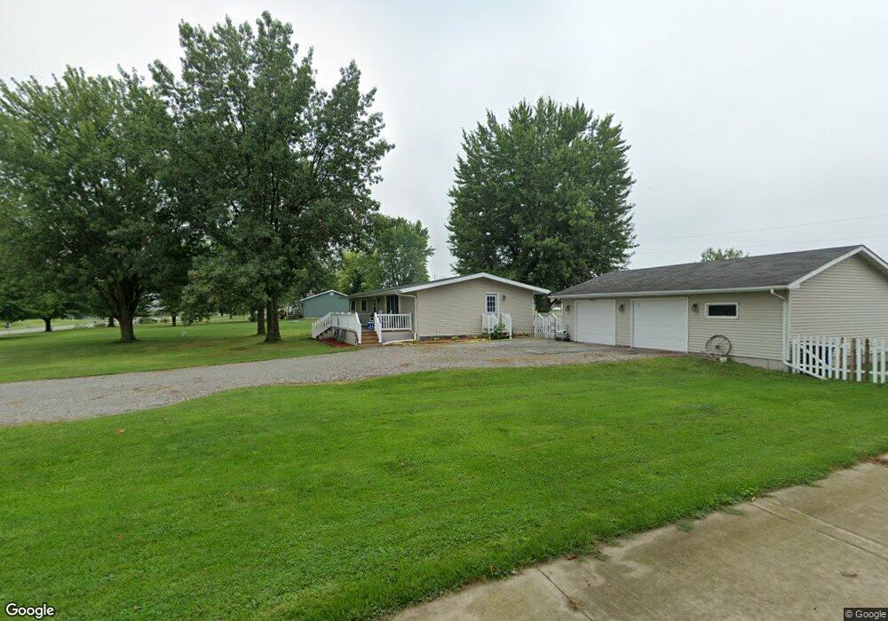
16319 Bluegrass Rd Ottumwa, IA 52501
Estimated Value: $249,226 - $337,000
4
Beds
2
Baths
1,392
Sq Ft
$206/Sq Ft
Est. Value
About This Home
This home is located at 16319 Bluegrass Rd, Ottumwa, IA 52501 and is currently estimated at $286,807, approximately $206 per square foot. 16319 Bluegrass Rd is a home located in Wapello County with nearby schools including Liberty Elementary School, Douma Elementary School, and Evans Middle School.
Ownership History
Date
Name
Owned For
Owner Type
Purchase Details
Closed on
Apr 16, 2019
Sold by
Strickland Robert L
Bought by
Strickland Icheryl M
Current Estimated Value
Purchase Details
Closed on
Feb 23, 2011
Sold by
Schulz Jose H W and Schulz Kell L
Bought by
Strickland Robert L and Strickland Cheryl
Home Financials for this Owner
Home Financials are based on the most recent Mortgage that was taken out on this home.
Original Mortgage
$130,000
Interest Rate
4.76%
Mortgage Type
New Conventional
Purchase Details
Closed on
Dec 1, 2009
Sold by
South Ottumwa Savings Bank
Bought by
Schulz Joseph W and Schulz Kelly L
Home Financials for this Owner
Home Financials are based on the most recent Mortgage that was taken out on this home.
Original Mortgage
$60,000
Interest Rate
5.05%
Mortgage Type
FHA
Create a Home Valuation Report for This Property
The Home Valuation Report is an in-depth analysis detailing your home's value as well as a comparison with similar homes in the area
Home Values in the Area
Average Home Value in this Area
Purchase History
| Date | Buyer | Sale Price | Title Company |
|---|---|---|---|
| Strickland Icheryl M | -- | -- | |
| Strickland Robert L | $140,000 | None Available | |
| Schulz Joseph W | $40,000 | None Available |
Source: Public Records
Mortgage History
| Date | Status | Borrower | Loan Amount |
|---|---|---|---|
| Previous Owner | Strickland Robert L | $130,000 | |
| Previous Owner | Schulz Joseph W | $60,000 |
Source: Public Records
Tax History Compared to Growth
Tax History
| Year | Tax Paid | Tax Assessment Tax Assessment Total Assessment is a certain percentage of the fair market value that is determined by local assessors to be the total taxable value of land and additions on the property. | Land | Improvement |
|---|---|---|---|---|
| 2025 | $3,030 | $259,570 | $20,960 | $238,610 |
| 2024 | $3,030 | $229,640 | $19,050 | $210,590 |
| 2023 | $2,558 | $229,640 | $19,050 | $210,590 |
| 2022 | $2,362 | $187,430 | $19,050 | $168,380 |
| 2021 | $2,490 | $163,110 | $19,050 | $144,060 |
| 2020 | $2,334 | $162,750 | $19,050 | $143,700 |
| 2019 | $2,264 | $155,560 | $0 | $0 |
| 2018 | $2,224 | $155,560 | $0 | $0 |
| 2017 | $2,224 | $143,480 | $0 | $0 |
| 2016 | $1,432 | $102,629 | $0 | $0 |
| 2015 | $1,454 | $102,629 | $0 | $0 |
| 2014 | -- | $102,629 | $0 | $0 |
Source: Public Records
Map
Nearby Homes
- 16311 Bluegrass Rd
- 2018 W Finley Ave
- 1404 Lake Rd
- 812 Lake Rd
- 746 Lake Rd
- 1975 Greenwood Dr
- 714 Lake Rd
- 1939 Gladstone St
- 530 Leighton St
- 1820 Gladstone St
- 1820 Richmond Ave
- 120 Shaul Ave
- 311 Minneopa Ave
- 439 Wildwood Dr
- 421 Minneopa Ave
- 1508 Hamilton St
- 9 Kingsley Dr
- 1401 W Finley Ave
- 448 Mckinley Ave
- 419 S Pocahontas St
- 16339 Bluegrass Rd
- 16303 Bluegrass Rd
- 16351 Bluegrass Rd
- 16300 Bluegrass Rd
- 16277 Bluegrass Rd
- 16257 Bluegrass Rd
- 16367 Bluegrass Rd
- 16265 Bluegrass Rd
- 16245 Bluegrass Rd
- 16378 Bluegrass Rd
- 16290 Bluegrass Rd
- 16383 Bluegrass Rd
- 16386 Bluegrass Rd
- 16217 Bluegrass Rd
- 16311 Bluegrass Rd Unit 6
- 16311 Bluegrass Rd
- 16311 Bluegrass Rd
- 16311 Bluegrass Rd
- 16311 Bluegrass Rd
- 16311 Bluegrass Rd Unit 2