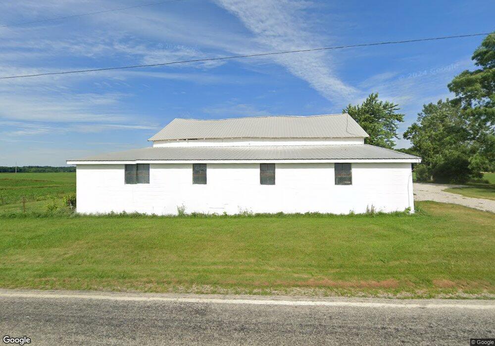
1632 State Route 511 Ashland, OH 44805
Estimated Value: $189,581 - $364,000
3
Beds
1
Bath
1,650
Sq Ft
$157/Sq Ft
Est. Value
About This Home
This home is located at 1632 State Route 511, Ashland, OH 44805 and is currently estimated at $259,145, approximately $157 per square foot. 1632 State Route 511 is a home located in Ashland County with nearby schools including Ashland High School, Ashland County Community Academy, and St. Edward Elementary School.
Ownership History
Date
Name
Owned For
Owner Type
Purchase Details
Closed on
Aug 3, 2022
Sold by
Bender Joahann E
Bought by
Joahann E Bender Irrevocable Trust
Current Estimated Value
Purchase Details
Closed on
Jan 19, 2016
Bought by
Bender Joahann E and Thompson Wayne A
Home Financials for this Owner
Home Financials are based on the most recent Mortgage that was taken out on this home.
Original Mortgage
$25,314
Interest Rate
3.92%
Mortgage Type
New Conventional
Purchase Details
Closed on
Sep 21, 1987
Bought by
Bender Joahann E
Create a Home Valuation Report for This Property
The Home Valuation Report is an in-depth analysis detailing your home's value as well as a comparison with similar homes in the area
Home Values in the Area
Average Home Value in this Area
Purchase History
| Date | Buyer | Sale Price | Title Company |
|---|---|---|---|
| Joahann E Bender Irrevocable Trust | -- | New Title Company Name | |
| Bender Joahann E | -- | -- | |
| Bender Joahann E | $42,800 | -- |
Source: Public Records
Mortgage History
| Date | Status | Borrower | Loan Amount |
|---|---|---|---|
| Previous Owner | Bender Joahann E | $25,314 | |
| Closed | Bender Joahann E | $33,575 |
Source: Public Records
Tax History Compared to Growth
Tax History
| Year | Tax Paid | Tax Assessment Tax Assessment Total Assessment is a certain percentage of the fair market value that is determined by local assessors to be the total taxable value of land and additions on the property. | Land | Improvement |
|---|---|---|---|---|
| 2024 | $1,173 | $42,620 | $15,410 | $27,210 |
| 2023 | $1,173 | $42,620 | $15,410 | $27,210 |
| 2022 | $1,393 | $30,440 | $11,000 | $19,440 |
| 2021 | $1,399 | $30,440 | $11,000 | $19,440 |
| 2020 | $1,328 | $30,440 | $11,000 | $19,440 |
| 2019 | $1,230 | $26,040 | $11,110 | $14,930 |
| 2018 | $1,136 | $23,940 | $11,110 | $12,830 |
| 2017 | $1,116 | $23,940 | $11,110 | $12,830 |
| 2016 | $1,020 | $21,190 | $9,840 | $11,350 |
| 2015 | $1,011 | $21,190 | $9,840 | $11,350 |
| 2013 | $1,090 | $22,390 | $9,790 | $12,600 |
Source: Public Records
Map
Nearby Homes
- 1653 Ohio 60
- 1581 County Road 995
- 1690 County Road 995
- 1015 Township Road 1696
- 0 Twp Rd 1806 Unit 11591470
- 1457 Township Road 853
- 1435 Township Road 853
- 1446 Township Road 805
- 1331 Eastern Ave
- 1706 Kingwood Ct
- 453 Hillcrest Dr
- 31 Morgan Ave
- 1109 Eastern Ave
- 531 Keen Ave
- 1011 Eastern Ave
- 0 Eagle Way
- 963 Avalon Dr
- 1111 Columbus Cir N
- 914 Chestnut St
- 208 High St
- 1628 State Route 511
- 1628 Ohio 511
- 1652 State Route 511
- 889 County Road 1600
- 896 County Road 1600
- 1589 State Route 511
- 1589 Ohio 511
- 873 County Road 1600
- 1587 Ohio 511
- 1587 State Route 511
- 0 Township Road 1654
- 888 County Road 1600
- 1579 State Route 511
- 876 County Road 1600
- 0 Co Road 1600 Unit 3479665
- 868 County Road 1600
- 1575 State Route 511
- 1575 Ohio 511
- 1570 Ohio 511
- 1573 Ohio 511