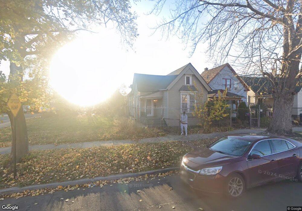
1633 Lansing St Detroit, MI 48209
Southwest Detroit NeighborhoodEstimated Value: $60,000 - $77,000
--
Bed
2
Baths
1,358
Sq Ft
$52/Sq Ft
Est. Value
About This Home
This home is located at 1633 Lansing St, Detroit, MI 48209 and is currently estimated at $70,333, approximately $51 per square foot. 1633 Lansing St is a home located in Wayne County with nearby schools including Maybury Elementary School, Charles L. Spain Elementary-Middle School, and Edward 'Duke' Ellington Conservatory of Music and Art.
Ownership History
Date
Name
Owned For
Owner Type
Purchase Details
Closed on
Dec 19, 2024
Sold by
Detroit Renaissance 3 Llc
Bought by
Draper Christopher Patrick and Draper Najet
Current Estimated Value
Purchase Details
Closed on
Dec 16, 2020
Sold by
The Detroit Land Bank Authority
Bought by
Detroit Renaissance 3 Llc
Purchase Details
Closed on
Jan 6, 2015
Sold by
Wayne County Treasurer
Bought by
Detroit Land Bank Authority
Create a Home Valuation Report for This Property
The Home Valuation Report is an in-depth analysis detailing your home's value as well as a comparison with similar homes in the area
Home Values in the Area
Average Home Value in this Area
Purchase History
| Date | Buyer | Sale Price | Title Company |
|---|---|---|---|
| Draper Christopher Patrick | -- | None Listed On Document | |
| Detroit Renaissance 3 Llc | -- | None Available | |
| Detroit Land Bank Authority | -- | None Available |
Source: Public Records
Tax History Compared to Growth
Tax History
| Year | Tax Paid | Tax Assessment Tax Assessment Total Assessment is a certain percentage of the fair market value that is determined by local assessors to be the total taxable value of land and additions on the property. | Land | Improvement |
|---|---|---|---|---|
| 2025 | $30 | $1,600 | $0 | $0 |
| 2024 | $30 | $400 | $0 | $0 |
| 2023 | $31 | $400 | $0 | $0 |
| 2022 | $35 | $400 | $0 | $0 |
| 2021 | $35 | $0 | $0 | $0 |
| 2020 | $0 | $0 | $0 | $0 |
| 2019 | $0 | $0 | $0 | $0 |
| 2018 | $0 | $0 | $0 | $0 |
| 2017 | $38 | $0 | $0 | $0 |
| 2016 | $38 | $0 | $0 | $0 |
| 2015 | $38 | $400 | $0 | $0 |
| 2013 | $872 | $8,718 | $0 | $0 |
| 2010 | -- | $12,492 | $404 | $12,088 |
Source: Public Records
Map
Nearby Homes
- 1028 Lansing St
- 1620 Morrell St
- 1408 Lansing St
- 1401 Mc Kinstry St
- 1937 Morrell St
- 1206 Lansing St
- 1502 Campbell St
- 1253 Junction Ave
- 1551 Campbell St Unit 1553 campbell
- 1103 Lansing St
- 1073 Morrell St
- 5839 Mcmillan St
- 735 Hubbard St
- 5627 Brandon St
- 5854 Romeyn St
- 2012 Hubbard St
- 1965 Vinewood St
- 1455 Vinewood St
- 1610 Military St
- 1021 Hubbard St
- 1627 Lansing St
- 1621 Lansing St
- 1645 Lansing St
- 1651 Lansing St
- 1615 Lansing St
- 1609 Lansing St
- 1603 Lansing St
- 1638 Ferdinand St
- 1644 Ferdinand St
- 1620 Ferdinand St
- 1597 Lansing St
- 1650 Ferdinand St
- 1614 Ferdinand St
- 1602 Lansing St
- 1608 Lansing St
- 1608 Ferdinand St
- 1630 Ferdinand St
- 1591 Lansing St
- 1626 Ferdinand St
- 1602 Ferdinand St