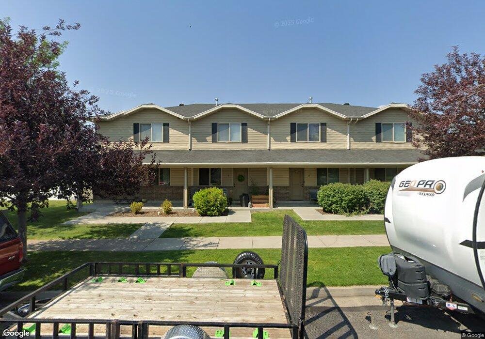
1633 N 200 W Logan, UT 84341
Bridger NeighborhoodEstimated Value: $714,000 - $752,000
6
Beds
6
Baths
3,360
Sq Ft
$218/Sq Ft
Est. Value
About This Home
This home is located at 1633 N 200 W, Logan, UT 84341 and is currently estimated at $733,000, approximately $218 per square foot. 1633 N 200 W is a home located in Cache County with nearby schools including Bridger School, Mount Logan Middle School, and Logan High School.
Ownership History
Date
Name
Owned For
Owner Type
Purchase Details
Closed on
Jun 25, 2021
Sold by
Shank Mary C
Bought by
Shank David L
Current Estimated Value
Purchase Details
Closed on
Jun 18, 2021
Sold by
Leathers Catherine Mary and Shank David L
Bought by
D & M North Llc
Purchase Details
Closed on
Apr 2, 2016
Sold by
Shank David L and Shank Mary C
Bought by
D & M North Llc
Purchase Details
Closed on
Jan 16, 2014
Sold by
Thompson Jackie
Bought by
Shank Trust B and Shank Mary C
Purchase Details
Closed on
Jan 15, 2010
Sold by
Thompson Robert
Bought by
Thompson Ken and Thompson Jackie
Create a Home Valuation Report for This Property
The Home Valuation Report is an in-depth analysis detailing your home's value as well as a comparison with similar homes in the area
Home Values in the Area
Average Home Value in this Area
Purchase History
| Date | Buyer | Sale Price | Title Company |
|---|---|---|---|
| Shank David L | -- | -- | |
| D & M North Llc | -- | None Listed On Document | |
| D & M North Llc | -- | None Available | |
| Shank Trust B | -- | Security Title Of Davis Coun | |
| Thompson Ken | -- | Hickman Land Title Company |
Source: Public Records
Tax History
| Year | Tax Paid | Tax Assessment Tax Assessment Total Assessment is a certain percentage of the fair market value that is determined by local assessors to be the total taxable value of land and additions on the property. | Land | Improvement |
|---|---|---|---|---|
| 2025 | $2,229 | $524,120 | $122,400 | $401,720 |
| 2023 | $2,403 | $521,720 | $120,000 | $401,720 |
| 2022 | $2,574 | $521,720 | $120,000 | $401,720 |
| 2021 | $2,817 | $485,200 | $120,000 | $365,200 |
| 2020 | $2,137 | $331,300 | $80,000 | $251,300 |
| 2019 | $2,234 | $331,300 | $80,000 | $251,300 |
| 2018 | $2,300 | $311,450 | $50,000 | $261,450 |
| 2017 | $2,297 | $164,450 | $0 | $0 |
| 2016 | $2,381 | $164,450 | $0 | $0 |
| 2015 | $2,384 | $164,450 | $0 | $0 |
| 2014 | $2,155 | $164,450 | $0 | $0 |
| 2013 | -- | $128,720 | $0 | $0 |
Source: Public Records
Map
Nearby Homes
- 1555 N 280 W Unit 102
- Park Avenue 1600 Plan at Park Avenue 1600
- 49 Kensington Place
- 60 Hampton Place
- 54 Kensington Place
- 2 Somerset Place
- 1521 N 420 W Unit 104
- 1515 N 450 W Unit 103
- 519 W 1570 N Unit 103
- 1926 Lavender Loop Unit 6
- 1492 N 565 W Unit 103
- 2200 N 220 W
- 490 W 1950 N Unit 27
- 239 E 1530 N
- 272 E 1725 N Unit 3
- 465 W 1140 N
- 1030 N 250 W
- 518 W 930 N
- 905 N 540 W
- 327 E 2230 N Unit A
- 231 W 1600 N
- 211 W 1600 N
- 235 W 1580 N Unit 102
- 235 W 1580 N Unit 3-101
- 255 W 1580 N Unit 2-103
- 1638 N 200 W
- 195 W 1600 N Unit 120
- 285 W 1580 N Unit 102
- 1593 N 160 W Unit 1
- 1593 N 160 W Unit 101
- 1593 N 160 W Unit 102
- 1593 N 160 W Unit 202
- 1593 N 160 W
- 1593 N 160 W Unit 201
- 165 W 1600 N Unit A130
- 1562 N 280 W Unit 101
- 1591 N 160 W Unit 2
- 180 W 1575 N Unit 108
- 180 W 1575 N Unit 107
- 180 W 1575 N Unit 203
Your Personal Tour Guide
Ask me questions while you tour the home.