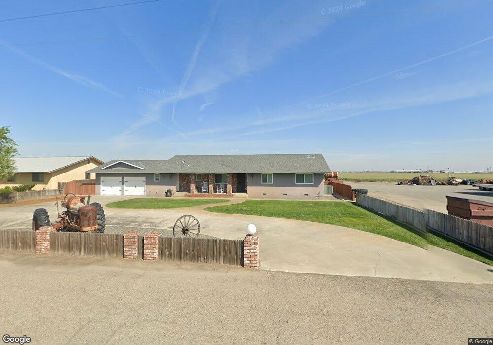
16332 Flint Ave Hanford, CA 93230
Estimated Value: $653,000 - $958,725
4
Beds
3
Baths
2,206
Sq Ft
$348/Sq Ft
Est. Value
About This Home
This home is located at 16332 Flint Ave, Hanford, CA 93230 and is currently estimated at $766,931, approximately $347 per square foot. 16332 Flint Ave is a home located in Kings County with nearby schools including Meadow Lane Elementary School, Liberty Middle School, and Lemoore High School.
Ownership History
Date
Name
Owned For
Owner Type
Purchase Details
Closed on
May 11, 2009
Sold by
Vaz Mabel E
Bought by
Cunha Eliseu A and Cunha Theresa M
Current Estimated Value
Purchase Details
Closed on
Dec 7, 2000
Sold by
Vaz Mable E and Vaz Mabel E
Bought by
Cunha Eliseu A and Cunha Theresa M
Home Financials for this Owner
Home Financials are based on the most recent Mortgage that was taken out on this home.
Original Mortgage
$630,000
Interest Rate
7.71%
Create a Home Valuation Report for This Property
The Home Valuation Report is an in-depth analysis detailing your home's value as well as a comparison with similar homes in the area
Home Values in the Area
Average Home Value in this Area
Purchase History
| Date | Buyer | Sale Price | Title Company |
|---|---|---|---|
| Cunha Eliseu A | -- | None Available | |
| Cunha Eliseu A | -- | Chicago Title Co |
Source: Public Records
Mortgage History
| Date | Status | Borrower | Loan Amount |
|---|---|---|---|
| Previous Owner | Cunha Eliseu A | $630,000 |
Source: Public Records
Tax History Compared to Growth
Tax History
| Year | Tax Paid | Tax Assessment Tax Assessment Total Assessment is a certain percentage of the fair market value that is determined by local assessors to be the total taxable value of land and additions on the property. | Land | Improvement |
|---|---|---|---|---|
| 2025 | $7,268 | $676,019 | $96,439 | $579,580 |
| 2023 | $7,268 | $649,998 | $92,923 | $557,075 |
| 2022 | $7,374 | $629,408 | $83,256 | $546,152 |
| 2021 | $7,203 | $619,368 | $83,924 | $535,444 |
| 2020 | $7,132 | $610,309 | $80,355 | $529,954 |
| 2019 | $7,092 | $597,934 | $78,371 | $519,563 |
| 2018 | $6,654 | $583,854 | $74,479 | $509,375 |
| 2017 | $6,539 | $577,222 | $77,835 | $499,387 |
| 2016 | $6,225 | $573,054 | $83,459 | $489,595 |
| 2015 | $6,224 | $567,104 | $84,863 | $482,241 |
| 2014 | $5,992 | $550,661 | $77,866 | $472,795 |
Source: Public Records
Map
Nearby Homes
- 16710 Flint Ave
- 15400 Excelsior Ave
- 14331 Fargo Ave
- 0 N Lemoore Ave Unit SN25187663
- 0 N Lemoore Ave Unit btwn. Aves. 16 & 17
- 8562 Serrano Ave
- 2613 W Mallard Ln
- 2610 W Mallard Ln
- 2608 W Heather Ln
- 17534 Lacey Blvd
- 7305 Highway 41
- 18896 Grangeville Blvd
- 0 Highway 41
- 19860 Fremont Ave
- 13290 Riverview Dr
- 2198 N Mitchell St
- 2190 N Mitchell St
- 18429 W Lacey Blvd
- 21530 Tiburico Ave
- 2516 Cortner St