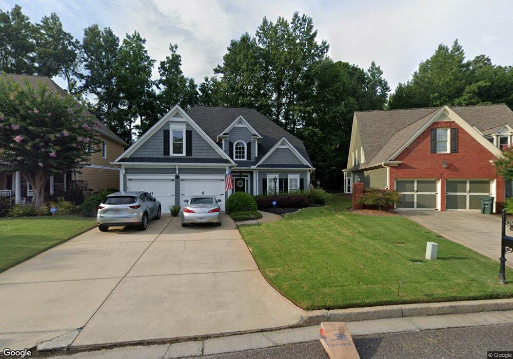
1634 Lightfoot Cir Marietta, GA 30062
Eastern Marietta NeighborhoodEstimated Value: $622,367 - $681,000
4
Beds
4
Baths
3,432
Sq Ft
$188/Sq Ft
Est. Value
About This Home
This home is located at 1634 Lightfoot Cir, Marietta, GA 30062 and is currently estimated at $646,342, approximately $188 per square foot. 1634 Lightfoot Cir is a home located in Cobb County with nearby schools including Sawyer Road Elementary School, Marietta Sixth Grade Academy, and Marietta Middle School.
Ownership History
Date
Name
Owned For
Owner Type
Purchase Details
Closed on
Nov 30, 2021
Sold by
Lance Etheridge
Bought by
Etheridge Melise W and Etheridge Wayne J
Current Estimated Value
Purchase Details
Closed on
Jul 9, 2015
Sold by
Stoyer Lucy
Bought by
Etheridge Lance
Home Financials for this Owner
Home Financials are based on the most recent Mortgage that was taken out on this home.
Original Mortgage
$250,400
Interest Rate
4.08%
Mortgage Type
Commercial
Purchase Details
Closed on
Jul 18, 2014
Sold by
Rogers Howard T
Bought by
Stoyer Lucy and Rogers Howard T Jr Living Trus
Purchase Details
Closed on
Jun 18, 2001
Sold by
Homes By Williamscraft Inc
Bought by
Rogers Howard T
Home Financials for this Owner
Home Financials are based on the most recent Mortgage that was taken out on this home.
Original Mortgage
$247,300
Interest Rate
7.14%
Mortgage Type
New Conventional
Create a Home Valuation Report for This Property
The Home Valuation Report is an in-depth analysis detailing your home's value as well as a comparison with similar homes in the area
Home Values in the Area
Average Home Value in this Area
Purchase History
| Date | Buyer | Sale Price | Title Company |
|---|---|---|---|
| Etheridge Melise W | -- | Smith Gambrell & Russell Llp | |
| Etheridge Lance | $313,000 | -- | |
| Stoyer Lucy | -- | -- | |
| Rogers Howard T | $309,200 | -- |
Source: Public Records
Mortgage History
| Date | Status | Borrower | Loan Amount |
|---|---|---|---|
| Previous Owner | Etheridge Lance | $250,400 | |
| Previous Owner | Rogers Howard T | $247,300 |
Source: Public Records
Tax History Compared to Growth
Tax History
| Year | Tax Paid | Tax Assessment Tax Assessment Total Assessment is a certain percentage of the fair market value that is determined by local assessors to be the total taxable value of land and additions on the property. | Land | Improvement |
|---|---|---|---|---|
| 2025 | $1,183 | $223,540 | $50,000 | $173,540 |
| 2024 | $1,183 | $211,860 | $44,000 | $167,860 |
| 2023 | $1,031 | $211,860 | $44,000 | $167,860 |
| 2022 | $1,183 | $182,380 | $40,400 | $141,980 |
| 2021 | $1,287 | $149,848 | $40,400 | $109,448 |
| 2020 | $1,287 | $149,848 | $40,400 | $109,448 |
| 2019 | $1,226 | $142,672 | $40,400 | $102,272 |
| 2018 | $1,100 | $128,000 | $40,400 | $87,600 |
| 2017 | $882 | $128,000 | $40,400 | $87,600 |
| 2016 | $765 | $111,020 | $38,380 | $72,640 |
| 2015 | $833 | $111,020 | $38,380 | $72,640 |
| 2014 | $762 | $109,172 | $0 | $0 |
Source: Public Records
Map
Nearby Homes
- 1580 Reids Ferry Way
- 1900 Branch View Dr
- 1599 Cambridge Place
- 1582 Cambridge
- 1701 Smithwood Dr
- 1519 Evanston Ln
- 1822 Hasty Rd
- 2252 Carefree Cir Unit 3
- 1833 Tree Top Ct
- 1972 Granite Mill Rd
- 1800 Chardin Way
- 1442 Glenover Cir
- 1834 Butterfly NE
- 1834 Butterfly Way
- 1838 Butterfly NE
- 1854 Butterfly Way
- 1850 Butterfly Way NE
- 1490 Longwing Ln
- Robie Plan at The Village at Sandy Plains
- Harbor Plan at The Village at Sandy Plains
- 1640 Lightfoot Cir
- 1628 Lightfoot Cir
- 1622 Lightfoot Cir
- 1646 Lightfoot Cir
- 1763 Holcomb Lake Rd
- 1740 Donald Dr
- 1767 Holcomb Lake Rd
- 1616 Lightfoot Cir
- 1750 Donald Dr
- 0 Lightfoot Cir Unit 7073044
- 0 Lightfoot Cir Unit 8556012
- 0 Lightfoot Cir Unit 8026010
- 0 Lightfoot Cir Unit 8015860
- 1610 Lightfoot Cir
- 1664 Lightfoot Cir
- 1604 Lightfoot Cir
- 1760 Donald Dr
- 1660 Tappahannock Trail
- 1756 Holcomb Lake Rd
- 1670 Lightfoot Cir