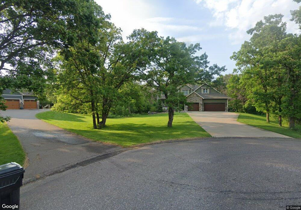
16340 Royal Rd Ramsey, MN 55303
Estimated Value: $699,365 - $822,000
3
Beds
3
Baths
2,980
Sq Ft
$254/Sq Ft
Est. Value
About This Home
This home is located at 16340 Royal Rd, Ramsey, MN 55303 and is currently estimated at $755,841, approximately $253 per square foot. 16340 Royal Rd is a home located in Anoka County with nearby schools including Brookside Elementary School, Anoka Middle School for the Arts - Fred Moor Campus, and Anoka Senior High School.
Ownership History
Date
Name
Owned For
Owner Type
Purchase Details
Closed on
Feb 14, 2013
Sold by
Zurek Kathleen Jane
Bought by
Smith Benjamin I and Smith Jessica M
Current Estimated Value
Home Financials for this Owner
Home Financials are based on the most recent Mortgage that was taken out on this home.
Original Mortgage
$71,250
Outstanding Balance
$49,992
Interest Rate
3.49%
Mortgage Type
Future Advance Clause Open End Mortgage
Estimated Equity
$705,849
Purchase Details
Closed on
Dec 10, 2001
Sold by
North Fork Inc
Bought by
Zurek Robert and Zurek Kathy
Create a Home Valuation Report for This Property
The Home Valuation Report is an in-depth analysis detailing your home's value as well as a comparison with similar homes in the area
Home Values in the Area
Average Home Value in this Area
Purchase History
| Date | Buyer | Sale Price | Title Company |
|---|---|---|---|
| Smith Benjamin I | $107,500 | Executive Title Inc | |
| Zurek Robert | $224,000 | -- |
Source: Public Records
Mortgage History
| Date | Status | Borrower | Loan Amount |
|---|---|---|---|
| Open | Smith Benjamin I | $71,250 |
Source: Public Records
Tax History Compared to Growth
Tax History
| Year | Tax Paid | Tax Assessment Tax Assessment Total Assessment is a certain percentage of the fair market value that is determined by local assessors to be the total taxable value of land and additions on the property. | Land | Improvement |
|---|---|---|---|---|
| 2025 | $7,192 | $650,200 | $125,500 | $524,700 |
| 2024 | $7,192 | $610,000 | $103,200 | $506,800 |
| 2023 | $6,629 | $596,100 | $98,500 | $497,600 |
| 2022 | $5,458 | $616,300 | $109,500 | $506,800 |
| 2021 | $5,197 | $472,600 | $92,200 | $380,400 |
| 2020 | $5,362 | $450,200 | $90,500 | $359,700 |
| 2019 | $5,658 | $449,600 | $90,500 | $359,100 |
| 2018 | $5,622 | $460,900 | $0 | $0 |
| 2017 | $4,925 | $441,800 | $0 | $0 |
| 2016 | $5,177 | $394,500 | $0 | $0 |
| 2015 | $5,027 | $394,500 | $85,900 | $308,600 |
| 2014 | -- | $80,400 | $80,400 | $0 |
Source: Public Records
Map
Nearby Homes
- 16401 Kangaroo St NW
- 9160 164th Ln NW
- 9080 168th Ave NW
- 17000 Jackal St NW
- 15721 Hedgehog St NW
- 8306 155th Ln NW
- 15295 Marmoset St NW
- 15240 Kangaroo St NW
- Ashlyn Plan at Trott Brook Crossing
- Alley Plan at Trott Brook Crossing
- Henry Plan at Trott Brook Crossing
- Sully Plan at Trott Brook Crossing
- 17041 Uranimite St NW
- Arlow Plan at Trott Brook Crossing
- Nora Plan at Trott Brook Crossing
- Kenny Plan at Trott Brook Crossing
- Hudson Plan at Trott Brook Crossing
- 15230 Kangaroo St NW
- 15212 Nutria St NW
- 7472 170th Ave NW
- 16330 Royal Rd
- 16321 Royal Rd
- 16320 Royal Rd
- 16311 Royal Rd
- 8751 162nd Ln NW
- 16291 Royal Rd
- 8781 162nd Ln NW
- 8781 162nd Ln NW
- 8750 162nd Ln NW
- 16290 Royal Rd
- 16271 Royal Rd
- 8801 162nd Ln NW
- 16424 Okapi St NW
- 16400 Okapi St NW
- 16261 Royal Rd
- 8450 166th Cir NW
- 16326 Okapi St NW
- 16260 Royal Rd
- 8780 162nd Ln NW
- 8800 162nd Ln NW