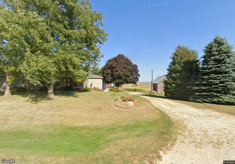
16353 Highway 56 Elkader, IA 52043
Estimated Value: $271,000 - $404,000
4
Beds
3
Baths
1,568
Sq Ft
$211/Sq Ft
Est. Value
About This Home
This home is located at 16353 Highway 56, Elkader, IA 52043 and is currently estimated at $331,436, approximately $211 per square foot. 16353 Highway 56 is a home located in Clayton County with nearby schools including Central Elementary School and Central Middle School/High School.
Ownership History
Date
Name
Owned For
Owner Type
Purchase Details
Closed on
Jul 12, 2019
Sold by
Holst Stephen G and Holst Amy A
Bought by
Schneider Jason A and Schneider Amanda M
Current Estimated Value
Home Financials for this Owner
Home Financials are based on the most recent Mortgage that was taken out on this home.
Original Mortgage
$178,875
Outstanding Balance
$156,374
Interest Rate
3.82%
Mortgage Type
New Conventional
Estimated Equity
$175,062
Create a Home Valuation Report for This Property
The Home Valuation Report is an in-depth analysis detailing your home's value as well as a comparison with similar homes in the area
Home Values in the Area
Average Home Value in this Area
Purchase History
| Date | Buyer | Sale Price | Title Company |
|---|---|---|---|
| Schneider Jason A | -- | -- |
Source: Public Records
Mortgage History
| Date | Status | Borrower | Loan Amount |
|---|---|---|---|
| Open | Schneider Jason A | $178,875 |
Source: Public Records
Tax History Compared to Growth
Tax History
| Year | Tax Paid | Tax Assessment Tax Assessment Total Assessment is a certain percentage of the fair market value that is determined by local assessors to be the total taxable value of land and additions on the property. | Land | Improvement |
|---|---|---|---|---|
| 2025 | $2,856 | $284,905 | $79,983 | $204,922 |
| 2024 | $2,770 | $241,249 | $69,550 | $171,699 |
| 2023 | $2,616 | $241,249 | $69,550 | $171,699 |
| 2022 | $2,524 | $196,298 | $59,640 | $136,658 |
| 2021 | $2,370 | $196,298 | $59,640 | $136,658 |
| 2020 | $2,370 | $178,950 | $52,185 | $126,765 |
| 2019 | $2,340 | $173,950 | $47,185 | $126,765 |
| 2018 | $2,340 | $172,063 | $47,185 | $124,878 |
| 2017 | $2,300 | $172,063 | $47,185 | $124,878 |
| 2015 | $1,892 | $160,007 | $38,730 | $121,277 |
| 2014 | $1,874 | $142,393 | $26,838 | $115,555 |
Source: Public Records
Map
Nearby Homes
- 14149 Iowa 56
- 710 Woodland Dr NW
- 707 N Main St
- 702 N Main St
- 247 Franzen Ridge Rd
- 249 Franzen Ridge Rd
- 301 N 1st St
- 209 2nd St SW
- 117 S Main St
- 302 N 3rd St
- 0 E Bridge St
- 26642 Iowa 13
- TBD Country Rd
- 27766 Highway 13
- TBD Birch Rd
- 10766 Bush Rd
- 0 13 Hwy Unit NBR20255145
- Tbd Acorn Rd
- Tbd Acorn Rd
- TBD Acorn Rd