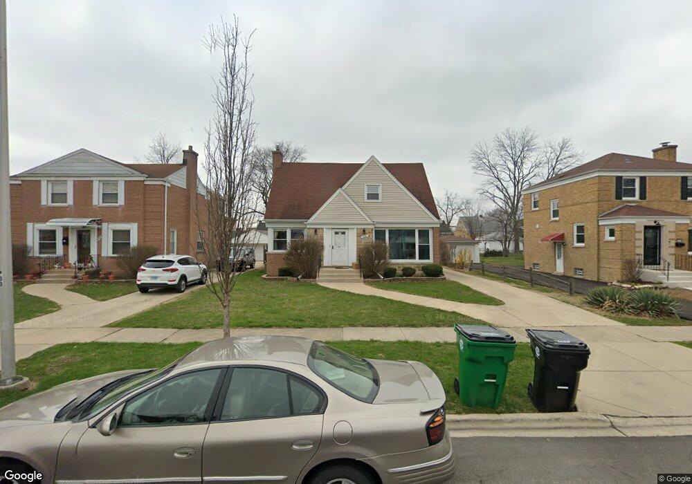
1636 Portsmouth Ave Westchester, IL 60154
Estimated Value: $313,000 - $328,911
3
Beds
2
Baths
969
Sq Ft
$332/Sq Ft
Est. Value
About This Home
This home is located at 1636 Portsmouth Ave, Westchester, IL 60154 and is currently estimated at $321,978, approximately $332 per square foot. 1636 Portsmouth Ave is a home located in Cook County with nearby schools including Westchester Primary School, Westchester Intermediate School, and Westchester Middle School.
Ownership History
Date
Name
Owned For
Owner Type
Purchase Details
Closed on
Feb 21, 2023
Sold by
Jean Audrey Stanger Revocable Trust
Bought by
Sloan Matthew K
Current Estimated Value
Home Financials for this Owner
Home Financials are based on the most recent Mortgage that was taken out on this home.
Original Mortgage
$234,600
Outstanding Balance
$227,423
Interest Rate
6.47%
Mortgage Type
New Conventional
Estimated Equity
$94,555
Purchase Details
Closed on
Nov 27, 2013
Sold by
Stanger Jean A
Bought by
Stanger Jean Audrey and The Jean Audrey Stanger Revocable Trust
Create a Home Valuation Report for This Property
The Home Valuation Report is an in-depth analysis detailing your home's value as well as a comparison with similar homes in the area
Home Values in the Area
Average Home Value in this Area
Purchase History
| Date | Buyer | Sale Price | Title Company |
|---|---|---|---|
| Sloan Matthew K | $255,000 | None Listed On Document | |
| Stanger Jean Audrey | -- | None Available |
Source: Public Records
Mortgage History
| Date | Status | Borrower | Loan Amount |
|---|---|---|---|
| Open | Sloan Matthew K | $234,600 |
Source: Public Records
Tax History Compared to Growth
Tax History
| Year | Tax Paid | Tax Assessment Tax Assessment Total Assessment is a certain percentage of the fair market value that is determined by local assessors to be the total taxable value of land and additions on the property. | Land | Improvement |
|---|---|---|---|---|
| 2024 | $5,257 | $26,000 | $4,690 | $21,310 |
| 2023 | $4,805 | $26,000 | $4,690 | $21,310 |
| 2022 | $4,805 | $21,908 | $4,020 | $17,888 |
| 2021 | $819 | $21,907 | $4,020 | $17,887 |
| 2020 | $745 | $21,907 | $4,020 | $17,887 |
| 2019 | $806 | $21,690 | $3,685 | $18,005 |
| 2018 | $797 | $21,690 | $3,685 | $18,005 |
| 2017 | $768 | $21,690 | $3,685 | $18,005 |
| 2016 | $1,490 | $18,891 | $3,350 | $15,541 |
| 2015 | $1,545 | $18,891 | $3,350 | $15,541 |
| 2014 | $1,478 | $18,891 | $3,350 | $15,541 |
| 2013 | $1,353 | $19,918 | $3,350 | $16,568 |
Source: Public Records
Map
Nearby Homes
- 1907 Suffolk Ave
- 1623 Manchester Ave
- 1932 Newcastle Ave
- 1900 Manchester Ave
- 1601 Bristol Ave
- 1500 Bristol Ave
- 1840 Gardner Rd
- 2128 Hull Ave
- 1433 Bristol Ave
- 10072 Drury Ln
- 1245 S Mannheim Rd Unit 2
- 1247 S Mannheim Rd Unit 3
- 10531 Camelot St
- 10524 Camelot St
- 10567 Waterford Dr
- 1119 Newcastle Ave
- 1016 Hull Ave
- 1860 Buckingham Ave
- 1811 Downing Ave
- 920 Suffolk Ave
- 1642 Portsmouth Ave
- 1646 Portsmouth Ave
- 1626 Portsmouth Ave
- 1637 Newcastle Ave
- 1641 Newcastle Ave
- 1631 Newcastle Ave
- 1652 Portsmouth Ave
- 1622 Portsmouth Ave
- 1647 Newcastle Ave
- 1627 Newcastle Ave
- 1637 Portsmouth Ave
- 1616 Portsmouth Ave
- 1651 Newcastle Ave
- 1656 Portsmouth Ave
- 1623 Newcastle Ave
- 1633 Portsmouth Ave
- 1643 Portsmouth Ave
- 1627 Portsmouth Ave
- 1647 Portsmouth Ave
- 1657 Newcastle Ave