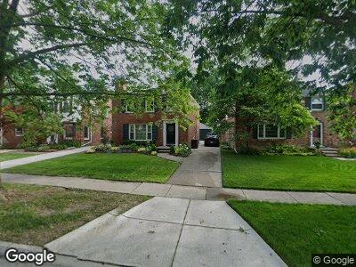
1636 Severn Rd Grosse Pointe Woods, MI 48236
Estimated Value: $328,290 - $358,000
3
Beds
2
Baths
1,696
Sq Ft
$203/Sq Ft
Est. Value
About This Home
This home is located at 1636 Severn Rd, Grosse Pointe Woods, MI 48236 and is currently estimated at $344,573, approximately $203 per square foot. 1636 Severn Rd is a home located in Wayne County with nearby schools including John Monteith Elementary School, Brownell Middle School, and Grosse Pointe North High School.
Ownership History
Date
Name
Owned For
Owner Type
Purchase Details
Closed on
Sep 23, 2004
Sold by
Butler Sandra Lee
Bought by
Butler Mark T
Current Estimated Value
Home Financials for this Owner
Home Financials are based on the most recent Mortgage that was taken out on this home.
Original Mortgage
$55,000
Outstanding Balance
$28,787
Interest Rate
5.8%
Mortgage Type
Credit Line Revolving
Estimated Equity
$306,710
Purchase Details
Closed on
Dec 23, 1999
Sold by
Anderson Michael J
Bought by
Butler Mark
Purchase Details
Closed on
Mar 17, 1999
Sold by
Burch Estate Of James E
Bought by
Anderson J J and Anderson Delaunay F
Create a Home Valuation Report for This Property
The Home Valuation Report is an in-depth analysis detailing your home's value as well as a comparison with similar homes in the area
Home Values in the Area
Average Home Value in this Area
Purchase History
| Date | Buyer | Sale Price | Title Company |
|---|---|---|---|
| Butler Mark T | -- | Tri County Title Agency Inc | |
| Butler Mark | $253,000 | -- | |
| Anderson J J | $205,000 | -- |
Source: Public Records
Mortgage History
| Date | Status | Borrower | Loan Amount |
|---|---|---|---|
| Open | Butler Mark | $55,000 |
Source: Public Records
Tax History Compared to Growth
Tax History
| Year | Tax Paid | Tax Assessment Tax Assessment Total Assessment is a certain percentage of the fair market value that is determined by local assessors to be the total taxable value of land and additions on the property. | Land | Improvement |
|---|---|---|---|---|
| 2024 | $2,923 | $146,700 | $0 | $0 |
| 2023 | $2,811 | $135,800 | $0 | $0 |
| 2022 | $4,403 | $121,100 | $0 | $0 |
| 2021 | $4,197 | $115,000 | $0 | $0 |
| 2020 | $4,322 | $121,000 | $0 | $0 |
| 2019 | $2,559 | $106,400 | $0 | $0 |
| 2018 | $2,515 | $97,200 | $0 | $0 |
| 2017 | $2,922 | $93,800 | $0 | $0 |
| 2016 | $3,984 | $91,800 | $0 | $0 |
| 2015 | $6,905 | $81,500 | $0 | $0 |
| 2013 | $6,660 | $71,400 | $0 | $0 |
| 2012 | -- | $65,100 | $17,200 | $47,900 |
Source: Public Records
Map
Nearby Homes
- 1855 Prestwick Rd
- 1878 Prestwick Rd
- 19299 Raymond St
- 484 Bournemouth Cir
- 19218 Eastborne St
- 19280 Berden St
- 1873 Manchester Blvd
- 21519 Sloan Dr
- 1898 Manchester Blvd
- 441 Roland Rd
- 21421 Bournemouth St
- 382 Provencal Rd
- 21719 Moross Rd
- 2071 Stanhope St
- 5228 Hillcrest St
- 21327 Prestwick Ave
- 19950 W Emory Ct
- 21306 Brierstone St
- 21746 Moross Rd
- 5921 Hillcrest St
- 1636 Severn Rd
- 1628 Severn Rd
- 1644 Severn Rd
- 1626 Severn Rd
- 1652 Severn Rd
- 1660 Severn Rd
- 1668 Severn Rd
- 19517 Mack Ave
- 1641 Broadstone Rd
- 19521 Mack Ave
- 1649 Broadstone Rd
- 1633 Broadstone Rd
- 1657 Broadstone Rd
- 1676 Severn Rd
- 1682 Severn Rd
- 1641 Severn Rd
- 19519 Mack Ave
- 1665 Broadstone Rd
- 1633 Severn Rd
- 1649 Severn Rd