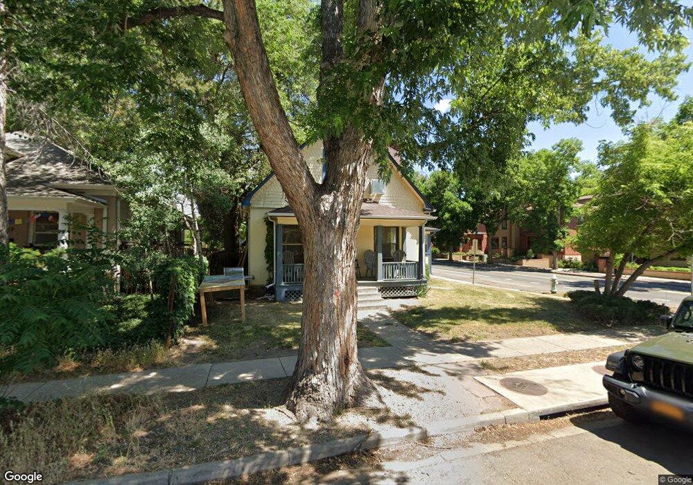
1637 Grove St Boulder, CO 80302
Goss-Grove NeighborhoodEstimated Value: $940,904 - $1,336,000
3
Beds
2
Baths
1,328
Sq Ft
$914/Sq Ft
Est. Value
About This Home
This home is located at 1637 Grove St, Boulder, CO 80302 and is currently estimated at $1,214,226, approximately $914 per square foot. 1637 Grove St is a home located in Boulder County with nearby schools including Whittier Elementary School, Casey Middle School, and Boulder High School.
Ownership History
Date
Name
Owned For
Owner Type
Purchase Details
Closed on
Dec 14, 2010
Sold by
Host Laurie A
Bought by
Snyder Laurie Adams
Current Estimated Value
Home Financials for this Owner
Home Financials are based on the most recent Mortgage that was taken out on this home.
Original Mortgage
$273,000
Outstanding Balance
$180,549
Interest Rate
4.24%
Mortgage Type
New Conventional
Estimated Equity
$1,033,677
Purchase Details
Closed on
Mar 23, 1998
Sold by
Host T Amory
Bought by
Host Laurie A
Home Financials for this Owner
Home Financials are based on the most recent Mortgage that was taken out on this home.
Original Mortgage
$130,000
Interest Rate
7.12%
Purchase Details
Closed on
Dec 31, 1994
Sold by
Host Thomas A
Bought by
Host Laurie A
Purchase Details
Closed on
Oct 17, 1994
Sold by
Host Thomas A
Bought by
Host Laurie A
Create a Home Valuation Report for This Property
The Home Valuation Report is an in-depth analysis detailing your home's value as well as a comparison with similar homes in the area
Home Values in the Area
Average Home Value in this Area
Purchase History
| Date | Buyer | Sale Price | Title Company |
|---|---|---|---|
| Snyder Laurie Adams | -- | Land Title Guarantee Company | |
| Host Laurie A | -- | -- | |
| Host Laurie A | $300 | -- | |
| Host Laurie A | $300 | -- | |
| Host Laurie A | $300 | -- |
Source: Public Records
Mortgage History
| Date | Status | Borrower | Loan Amount |
|---|---|---|---|
| Open | Snyder Laurie Adams | $273,000 | |
| Previous Owner | Host Laurie A | $130,000 |
Source: Public Records
Tax History Compared to Growth
Tax History
| Year | Tax Paid | Tax Assessment Tax Assessment Total Assessment is a certain percentage of the fair market value that is determined by local assessors to be the total taxable value of land and additions on the property. | Land | Improvement |
|---|---|---|---|---|
| 2025 | $5,428 | $57,281 | $35,356 | $21,925 |
| 2024 | $5,428 | $57,281 | $35,356 | $21,925 |
| 2023 | $5,332 | $60,870 | $40,957 | $23,597 |
| 2022 | $4,744 | $50,276 | $30,976 | $19,300 |
| 2021 | $4,527 | $51,724 | $31,868 | $19,856 |
| 2020 | $4,024 | $46,225 | $29,530 | $16,695 |
| 2019 | $3,962 | $46,225 | $29,530 | $16,695 |
| 2018 | $3,521 | $40,608 | $21,096 | $19,512 |
| 2017 | $3,411 | $44,895 | $23,323 | $21,572 |
| 2016 | $3,458 | $39,951 | $21,810 | $18,141 |
| 2015 | $3,275 | $33,202 | $15,204 | $17,998 |
| 2014 | $2,792 | $33,202 | $15,204 | $17,998 |
Source: Public Records
Map
Nearby Homes
- 1629 17th St Unit A
- 1842 Canyon Blvd Unit 105
- 1842 Canyon Blvd Unit 202
- 1723 15th St
- 1655 Walnut St Unit 309
- 1922 Grove St
- 1707 Walnut St Unit 203
- 1707 Walnut St Unit 209
- 1707 Walnut St Unit 307
- 1707 Walnut St Unit 208
- 1707 Walnut St Unit 308
- 1707 Walnut St Unit 101
- 1707 Walnut St Unit 103
- 1707 Walnut St Unit 207
- 1707 Walnut St Unit 206
- 1707 Walnut St Unit 202
- 1707 Walnut St Unit 210
- 1945 Canyon Blvd
- 1934 18th St Unit 14
- 1837 Walnut St Unit E
- 1605 17th St
- 1631 Grove St
- 1623 Grove St
- 1711 Grove St Unit 1B
- 1627 17th St
- 1625 17th St
- 1638 Grove St
- 1616 17th St Unit 2B
- 1611 Grove St
- 1626 17th St Unit 3B
- 1612 17th St Unit 2D
- 1622 17th St Unit 2C
- 1620 17th St Unit 2A
- 1705 Grove St Unit 1E
- 1610 17th St Unit 1A
- 1622 17th St Unit 2
- 1622 17th St Unit C
- 1628 17th St Unit 3A
- 1704 Grove St
- 1629 17th St