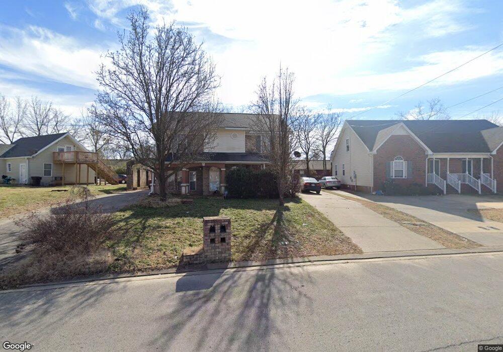
1638 Center Pointe Dr Murfreesboro, TN 37130
Estimated Value: $252,000 - $281,000
--
Bed
3
Baths
1,460
Sq Ft
$183/Sq Ft
Est. Value
About This Home
This home is located at 1638 Center Pointe Dr, Murfreesboro, TN 37130 and is currently estimated at $266,793, approximately $182 per square foot. 1638 Center Pointe Dr is a home located in Rutherford County with nearby schools including Discovery School, Reeves-Rogers Elementary School, and Oakland Middle School.
Ownership History
Date
Name
Owned For
Owner Type
Purchase Details
Closed on
Aug 25, 2009
Sold by
Farris Valerie
Bought by
Jiang Hong
Current Estimated Value
Home Financials for this Owner
Home Financials are based on the most recent Mortgage that was taken out on this home.
Original Mortgage
$73,400
Interest Rate
5.19%
Purchase Details
Closed on
Aug 24, 2007
Sold by
And Patterson Russell D
Bought by
Farri Farris and Farri Natalie
Home Financials for this Owner
Home Financials are based on the most recent Mortgage that was taken out on this home.
Original Mortgage
$105,069
Interest Rate
6.65%
Mortgage Type
Purchase Money Mortgage
Purchase Details
Closed on
Aug 26, 2003
Sold by
Rodd Hunter
Bought by
Patterson Russell D and Patterson Dale B
Home Financials for this Owner
Home Financials are based on the most recent Mortgage that was taken out on this home.
Original Mortgage
$88,117
Interest Rate
5.94%
Create a Home Valuation Report for This Property
The Home Valuation Report is an in-depth analysis detailing your home's value as well as a comparison with similar homes in the area
Home Values in the Area
Average Home Value in this Area
Purchase History
| Date | Buyer | Sale Price | Title Company |
|---|---|---|---|
| Jiang Hong | $105,000 | -- | |
| Farri Farris | $105,900 | -- | |
| Patterson Russell D | $89,500 | -- |
Source: Public Records
Mortgage History
| Date | Status | Borrower | Loan Amount |
|---|---|---|---|
| Closed | Patterson Russell D | $73,400 | |
| Previous Owner | Patterson Russell D | $105,069 | |
| Previous Owner | Patterson Russell D | $88,117 |
Source: Public Records
Tax History Compared to Growth
Tax History
| Year | Tax Paid | Tax Assessment Tax Assessment Total Assessment is a certain percentage of the fair market value that is determined by local assessors to be the total taxable value of land and additions on the property. | Land | Improvement |
|---|---|---|---|---|
| 2025 | $1,337 | $47,250 | $8,125 | $39,125 |
| 2024 | $1,337 | $47,250 | $8,125 | $39,125 |
| 2023 | $887 | $47,250 | $8,125 | $39,125 |
| 2022 | $764 | $47,250 | $8,125 | $39,125 |
| 2021 | $817 | $36,825 | $6,500 | $30,325 |
| 2020 | $817 | $36,825 | $6,500 | $30,325 |
| 2019 | $817 | $36,825 | $6,500 | $30,325 |
| 2018 | $1,123 | $36,825 | $0 | $0 |
| 2017 | $989 | $25,450 | $0 | $0 |
| 2016 | $989 | $25,450 | $0 | $0 |
| 2015 | $989 | $25,450 | $0 | $0 |
| 2014 | $633 | $25,450 | $0 | $0 |
| 2013 | -- | $25,775 | $0 | $0 |
Source: Public Records
Map
Nearby Homes
- 1245 Old Lascassas Rd Unit C
- 1306 Maymont Dr
- 1005 Empire Blvd
- 1311 Halifax Ct
- 1006 Harrison Ave
- 1029 Empire Blvd
- 1214 Wenlon Dr
- 2123 Gold Valley Dr
- 703 Chickasaw Rd
- 2153 Gold Valley Dr
- 2175 Veranda Place
- 1407 Leaf Ave
- 2187 Gold Valley Dr
- 2210 Keegan Dr
- 1325 Wenlon Dr Unit 85
- 1325 Wenlon Dr Unit 91
- 1325 Wenlon Dr Unit 21
- 1325 Wenlon Dr Unit 59
- 1325 Wenlon Dr Unit 7
- 1325 Wenlon Dr Unit 13
- 1632 Center Pointe Dr
- 1640 Center Pointe Dr
- 1630 Center Pointe Dr
- 1624 Center Pointe Dr
- 1207 Old Lascassas Rd
- 1622 Center Pointe Dr
- 1639 Center Pointe Dr
- 1616 Center Pointe Dr
- 1633 Center Pointe Dr
- 1641 Center Pointe Dr
- 1631 Center Pointe Dr
- 1647 Center Pointe Dr
- 1614 Center Pointe Dr
- 1649 Center Pointe Dr
- 1623 Center Pointe Dr
- 1125 Old Lascassas Rd
- 1655 Center Pointe Dr Unit 1657
- 1531 Middleborough Ct
- 1608 Center Pointe Dr
- 1533 Middleborough Ct