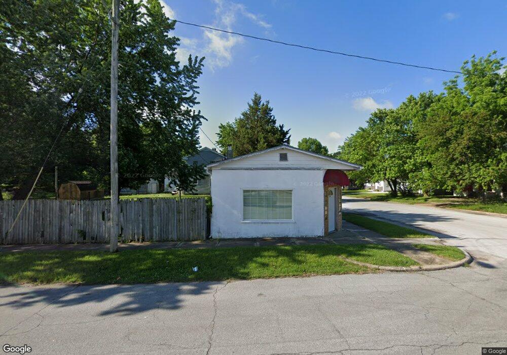
1638 N Main Ave Springfield, MO 65803
Woodland Heights NeighborhoodEstimated Value: $60,572 - $145,000
Studio
--
Bath
--
Sq Ft
5,271
Sq Ft Lot
About This Home
This home is located at 1638 N Main Ave, Springfield, MO 65803 and is currently estimated at $100,393. 1638 N Main Ave is a home located in Greene County with nearby schools including Weaver Elementary School, Pipkin Middle School, and Central High School.
Ownership History
Date
Name
Owned For
Owner Type
Purchase Details
Closed on
Aug 22, 2025
Sold by
Baker Cathy A
Bought by
Donald & Clara Tyson Family Trust
Current Estimated Value
Purchase Details
Closed on
Nov 20, 2015
Sold by
Jenkins James C
Bought by
Pilot Travel Centers Llc
Purchase Details
Closed on
Jan 30, 2009
Sold by
Dunville Charles
Bought by
Baker Cecil Timothy
Home Financials for this Owner
Home Financials are based on the most recent Mortgage that was taken out on this home.
Original Mortgage
$28,000
Interest Rate
8.37%
Mortgage Type
Adjustable Rate Mortgage/ARM
Create a Home Valuation Report for This Property
The Home Valuation Report is an in-depth analysis detailing your home's value as well as a comparison with similar homes in the area
Home Values in the Area
Average Home Value in this Area
Purchase History
| Date | Buyer | Sale Price | Title Company |
|---|---|---|---|
| Donald & Clara Tyson Family Trust | -- | Waco Title | |
| Pilot Travel Centers Llc | -- | Chicago Title | |
| Pilot Travel Centers Llc | -- | Fidelity National Title Ins | |
| Baker Cecil Timothy | -- | None Available |
Source: Public Records
Mortgage History
| Date | Status | Borrower | Loan Amount |
|---|---|---|---|
| Previous Owner | Baker Cecil Timothy | $28,000 |
Source: Public Records
Tax History
| Year | Tax Paid | Tax Assessment Tax Assessment Total Assessment is a certain percentage of the fair market value that is determined by local assessors to be the total taxable value of land and additions on the property. | Land | Improvement |
|---|---|---|---|---|
| 2025 | $448 | $8,990 | $3,330 | $5,660 |
| 2024 | $347 | $6,460 | $1,540 | $4,920 |
| 2023 | $345 | $6,460 | $1,540 | $4,920 |
| 2022 | $342 | $6,270 | $1,540 | $4,730 |
| 2021 | $342 | $6,270 | $1,540 | $4,730 |
| 2020 | $353 | $6,180 | $1,540 | $4,640 |
| 2019 | $343 | $6,180 | $1,540 | $4,640 |
| 2018 | $310 | $5,590 | $1,540 | $4,050 |
| 2017 | $307 | $5,630 | $1,540 | $4,090 |
| 2016 | $309 | $5,630 | $1,540 | $4,090 |
| 2015 | $306 | $5,630 | $1,540 | $4,090 |
| 2014 | $308 | $5,630 | $1,540 | $4,090 |
Source: Public Records
Map
Nearby Homes
- 521 W Locust St
- 835 N Campbell Ave
- 1851 N Main Ave
- 1502 N Grant Ave
- 1863 N Grant Ave
- 1898 N Main Ave
- 716 W Division St
- 1512 N Missouri Ave
- 1510 N Robberson Ave
- 1850 N Robberson Ave
- 2006 N Douglas Ave
- 1026 W Commercial St
- 1042 W Commercial St
- 2038 N Douglas Ave
- 1056 W Commercial St
- 2023 N Robberson Ave
- 1027 W Division St
- 1220 N Grant Ave
- 1105 W Division St
- 531 W Webster St
- 1628 N Main Ave
- 518 W Pacific St
- 1622 N Main Ave
- 510 W Pacific St
- 1639 N Main Ave
- 1616 N Main Ave
- 511 W Pacific St
- 504 W Pacific St
- 1633 N Main Ave
- 1629 N Lyon Ave
- 1627 N Main Ave
- 522 W Commercial St
- 1612 N Main Ave
- 1623 N Lyon Ave
- 1623 N Main Ave
- 502 W Pacific St
- 1617 N Lyon Ave
- 1617 N Main Ave
- 1617 N Main Ave Unit A/B
- 1611 N Lyon Ave
Your Personal Tour Guide
Ask me questions while you tour the home.