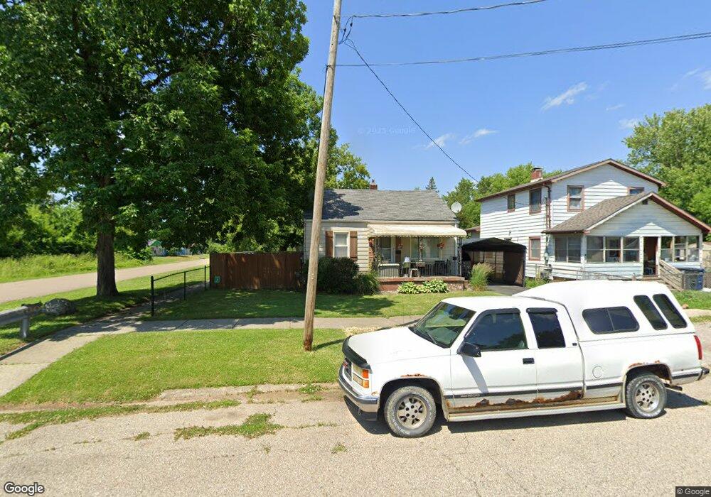
1638 Pettibone Ave Flint, MI 48507
South Side NeighborhoodEstimated Value: $50,000 - $78,000
2
Beds
1
Bath
786
Sq Ft
$76/Sq Ft
Est. Value
About This Home
This home is located at 1638 Pettibone Ave, Flint, MI 48507 and is currently estimated at $59,420, approximately $75 per square foot. 1638 Pettibone Ave is a home located in Genesee County with nearby schools including Neithercut Elementary School, Flint Southwestern Classical Academy, and Flint Cultural Center Academy.
Ownership History
Date
Name
Owned For
Owner Type
Purchase Details
Closed on
Apr 21, 2011
Sold by
Donovan Shaun and Federal Housing Commissioner
Bought by
Bradley Jane
Current Estimated Value
Purchase Details
Closed on
Mar 15, 2011
Sold by
Michigan State Housing Development Autho
Bought by
Secretary Of Housing & Urban Development
Purchase Details
Closed on
Jul 21, 2010
Sold by
Adams Patrick
Bought by
Michigan State Housing Development Autho
Purchase Details
Closed on
Sep 21, 2001
Sold by
Dailey Gerald E and Dailey Margaret E
Bought by
Adams Patrick
Create a Home Valuation Report for This Property
The Home Valuation Report is an in-depth analysis detailing your home's value as well as a comparison with similar homes in the area
Home Values in the Area
Average Home Value in this Area
Purchase History
| Date | Buyer | Sale Price | Title Company |
|---|---|---|---|
| Bradley Jane | $7,500 | Custom Closing Services Inc | |
| Secretary Of Housing & Urban Development | -- | None Available | |
| Michigan State Housing Development Autho | $50,756 | None Available | |
| Adams Patrick | $61,500 | Metropolitan Title Company |
Source: Public Records
Tax History Compared to Growth
Tax History
| Year | Tax Paid | Tax Assessment Tax Assessment Total Assessment is a certain percentage of the fair market value that is determined by local assessors to be the total taxable value of land and additions on the property. | Land | Improvement |
|---|---|---|---|---|
| 2025 | $1,049 | $17,800 | $0 | $0 |
| 2024 | $974 | $18,000 | $0 | $0 |
| 2023 | $953 | $15,200 | $0 | $0 |
| 2022 | $0 | $12,800 | $0 | $0 |
| 2021 | $965 | $11,400 | $0 | $0 |
| 2020 | $890 | $9,500 | $0 | $0 |
| 2019 | $1,041 | $10,200 | $0 | $0 |
| 2018 | $998 | $12,700 | $0 | $0 |
| 2017 | $972 | $0 | $0 | $0 |
| 2016 | $965 | $0 | $0 | $0 |
| 2015 | -- | $0 | $0 | $0 |
| 2014 | -- | $0 | $0 | $0 |
| 2012 | -- | $14,600 | $0 | $0 |
Source: Public Records
Map
Nearby Homes
- 1741 Carmanbrook Pkwy
- 1814 Carmanbrook Pkwy
- 1523 Waldman Ave
- 1727 Briarwood Dr
- 1410 Berrywood Ln
- 1902 Crestbrook Ln
- 1225 Waldman Ave
- 1209 Lincoln Ave
- 1607 Mulberry Ln
- 1418 Blueberry Ln
- 2107 Stoney Brook Ct
- 4101 Greenbrook Ln
- 1228 Leland St
- 1416 Blackberry Ln
- 1826 Greenbrook Ln
- 1212 Crawford St
- 1101 Lincoln Ave
- 1102 W Atherton Rd
- 1818 Rockcreek Ln
- 1329 Huron St
- 1634 Pettibone Ave
- 1637 Lincoln Ave
- 1633 Lincoln Ave
- 1626 Pettibone Ave
- 3513 Briarwood Dr
- 3507 Briarwood Dr
- 1625 Lincoln Ave
- 3601 Briarwood Dr
- 1631 Pettibone Ave
- 1622 Pettibone Ave
- 3501 Briarwood Dr
- 1627 Pettibone Ave
- 3607 Briarwood Dr
- 1621 Lincoln Ave
- 1639 Pettibone Ave
- 1618 Pettibone Ave
- 1623 Pettibone Ave
- 3421 Briarwood Dr
- 1617 Lincoln Ave
- 3613 Briarwood Dr