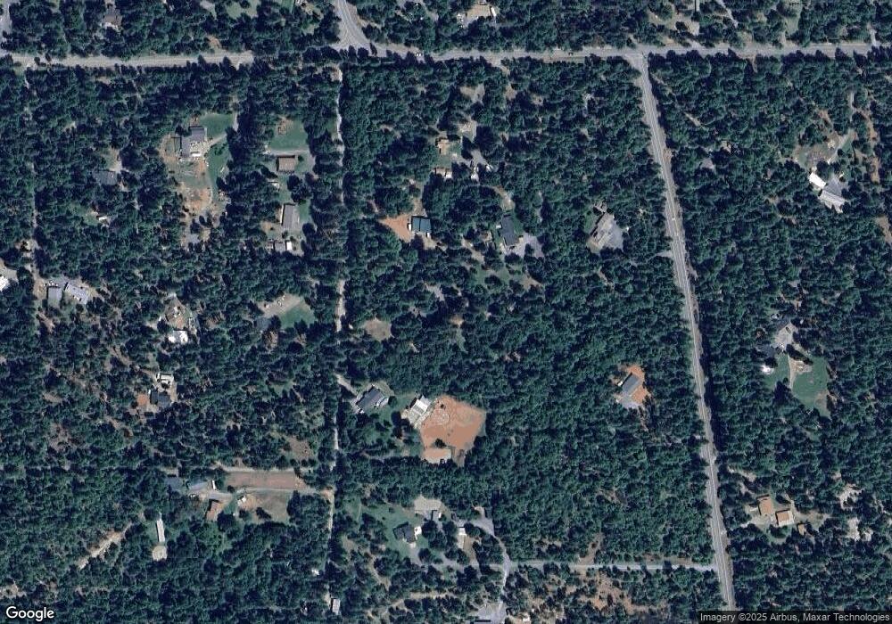
1638 Queens Branch Rd Rogue River, OR 97537
Estimated Value: $399,000 - $424,668
2
Beds
1
Bath
816
Sq Ft
$505/Sq Ft
Est. Value
About This Home
This home is located at 1638 Queens Branch Rd, Rogue River, OR 97537 and is currently estimated at $411,834, approximately $504 per square foot. 1638 Queens Branch Rd is a home located in Jackson County with nearby schools including South Valley Academy, Rogue River Elementary School, and Rogue River Junior/Senior High School.
Ownership History
Date
Name
Owned For
Owner Type
Purchase Details
Closed on
Mar 5, 2009
Sold by
Grenon Karl W and Grenon Lynda J
Bought by
Grenon Karl W and Grenon Lynda J
Current Estimated Value
Home Financials for this Owner
Home Financials are based on the most recent Mortgage that was taken out on this home.
Original Mortgage
$94,000
Interest Rate
5.03%
Mortgage Type
New Conventional
Create a Home Valuation Report for This Property
The Home Valuation Report is an in-depth analysis detailing your home's value as well as a comparison with similar homes in the area
Home Values in the Area
Average Home Value in this Area
Purchase History
| Date | Buyer | Sale Price | Title Company |
|---|---|---|---|
| Grenon Karl W | -- | First American |
Source: Public Records
Mortgage History
| Date | Status | Borrower | Loan Amount |
|---|---|---|---|
| Closed | Grenon Karl W | $94,000 |
Source: Public Records
Tax History Compared to Growth
Tax History
| Year | Tax Paid | Tax Assessment Tax Assessment Total Assessment is a certain percentage of the fair market value that is determined by local assessors to be the total taxable value of land and additions on the property. | Land | Improvement |
|---|---|---|---|---|
| 2025 | $2,398 | $238,050 | $125,040 | $113,010 |
| 2024 | $2,398 | $231,120 | $139,070 | $92,050 |
| 2023 | $2,320 | $224,390 | $135,020 | $89,370 |
| 2022 | $2,270 | $224,390 | $135,020 | $89,370 |
| 2021 | $2,225 | $217,860 | $131,090 | $86,770 |
| 2020 | $2,209 | $217,380 | $127,280 | $90,100 |
| 2019 | $2,155 | $204,910 | $119,980 | $84,930 |
| 2018 | $2,100 | $198,950 | $116,490 | $82,460 |
| 2017 | $2,051 | $198,950 | $116,490 | $82,460 |
| 2016 | $2,000 | $187,540 | $109,800 | $77,740 |
| 2015 | $1,939 | $187,540 | $109,800 | $77,740 |
| 2014 | $1,874 | $176,780 | $103,490 | $73,290 |
Source: Public Records
Map
Nearby Homes
- 7435 W Evans Creek Rd
- 7310 W Evans Creek Rd
- 7118 Redthorne Rd
- 835 Minthorne Rd
- 255 Queens Branch Rd
- 9184 W Evans Creek Rd
- 1205 Pine Grove Rd
- 149 Queens Branch Rd
- 8797 W Evans Creek Rd
- 1105 Pine Grove Rd
- 1475 Pleasant Creek Rd
- 6324 E Evans Creek Rd
- 643 Covered Bridge Rd
- 8951 E Evans Creek Rd Unit 14
- 5406 E Evans Creek Rd
- 798 Covered Bridge Rd
- 256 Deruyte Way
- 254 Deruyte Way
- 257 Deruyte Way
- 252 Deruyte Way
- 1515 Queens Branch Rd
- 1650 Queens Branch Rd
- 1545 Queens Branch Rd
- 7867 W Evans Creek Rd
- 1627 Queens Branch Rd
- 1631 Queens Branch Rd
- 7923 W Evans Creek Rd
- 7729 W Evans Creek Rd
- 7920 W Evans Creek Rd
- 1550 Queens Branch Rd
- 1635 Queens Branch Rd
- 1695 Queens Branch Rd
- 1590 Queens Branch Rd
- 7800 W Evans Creek Rd
- 1500 Queens Branch Rd
- 1825 Queens Branch Rd
- 7750 W Evans Creek Rd
- 8021 W Evans Creek Rd
- 1765 Queens Branch Rd
- 1416 Queens Branch Rd
