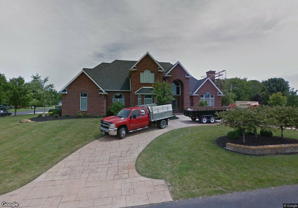
16391 Lindsey Dr Kenton, OH 43326
Estimated Value: $568,582 - $647,000
4
Beds
5
Baths
4,577
Sq Ft
$132/Sq Ft
Est. Value
About This Home
This home is located at 16391 Lindsey Dr, Kenton, OH 43326 and is currently estimated at $603,146, approximately $131 per square foot. 16391 Lindsey Dr is a home located in Hardin County with nearby schools including Kenton Elementary School, Kenton Middle School, and Kenton High School.
Ownership History
Date
Name
Owned For
Owner Type
Purchase Details
Closed on
Jun 22, 2022
Sold by
Haushalter Nikki M and Haushalter David
Bought by
Heydinger Chad and Heydinger Tasha
Current Estimated Value
Home Financials for this Owner
Home Financials are based on the most recent Mortgage that was taken out on this home.
Original Mortgage
$388,000
Outstanding Balance
$363,802
Interest Rate
3.75%
Mortgage Type
New Conventional
Estimated Equity
$239,344
Purchase Details
Closed on
Jan 6, 2004
Bought by
Haushalter Nikki M
Create a Home Valuation Report for This Property
The Home Valuation Report is an in-depth analysis detailing your home's value as well as a comparison with similar homes in the area
Home Values in the Area
Average Home Value in this Area
Purchase History
| Date | Buyer | Sale Price | Title Company |
|---|---|---|---|
| Heydinger Chad | $485,000 | Superior Title | |
| Heydinger Chad | $485,000 | Superior Title | |
| Haushalter Nikki M | $40,000 | -- |
Source: Public Records
Mortgage History
| Date | Status | Borrower | Loan Amount |
|---|---|---|---|
| Open | Heydinger Chad | $388,000 | |
| Closed | Heydinger Chad | $388,000 |
Source: Public Records
Tax History Compared to Growth
Tax History
| Year | Tax Paid | Tax Assessment Tax Assessment Total Assessment is a certain percentage of the fair market value that is determined by local assessors to be the total taxable value of land and additions on the property. | Land | Improvement |
|---|---|---|---|---|
| 2024 | $7,385 | $176,130 | $12,980 | $163,150 |
| 2023 | $7,385 | $176,130 | $12,980 | $163,150 |
| 2022 | $7,200 | $159,800 | $6,350 | $153,450 |
| 2021 | $7,228 | $159,800 | $6,350 | $153,450 |
| 2020 | $6,242 | $159,800 | $6,350 | $153,450 |
| 2019 | $4,772 | $127,140 | $6,050 | $121,090 |
| 2018 | $4,777 | $127,140 | $6,050 | $121,090 |
| 2017 | $2,374 | $127,140 | $6,050 | $121,090 |
| 2016 | $4,279 | $121,570 | $5,920 | $115,650 |
| 2015 | $4,241 | $121,570 | $5,920 | $115,650 |
| 2014 | $2,152 | $121,570 | $5,920 | $115,650 |
| 2013 | $2,442 | $131,900 | $5,920 | $125,980 |
Source: Public Records
Map
Nearby Homes
- 11896 Parklane Dr
- 920 Cooper St
- 115 Scioto St
- 1 C Ct
- 79 Broadway St
- 13450 State Route 292
- 39 Grape St
- 530 E Franklin St
- 510 Decatur St
- 508 Decatur St
- 513 E Franklin St
- 509 E Carrol St
- 324 Stone Hedge Ln Unit 324
- 121 S High St
- 639 S Main St
- 104 Oak Ln Unit 15
- 727 S Detroit St
- 320 Letson Ave
- 0 N Barron St
- 503 Jennings St
- 16388 Lindsey Dr
- 16414 Lindsey Dr
- 16427 Lindsey Dr
- 16382 Maureen Dr
- 16350 Maureen Dr
- 16406 Maureen Dr
- 16381 Maureen Dr
- 16405 Maureen Dr
- 16428 Maureen Dr
- 16296 Maureen Dr
- 16455 Lindsey Dr
- 16450 Lindsey Dr
- 12354 Lora Dr
- 16427 Maureen Dr
- 16450 Maureen Dr
- 16493 Lindsey Dr
- 16284 Maureen Dr
- 12353 Lora Dr
- 16449 Maureen Dr