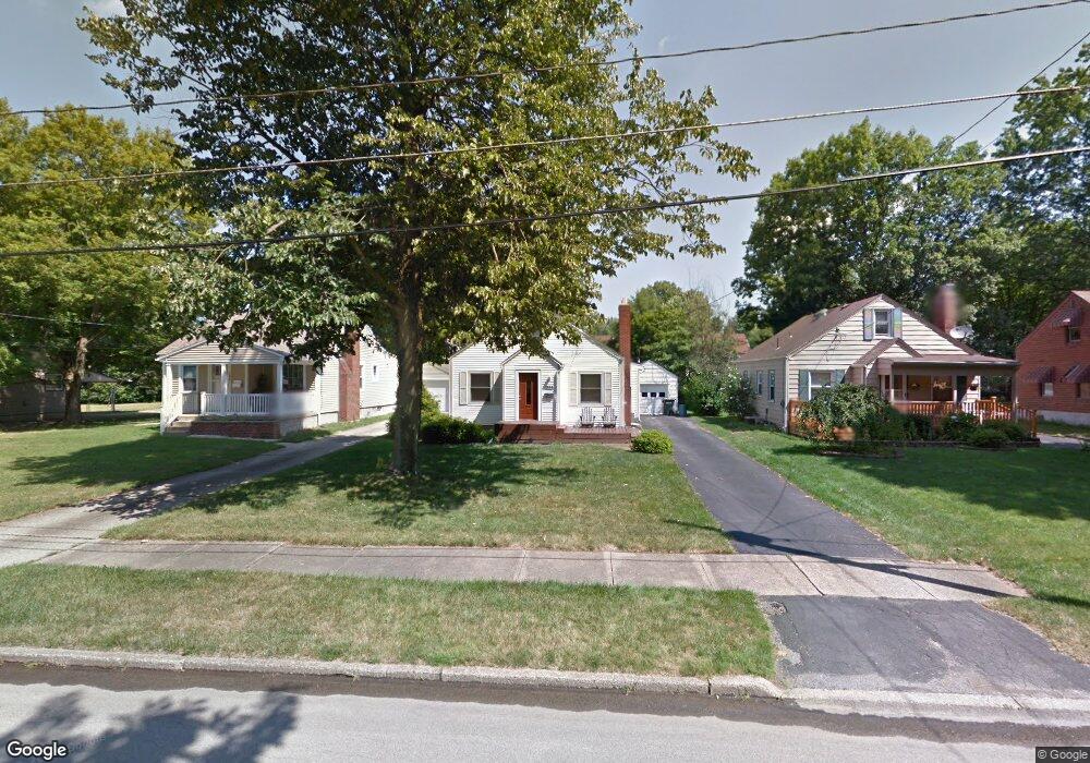
164 Homestead Dr Youngstown, OH 44512
Estimated Value: $117,000 - $142,000
3
Beds
1
Bath
1,406
Sq Ft
$94/Sq Ft
Est. Value
About This Home
This home is located at 164 Homestead Dr, Youngstown, OH 44512 and is currently estimated at $132,403, approximately $94 per square foot. 164 Homestead Dr is a home located in Mahoning County with nearby schools including Boardman Glenwood Junior High School, Boardman High School, and Horizon Science Academy - Youngstown.
Ownership History
Date
Name
Owned For
Owner Type
Purchase Details
Closed on
Jul 25, 2024
Sold by
Sperati Michael R and Sepratti Michael
Bought by
Sperati Michael R
Current Estimated Value
Purchase Details
Closed on
Aug 20, 2003
Sold by
Langley Lawrence F and Langley Loraine G
Bought by
Sepratti Michael
Home Financials for this Owner
Home Financials are based on the most recent Mortgage that was taken out on this home.
Original Mortgage
$66,400
Interest Rate
5.62%
Mortgage Type
Purchase Money Mortgage
Purchase Details
Closed on
Jun 16, 1986
Bought by
Langley Lawrence F
Create a Home Valuation Report for This Property
The Home Valuation Report is an in-depth analysis detailing your home's value as well as a comparison with similar homes in the area
Home Values in the Area
Average Home Value in this Area
Purchase History
| Date | Buyer | Sale Price | Title Company |
|---|---|---|---|
| Sperati Michael R | -- | None Listed On Document | |
| Sperati Michael R | -- | None Listed On Document | |
| Sepratti Michael | $83,000 | -- | |
| Langley Lawrence F | $37,400 | -- |
Source: Public Records
Mortgage History
| Date | Status | Borrower | Loan Amount |
|---|---|---|---|
| Previous Owner | Sepratti Michael | $66,400 | |
| Closed | Sepratti Michael | $8,300 |
Source: Public Records
Tax History Compared to Growth
Tax History
| Year | Tax Paid | Tax Assessment Tax Assessment Total Assessment is a certain percentage of the fair market value that is determined by local assessors to be the total taxable value of land and additions on the property. | Land | Improvement |
|---|---|---|---|---|
| 2024 | $1,491 | $29,030 | $4,190 | $24,840 |
| 2023 | $1,471 | $29,030 | $4,190 | $24,840 |
| 2022 | $1,556 | $23,530 | $3,830 | $19,700 |
| 2021 | $1,557 | $23,530 | $3,830 | $19,700 |
| 2020 | $1,565 | $23,530 | $3,830 | $19,700 |
| 2019 | $1,568 | $20,820 | $3,390 | $17,430 |
| 2018 | $1,322 | $20,820 | $3,390 | $17,430 |
| 2017 | $1,332 | $20,820 | $3,390 | $17,430 |
| 2016 | $1,344 | $21,010 | $3,790 | $17,220 |
| 2015 | $1,318 | $21,010 | $3,790 | $17,220 |
| 2014 | $1,321 | $21,010 | $3,790 | $17,220 |
| 2013 | $1,305 | $21,010 | $3,790 | $17,220 |
Source: Public Records
Map
Nearby Homes
- 175 Homestead Dr
- 148 Clifton Dr
- 83 Beechwood Dr
- 94 Beechwood Dr
- 127 Melrose Ave
- 0 Indianola Rd
- 94 Shadyside Dr
- 4508 Southern Blvd
- 4504 Southern Blvd
- 4552 New England Blvd
- 28 Terrace Dr
- 60 Shadyside Dr
- 81 Melrose Ave
- 429 Tudor Ln
- 167 Afton Ave
- 149 Argyle Ave
- 329 Afton Ave
- 30 Pinehurst Ave
- 4307 Helena Ave
- 4312 Helena Ave
- 168 Homestead Dr
- 166 Homestead Dr
- 178 Homestead Dr
- 160 Homestead Dr
- 182 Homestead Dr
- 173 Terrace Dr
- 169 Terrace Dr
- 177 Terrace Dr
- 165 Terrace Dr
- 181 Terrace Dr
- 184 Homestead Dr
- 152 Homestead Dr
- 167 Homestead Dr
- 173 Homestead Dr
- 161 Terrace Dr
- 185 Terrace Dr
- 161 Homestead Dr
- 148 Homestead Dr
- 157 Terrace Dr
- 155 Homestead Dr