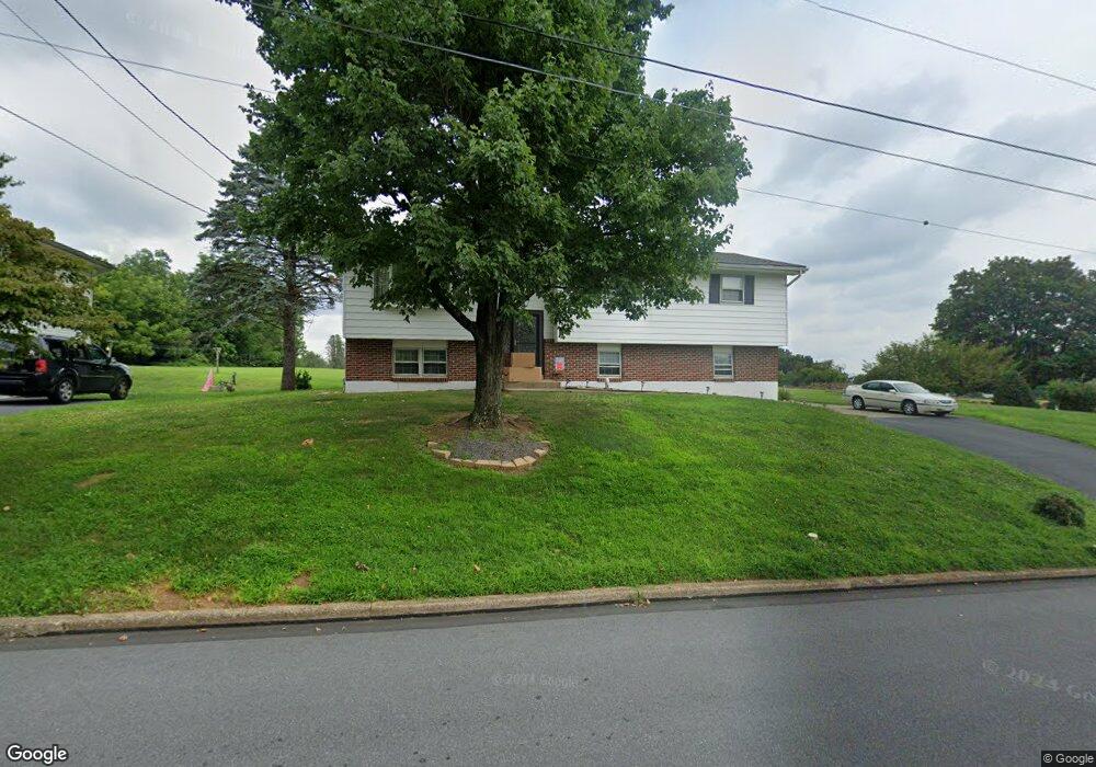
1640 Mine Lane Rd Easton, PA 18045
Estimated Value: $383,806 - $423,000
3
Beds
3
Baths
2,050
Sq Ft
$197/Sq Ft
Est. Value
About This Home
This home is located at 1640 Mine Lane Rd, Easton, PA 18045 and is currently estimated at $403,452, approximately $196 per square foot. 1640 Mine Lane Rd is a home located in Northampton County with nearby schools including Palmer Elementary School, Easton Area Middle School, and Easton Area High School.
Ownership History
Date
Name
Owned For
Owner Type
Purchase Details
Closed on
Sep 17, 2015
Sold by
Kocher Paul C and Kocher Lucy G
Bought by
Hudak Kevin L and Robertson Deanna L
Current Estimated Value
Home Financials for this Owner
Home Financials are based on the most recent Mortgage that was taken out on this home.
Original Mortgage
$202,376
Interest Rate
4.01%
Mortgage Type
Purchase Money Mortgage
Purchase Details
Closed on
Jul 24, 2015
Sold by
Kocher Paul C and Kocher Lucy G
Bought by
Hudak Kevin L and Robertson Deanna L
Home Financials for this Owner
Home Financials are based on the most recent Mortgage that was taken out on this home.
Original Mortgage
$202,376
Interest Rate
4.01%
Mortgage Type
Purchase Money Mortgage
Purchase Details
Closed on
Jan 1, 1990
Bought by
Kocher Paul C and Kocher Lucy G
Purchase Details
Closed on
Dec 1, 1987
Bought by
Not Provided
Create a Home Valuation Report for This Property
The Home Valuation Report is an in-depth analysis detailing your home's value as well as a comparison with similar homes in the area
Home Values in the Area
Average Home Value in this Area
Purchase History
| Date | Buyer | Sale Price | Title Company |
|---|---|---|---|
| Hudak Kevin L | -- | None Available | |
| Hudak Kevin L | $200,000 | None Available | |
| Kocher Paul C | -- | -- | |
| Not Provided | -- | -- |
Source: Public Records
Mortgage History
| Date | Status | Borrower | Loan Amount |
|---|---|---|---|
| Previous Owner | Hudak Kevin L | $202,376 |
Source: Public Records
Tax History Compared to Growth
Tax History
| Year | Tax Paid | Tax Assessment Tax Assessment Total Assessment is a certain percentage of the fair market value that is determined by local assessors to be the total taxable value of land and additions on the property. | Land | Improvement |
|---|---|---|---|---|
| 2025 | $704 | $65,200 | $19,300 | $45,900 |
| 2024 | $5,778 | $65,200 | $19,300 | $45,900 |
| 2023 | $5,675 | $65,200 | $19,300 | $45,900 |
| 2022 | $5,590 | $65,200 | $19,300 | $45,900 |
| 2021 | $5,571 | $65,200 | $19,300 | $45,900 |
| 2020 | $5,568 | $65,200 | $19,300 | $45,900 |
| 2019 | $5,489 | $65,200 | $19,300 | $45,900 |
| 2018 | $5,396 | $65,200 | $19,300 | $45,900 |
| 2017 | $5,268 | $65,200 | $19,300 | $45,900 |
| 2016 | -- | $57,700 | $19,300 | $38,400 |
| 2015 | -- | $57,700 | $19,300 | $38,400 |
| 2014 | -- | $57,700 | $19,300 | $38,400 |
Source: Public Records
Map
Nearby Homes
- 604 Berks St
- 1701 Chain Dam Rd
- 6 Gold Rose Ln
- 4 Middle Ct
- 30 Wilden Dr
- 53 Blenheim Dr
- 12 Kendon Dr
- 3772 Fleetwood Dr
- 3660 Southwood Dr
- 353 Wedgewood Dr
- 0 Stewart St
- 335 Berger Rd
- 360 Wedgewood Dr
- 325 Berger Rd
- 3920 Rau Ln Unit 6
- 3930 Rau Ln Unit 5
- 2463 Hillside Ave
- 2734 Tamlynn Ln
- 1049 S 25th St
- 2246 2nd St
- 1630 Mine Lane Rd
- 1641 Mine Lane Rd
- 1633 Mine Lane Rd
- 1650 Mine Lane Rd
- 1624 Mine Lane Rd
- 1649 Mine Lane Rd
- 1623 Mine Lane Rd
- 1700 Mine Lane Rd
- 144 Applewood Dr
- 140 Applewood Dr
- 1617 Mine Lane Rd
- 148 Applewood Dr
- 136 Applewood Dr
- 1620 Mine Lane Rd
- 1701 Mine Lane Rd
- 1609 Mine Lane Rd
- 130 Applewood Dr
- 200 Applewood Dr
- 147 Applewood Dr