Estimated Value: $268,938 - $348,000
Studio
2
Baths
1,960
Sq Ft
$158/Sq Ft
Est. Value
About This Home
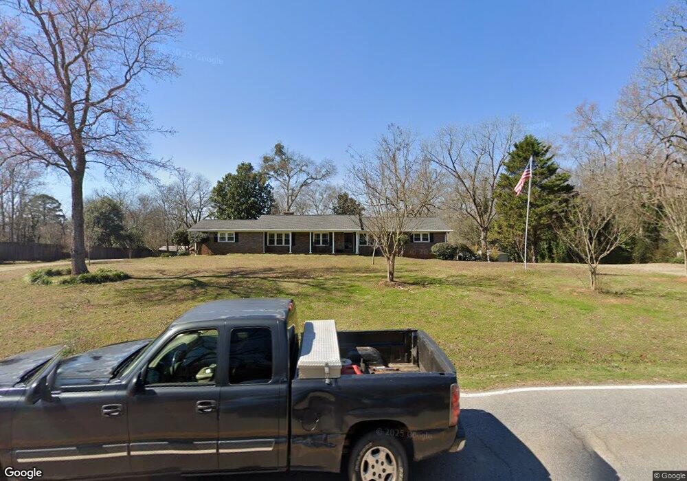
This home is located at 1641 Main St, Comer, GA 30629 and is currently estimated at $310,485, approximately $158 per square foot. 1641 Main St is a home located in Madison County with nearby schools including Madison County High School.
Ownership History
Date
Name
Owned For
Owner Type
Purchase Details
Closed on
Nov 8, 2022
Sold by
Prior John T
Bought by
Prior Deborah Howard and Prior John T
Current Estimated Value
Purchase Details
Closed on
Mar 12, 2012
Sold by
Gaultney John M
Bought by
Prior John T
Home Financials for this Owner
Home Financials are based on the most recent Mortgage that was taken out on this home.
Original Mortgage
$89,179
Interest Rate
3.75%
Mortgage Type
FHA
Purchase Details
Closed on
Apr 5, 2011
Sold by
Mccannon Addie B
Bought by
Gaultney John M and Hugh H Jones Irrevocable Trust
Purchase Details
Closed on
Jan 1, 1985
Bought by
Mccannon Addie Eliza
Create a Home Valuation Report for This Property
The Home Valuation Report is an in-depth analysis detailing your home's value as well as a comparison with similar homes in the area
Purchase History
| Date | Buyer | Sale Price | Title Company |
|---|---|---|---|
| Prior Deborah Howard | -- | -- | |
| Prior John T | $91,500 | -- | |
| Gaultney John M | -- | -- | |
| Mccannon Addie Eliza | -- | -- |
Source: Public Records
Mortgage History
| Date | Status | Borrower | Loan Amount |
|---|---|---|---|
| Previous Owner | Prior John T | $89,179 |
Source: Public Records
Tax History
| Year | Tax Paid | Tax Assessment Tax Assessment Total Assessment is a certain percentage of the fair market value that is determined by local assessors to be the total taxable value of land and additions on the property. | Land | Improvement |
|---|---|---|---|---|
| 2025 | $2,583 | $85,355 | $15,045 | $70,310 |
| 2024 | $25 | $83,038 | $15,045 | $67,993 |
| 2023 | $2,742 | $75,937 | $12,537 | $63,400 |
| 2022 | $2,063 | $64,496 | $8,620 | $55,876 |
| 2021 | $1,685 | $46,662 | $8,620 | $38,042 |
| 2020 | $1,465 | $45,409 | $7,367 | $38,042 |
| 2019 | $1,454 | $44,546 | $7,367 | $37,179 |
| 2018 | $1,406 | $42,926 | $6,740 | $36,186 |
| 2017 | $1,535 | $44,667 | $6,269 | $38,398 |
| 2016 | $1,150 | $38,157 | $5,702 | $32,455 |
| 2015 | $1,146 | $38,157 | $5,702 | $32,455 |
| 2014 | $1,252 | $41,645 | $8,553 | $33,092 |
| 2013 | -- | $42,027 | $9,679 | $32,348 |
Source: Public Records
Map
Nearby Homes
- 79 Gholston St
- 113 Sidetrack Cir
- 77 Laurel Ave
- 540 Sunset Ave
- 12 Laurel Ave
- 0 Clairmont Ave Unit 10700774
- 549 Gholston St
- 1360 Hill St
- 640 Gholston St
- 2633 Paoli St Unit TRACT 1
- 2665 Paoli St Unit TRACT 3
- 130 Shannons Place
- 10 Shannons Ln
- 116 Scarlett Oak Ln
- 52 Willow Oak Cir
- 0 Lowe Rd Unit 10614126
- 2975 Georgia 72
- 1104 Farm Rd
- 109 Mill Run
- 760 Fortson Compton Rd
Your Personal Tour Guide
Ask me questions while you tour the home.