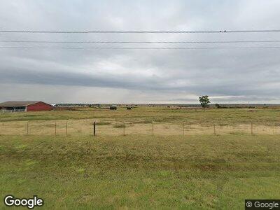
16419 S Highway 74 Marshall, OK 73056
Estimated Value: $238,000
3
Beds
1
Bath
1,221
Sq Ft
$195/Sq Ft
Est. Value
About This Home
This home is located at 16419 S Highway 74, Marshall, OK 73056 and is currently estimated at $238,000, approximately $194 per square foot. 16419 S Highway 74 is a home located in Garfield County with nearby schools including Covington-Douglas Elementary School and Covington-Douglas High School.
Ownership History
Date
Name
Owned For
Owner Type
Purchase Details
Closed on
Dec 18, 2023
Sold by
Sebranek Larry G and Sebranek Sharon L
Bought by
Weigt Mark R and Weigt Brenda J
Current Estimated Value
Home Financials for this Owner
Home Financials are based on the most recent Mortgage that was taken out on this home.
Original Mortgage
$395,395
Interest Rate
7.22%
Mortgage Type
Construction
Purchase Details
Closed on
Aug 2, 1991
Sold by
Vinyard Edaleen J
Bought by
Sebranek Larry G
Create a Home Valuation Report for This Property
The Home Valuation Report is an in-depth analysis detailing your home's value as well as a comparison with similar homes in the area
Home Values in the Area
Average Home Value in this Area
Purchase History
| Date | Buyer | Sale Price | Title Company |
|---|---|---|---|
| Weigt Mark R | $227,000 | None Listed On Document | |
| Sebranek Larry G | $50,000 | -- |
Source: Public Records
Mortgage History
| Date | Status | Borrower | Loan Amount |
|---|---|---|---|
| Open | Wagon Wheel Wind Project Llc | $1,143,571,820 | |
| Closed | Sebranek Larry G | $395,395 | |
| Previous Owner | Sebranek Larry G | $102,492 |
Source: Public Records
Tax History Compared to Growth
Tax History
| Year | Tax Paid | Tax Assessment Tax Assessment Total Assessment is a certain percentage of the fair market value that is determined by local assessors to be the total taxable value of land and additions on the property. | Land | Improvement |
|---|---|---|---|---|
| 2024 | $828 | $8,647 | $742 | $7,905 |
| 2023 | $800 | $8,395 | $719 | $7,676 |
| 2022 | $748 | $8,150 | $696 | $7,454 |
| 2021 | $739 | $7,913 | $672 | $7,241 |
| 2020 | $707 | $7,682 | $652 | $7,030 |
| 2019 | $648 | $7,458 | $621 | $6,837 |
| 2018 | $581 | $7,241 | $654 | $6,587 |
| 2017 | $542 | $7,031 | $608 | $6,423 |
| 2016 | $525 | $11,384 | $984 | $10,400 |
| 2015 | $496 | $6,627 | $984 | $5,643 |
| 2014 | $479 | $6,435 | $984 | $5,451 |
Source: Public Records
Map
Nearby Homes
- 000 E0570 Rd
- 0000 S 138th St
- 23900 N Broadway
- 7676 W County Road 66
- 17779 N Western Ave
- 0 N Broadway
- 12705 N3140 Rd
- 0 N3140 Rd
- 4120 S 126th St
- 3818 Harlo
- 504 W Olive St
- 0 Bryant Rd
- 14400 Chisholm Rd
- 7151 Independence
- 14270 W County Road 70
- 2321 Interstate 35
- 0 Pioneer Unit 1156398
- 8401 Gunsmoke
- Chisholm Trail Estates
- 0 Rockwell Ave
