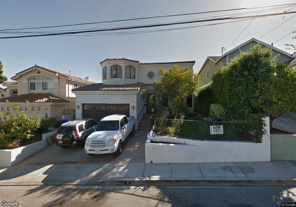
1642 1st St Manhattan Beach, CA 90266
Estimated Value: $3,283,000 - $5,024,000
4
Beds
3
Baths
2,641
Sq Ft
$1,617/Sq Ft
Est. Value
About This Home
This home is located at 1642 1st St, Manhattan Beach, CA 90266 and is currently estimated at $4,270,665, approximately $1,617 per square foot. 1642 1st St is a home located in Los Angeles County with nearby schools including Aurelia Pennekamp Elementary School, Manhattan Beach Middle School, and Mira Costa High School.
Ownership History
Date
Name
Owned For
Owner Type
Purchase Details
Closed on
Jun 25, 2013
Sold by
Vonbuttlar Henrik
Bought by
Vonbuttlar Henrik and Fujimoto Judy S
Current Estimated Value
Purchase Details
Closed on
Apr 8, 2013
Sold by
Burns G H
Bought by
Vonvonbuttlar Henrik Von and Fujimoto Judy S
Home Financials for this Owner
Home Financials are based on the most recent Mortgage that was taken out on this home.
Original Mortgage
$1,760,000
Interest Rate
3.38%
Mortgage Type
New Conventional
Purchase Details
Closed on
Apr 26, 2007
Sold by
Burns George
Bought by
Burns G H and Burns B
Home Financials for this Owner
Home Financials are based on the most recent Mortgage that was taken out on this home.
Original Mortgage
$1,733,000
Interest Rate
6.15%
Mortgage Type
Construction
Purchase Details
Closed on
Apr 25, 2007
Sold by
Burns G H
Bought by
Burns George and Burns Bernice
Home Financials for this Owner
Home Financials are based on the most recent Mortgage that was taken out on this home.
Original Mortgage
$1,733,000
Interest Rate
6.15%
Mortgage Type
Construction
Purchase Details
Closed on
May 25, 2005
Sold by
Burns George
Bought by
Burns G H and Burns B
Purchase Details
Closed on
Jun 6, 2000
Sold by
Charugundla Gandhi
Bought by
Burns George and Burns Bernice F
Home Financials for this Owner
Home Financials are based on the most recent Mortgage that was taken out on this home.
Original Mortgage
$504,000
Interest Rate
8.25%
Purchase Details
Closed on
Mar 1, 1999
Sold by
Mendiola Rodolfo A
Bought by
Charugundla Gandhi and Charugundla Girija
Home Financials for this Owner
Home Financials are based on the most recent Mortgage that was taken out on this home.
Original Mortgage
$427,000
Interest Rate
6.87%
Create a Home Valuation Report for This Property
The Home Valuation Report is an in-depth analysis detailing your home's value as well as a comparison with similar homes in the area
Home Values in the Area
Average Home Value in this Area
Purchase History
| Date | Buyer | Sale Price | Title Company |
|---|---|---|---|
| Vonbuttlar Henrik | -- | None Available | |
| Vonvonbuttlar Henrik Von | $2,200,000 | Usa National Title Company | |
| Burns G H | -- | Old Republic Title Company | |
| Burns George | -- | Old Republic Title Company | |
| Burns G H | -- | -- | |
| Burns George | $630,000 | Continental Land Title | |
| Charugundla Gandhi | $569,500 | First American Title Co |
Source: Public Records
Mortgage History
| Date | Status | Borrower | Loan Amount |
|---|---|---|---|
| Previous Owner | Vonvonbuttlar Henrik Von | $1,760,000 | |
| Previous Owner | Burns George | $1,733,000 | |
| Previous Owner | Burns George | $504,000 | |
| Previous Owner | Charugundla Gandhi | $427,000 | |
| Closed | Burns George | $63,000 |
Source: Public Records
Tax History Compared to Growth
Tax History
| Year | Tax Paid | Tax Assessment Tax Assessment Total Assessment is a certain percentage of the fair market value that is determined by local assessors to be the total taxable value of land and additions on the property. | Land | Improvement |
|---|---|---|---|---|
| 2025 | $30,583 | $2,715,141 | $1,653,434 | $1,061,707 |
| 2024 | $30,583 | $2,661,904 | $1,621,014 | $1,040,890 |
| 2023 | $29,685 | $2,609,711 | $1,589,230 | $1,020,481 |
| 2022 | $29,171 | $2,558,541 | $1,558,069 | $1,000,472 |
| 2021 | $28,646 | $2,508,374 | $1,527,519 | $980,855 |
| 2020 | $28,381 | $2,482,655 | $1,511,857 | $970,798 |
| 2019 | $27,875 | $2,433,976 | $1,482,213 | $951,763 |
| 2018 | $27,267 | $2,386,251 | $1,453,150 | $933,101 |
| 2016 | $25,338 | $2,288,516 | $1,396,723 | $891,793 |
| 2015 | $24,812 | $2,254,141 | $1,375,743 | $878,398 |
| 2014 | $24,460 | $2,209,987 | $1,348,795 | $861,192 |
Source: Public Records
Map
Nearby Homes
- 1643 3rd St
- 207 S Aviation Blvd
- 1500 2nd St
- 2700 Aviation Blvd
- 1902 Gates Ave
- 2406 Aviation Blvd Unit C
- 1756 Ruhland Ave
- 1906 Plant Ave
- 1757 8th St
- 1760 9th St
- 615 Aviation Way
- 1816 9th St
- 1820 9th St
- 1752 Carver St
- 1752 Dixon St
- 1758 Reed St
- 3202 Green Ln
- 2021 Curtis Ave
- 1742 Reed St
- 2005 Mathews Ave Unit C