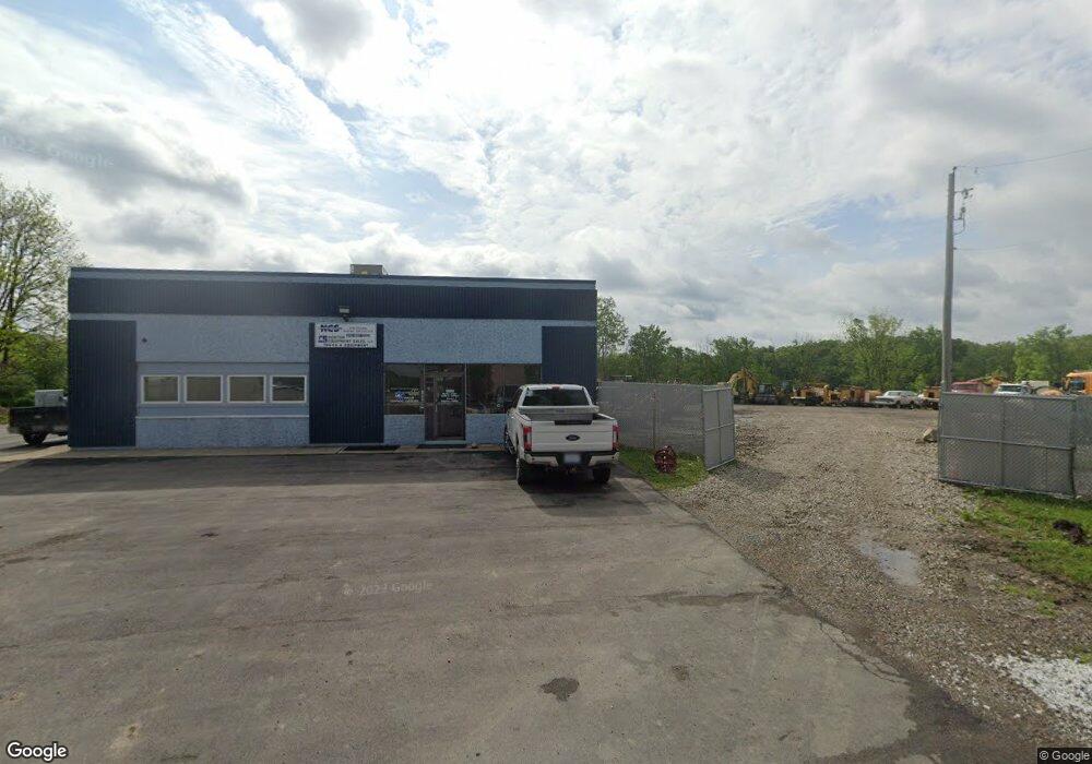
1642 Mayfield Rd Lapeer, MI 48446
Estimated Value: $680,449
--
Bed
--
Bath
5,720
Sq Ft
$119/Sq Ft
Est. Value
About This Home
This home is located at 1642 Mayfield Rd, Lapeer, MI 48446 and is currently estimated at $680,449, approximately $118 per square foot. 1642 Mayfield Rd is a home located in Lapeer County with nearby schools including Rolland-Warner Middle School, Lapeer High School, and Chatfield School.
Ownership History
Date
Name
Owned For
Owner Type
Purchase Details
Closed on
Jul 29, 2025
Sold by
Norton Equipment Sales Llc
Bought by
Big Bison 57 Llc
Current Estimated Value
Purchase Details
Closed on
Mar 21, 2008
Sold by
Mcinally Larry W and Mcinally Frances J
Bought by
Norton Equipment Sales Llc
Home Financials for this Owner
Home Financials are based on the most recent Mortgage that was taken out on this home.
Original Mortgage
$280,000
Interest Rate
5.79%
Mortgage Type
Commercial
Create a Home Valuation Report for This Property
The Home Valuation Report is an in-depth analysis detailing your home's value as well as a comparison with similar homes in the area
Home Values in the Area
Average Home Value in this Area
Purchase History
| Date | Buyer | Sale Price | Title Company |
|---|---|---|---|
| Big Bison 57 Llc | -- | None Listed On Document | |
| Norton Equipment Sales Llc | $350,000 | -- |
Source: Public Records
Mortgage History
| Date | Status | Borrower | Loan Amount |
|---|---|---|---|
| Previous Owner | Norton Equipment Sales Llc | $280,000 |
Source: Public Records
Tax History Compared to Growth
Tax History
| Year | Tax Paid | Tax Assessment Tax Assessment Total Assessment is a certain percentage of the fair market value that is determined by local assessors to be the total taxable value of land and additions on the property. | Land | Improvement |
|---|---|---|---|---|
| 2025 | $5,322 | $180,200 | $0 | $0 |
| 2024 | $1,316 | $166,600 | $0 | $0 |
| 2023 | $1,257 | $164,600 | $0 | $0 |
| 2022 | $4,818 | $150,500 | $0 | $0 |
| 2021 | $4,515 | $139,300 | $0 | $0 |
| 2020 | $4,463 | $144,600 | $0 | $0 |
| 2019 | $4,474 | $127,400 | $0 | $0 |
| 2018 | $4,370 | $118,300 | $115,800 | $2,500 |
| 2017 | $4,285 | $120,600 | $0 | $0 |
| 2016 | $1,079 | $121,300 | $103,000 | $18,300 |
| 2015 | -- | $0 | $0 | $0 |
| 2014 | -- | $107,300 | $103,000 | $4,300 |
| 2013 | -- | $117,800 | $103,000 | $14,800 |
Source: Public Records
Map
Nearby Homes
- 121 Davis Lake Rd
- 00 Rulane Dr
- 1565 Heather Dr
- 00 N Saginaw St
- 1545 Rulane Dr
- 396 Hickory Ln
- 305 Angle Rd
- 0 N Lapeer Rd Unit 50132752
- 1938 Mayfield Rd
- 210 N Saginaw St
- 1636 Woodbridge Park Ave
- 1470 Lincoln St
- 33 Union St
- 1423 Luxington Dr
- 1468 Lincoln St
- 1440 Lincoln St
- 1408 Lincoln St
- 1389 Luxington Dr
- 1225 N Saginaw St
- 1086 N Saginaw St
- 1648 Mayfield Rd
- PAR 2 Debi Ann
- 0000 Christine-Nicole Dr
- Lot 16 Carol
- 3 PAR Slater Rd
- PAR 3 Debi Ann
- PAR 1 Debi Ann
- Lot 15 Carol
- 226 Davis Lake Rd
- 185 Davis Lake Rd
- 214 Davis Lake Rd
- 210 Davis Lake Rd
- 186 Davis Lake Rd
- 1678 Mayfield Rd
- 176 Davis Lake Rd
- 141 Davis Lake Rd
- 1640 N Lapeer Rd
- 166 Davis Lake Rd
- 150 Davis Lake Rd
- 121 Davis Lake Rd