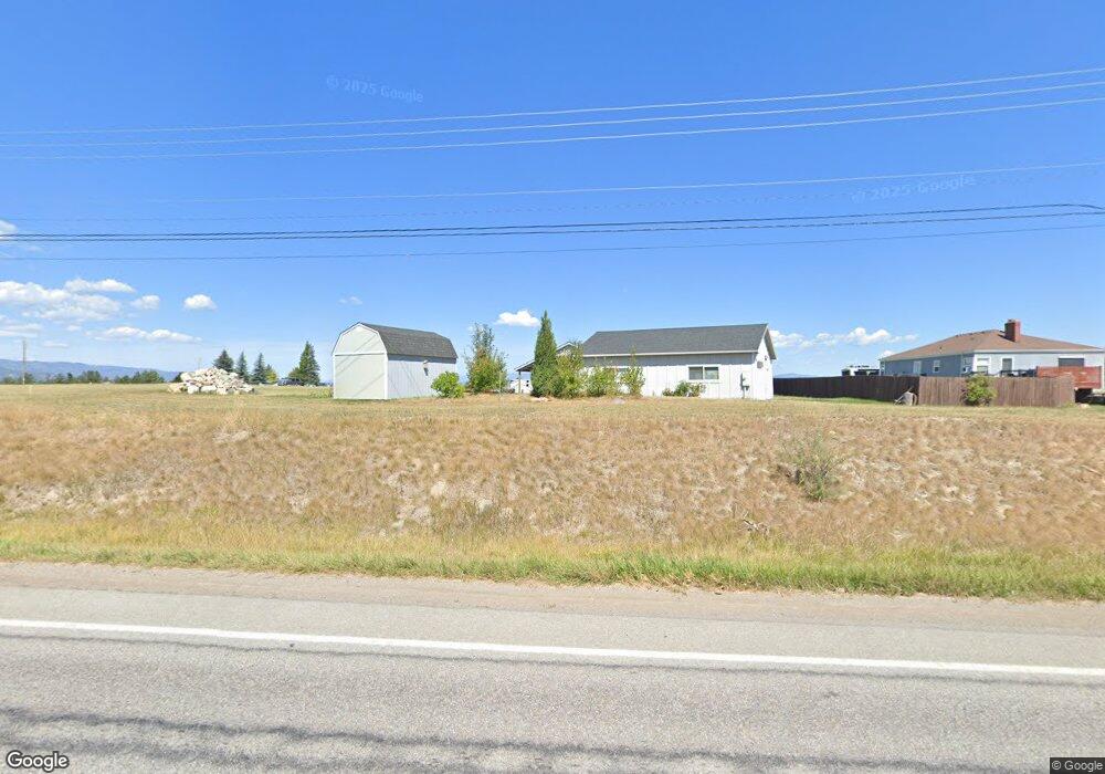
1643 Us Highway 2 W Kalispell, MT 59901
Estimated Value: $490,439 - $621,000
1
Bed
2
Baths
1,008
Sq Ft
$559/Sq Ft
Est. Value
About This Home
This home is located at 1643 Us Highway 2 W, Kalispell, MT 59901 and is currently estimated at $563,610, approximately $559 per square foot. 1643 Us Highway 2 W is a home located in Flathead County with nearby schools including Lillian Peterson School, Kalispell Middle School, and Flathead High School.
Ownership History
Date
Name
Owned For
Owner Type
Purchase Details
Closed on
Apr 8, 2025
Sold by
Rose Gregg A and Rose Tara L
Bought by
Rose Tribe Trust and Rose
Current Estimated Value
Purchase Details
Closed on
Mar 15, 2010
Sold by
Clark Allen B and Clark Linda M
Bought by
Rose Tara L and Rose Gregg A
Home Financials for this Owner
Home Financials are based on the most recent Mortgage that was taken out on this home.
Original Mortgage
$170,100
Interest Rate
5%
Mortgage Type
New Conventional
Create a Home Valuation Report for This Property
The Home Valuation Report is an in-depth analysis detailing your home's value as well as a comparison with similar homes in the area
Purchase History
| Date | Buyer | Sale Price | Title Company |
|---|---|---|---|
| Rose Tribe Trust | -- | None Listed On Document | |
| Rose Tara L | -- | Fidelity National Title |
Source: Public Records
Mortgage History
| Date | Status | Borrower | Loan Amount |
|---|---|---|---|
| Previous Owner | Rose Tara L | $170,100 |
Source: Public Records
Tax History
| Year | Tax Paid | Tax Assessment Tax Assessment Total Assessment is a certain percentage of the fair market value that is determined by local assessors to be the total taxable value of land and additions on the property. | Land | Improvement |
|---|---|---|---|---|
| 2025 | $1,836 | $477,700 | $0 | $0 |
| 2024 | $2,455 | $384,500 | $0 | $0 |
| 2023 | $2,491 | $384,500 | $0 | $0 |
| 2022 | $2,290 | $269,400 | $0 | $0 |
| 2021 | $2,401 | $269,400 | $0 | $0 |
| 2020 | $2,244 | $242,100 | $0 | $0 |
| 2019 | $2,247 | $242,100 | $0 | $0 |
| 2018 | $1,895 | $194,400 | $0 | $0 |
| 2017 | $1,642 | $194,400 | $0 | $0 |
| 2016 | $1,576 | $176,500 | $0 | $0 |
| 2015 | $1,601 | $176,500 | $0 | $0 |
| 2014 | $1,709 | $113,579 | $0 | $0 |
Source: Public Records
Map
Nearby Homes
- 1027 S View Ln
- 2 Konley Dr
- 875 2 Mile Dr
- 26 W View Dr
- 1381 Creekside Ct
- 130 Greenbriar Dr
- 163 Greenbriar Dr
- 622 Corporate Dr
- TBD Tbd
- 630 Corporate Dr
- 224 Kara Dr
- 210 Kara Dr
- 287 Kara Dr
- 429 Needlegrass Ln
- 420 Needlegrass Ln
- 105 Matthew Ct
- The Orchard Plan at Aspen Creek
- The Middleton Plan at Aspen Creek
- The Clearwater Plan at Aspen Creek
- The Dover Plan at Aspen Creek
- 1643 Highway 2 W
- 1643 Highway 2
- 1657 Us Highway 2 W
- 1657 Us Highway 2 W
- 1647 U S Hwy 2 W
- 1650 Us Highway 2 W
- 1662 & 1660 Us Highway 2 W
- 1662 Us Highway 2 W
- 1639 Us Highway 2 W
- 1667 Us Highway 2 W
- 1649 Us Highway 2 W
- 75 Hartt Hill Dr
- 1617 Us Highway 2 W
- 1617 U S Highway 2 W
- 1700 Us Highway 2 W
- 913 S View Ln
- 913 Southview Ln
- 197 Rose Heights Ln
- 935 Southview Ln
- 1770 Us Highway 2 W