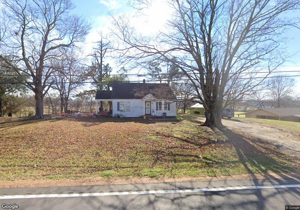
1645 Highway 59 W Covington, TN 38019
Estimated Value: $90,000 - $173,000
2
Beds
1
Bath
1,020
Sq Ft
$134/Sq Ft
Est. Value
About This Home
This home is located at 1645 Highway 59 W, Covington, TN 38019 and is currently estimated at $136,194, approximately $133 per square foot. 1645 Highway 59 W is a home located in Tipton County with nearby schools including Crestview Elementary School, Crestview Middle School, and Brighton High School.
Ownership History
Date
Name
Owned For
Owner Type
Purchase Details
Closed on
Aug 9, 2023
Sold by
Frank A & Martha M Brotherton Revocable
Bought by
Premium Investments Llc
Current Estimated Value
Purchase Details
Closed on
Apr 7, 2022
Sold by
Frank A & Martha M Brotherton Revocable
Bought by
Cromwell & Scott Llc
Purchase Details
Closed on
Nov 4, 1996
Sold by
Brotherton Frank A
Bought by
Brotherton Revocable Trust
Purchase Details
Closed on
Aug 20, 1990
Bought by
Brotherton Frank A and Brotherton Martha M
Purchase Details
Closed on
Apr 11, 1990
Bought by
Vandergrift William Houston
Purchase Details
Closed on
Jun 22, 1989
Bought by
Beasley Sammy W
Purchase Details
Closed on
Feb 20, 1989
Bought by
Chisolm John Hill
Purchase Details
Closed on
Feb 7, 1989
Bought by
Walker Bertha
Purchase Details
Closed on
Oct 6, 1970
Bought by
Jones Jones L and Jones Rosie
Purchase Details
Closed on
Feb 16, 1960
Create a Home Valuation Report for This Property
The Home Valuation Report is an in-depth analysis detailing your home's value as well as a comparison with similar homes in the area
Home Values in the Area
Average Home Value in this Area
Purchase History
| Date | Buyer | Sale Price | Title Company |
|---|---|---|---|
| Premium Investments Llc | $55,000 | None Listed On Document | |
| Cromwell & Scott Llc | $8,000 | Law Group Llp | |
| Brotherton Revocable Trust | -- | -- | |
| Brotherton Frank A | $30,000 | -- | |
| Vandergrift William Houston | $36,000 | -- | |
| Beasley Sammy W | $27,500 | -- | |
| Chisolm John Hill | $21,000 | -- | |
| Walker Bertha | -- | -- | |
| Jones Jones L | -- | -- | |
| -- | -- | -- |
Source: Public Records
Tax History Compared to Growth
Tax History
| Year | Tax Paid | Tax Assessment Tax Assessment Total Assessment is a certain percentage of the fair market value that is determined by local assessors to be the total taxable value of land and additions on the property. | Land | Improvement |
|---|---|---|---|---|
| 2024 | $325 | $21,350 | $5,700 | $15,650 |
| 2023 | $274 | $21,350 | $5,700 | $15,650 |
| 2022 | $260 | $12,725 | $4,200 | $8,525 |
| 2021 | $260 | $12,725 | $4,200 | $8,525 |
| 2020 | $259 | $12,725 | $4,200 | $8,525 |
| 2019 | $257 | $10,625 | $3,675 | $6,950 |
| 2018 | $257 | $10,625 | $3,675 | $6,950 |
| 2017 | $257 | $10,625 | $3,675 | $6,950 |
| 2016 | $257 | $10,625 | $3,675 | $6,950 |
| 2015 | $257 | $10,625 | $3,675 | $6,950 |
| 2014 | $257 | $10,615 | $0 | $0 |
Source: Public Records
Map
Nearby Homes
- 1364 Tennessee 59
- 1679 Walton Loop
- 902 Hatchie Ave
- 513 Garland Ave
- 900 Peete St
- 714 W Sherrod Ave
- 1329 Herring Dr
- 600 W Sherrod Ave
- 000 Davis St
- 509 S College St
- 0 N Munford St Unit 10156264
- 0 N Munford St Unit 10156263
- 202 Holly Grove Rd
- 133 W Washington Ave
- 111 W Washington Ave
- 518 James St
- 417 Lennanwood Ave
- 502 James Ave
- 65 Paulette Cir
- 0 Holly Grove Rd
- 1645 Tennessee 59
- 1671 Highway 59 W
- 1622 Highway 59 W
- 1688 Highway 59 W
- 1709 Highway 59 W
- 1555 Highway 59 W
- 1720 Highway 59 W
- 1517 Highway 59 W
- 1742 Tennessee 59
- 1742 Highway 59 W
- 69 Walton Loop
- 59 Walton Loop
- 1495 Highway 59 W
- 95 Walton Loop
- 127 Walton Loop
- 1797 Highway 59 W
- 0 Walton Loop
- 1461 Highway 59 W
- 1821 Highway 59 W
- 1790 Highway 59 W