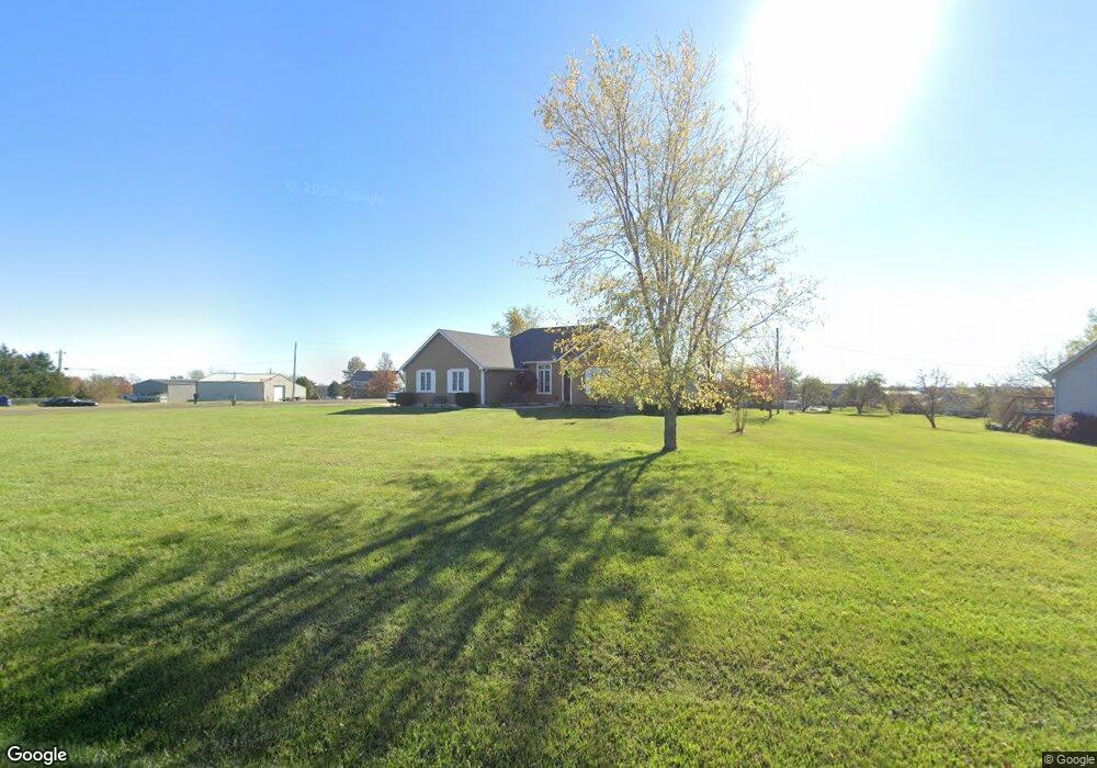
16451 Gilman Rd Leavenworth, KS 66048
Estimated Value: $415,000 - $488,000
3
Beds
3
Baths
1,990
Sq Ft
$222/Sq Ft
Est. Value
About This Home
This home is located at 16451 Gilman Rd, Leavenworth, KS 66048 and is currently estimated at $442,672, approximately $222 per square foot. 16451 Gilman Rd is a home located in Leavenworth County with nearby schools including Lansing Elementary School, Lansing Middle 6-8, and Lansing High 9-12.
Ownership History
Date
Name
Owned For
Owner Type
Purchase Details
Closed on
Nov 1, 2001
Bought by
Bleam Edwin K and Bleam Cheryl D
Current Estimated Value
Home Financials for this Owner
Home Financials are based on the most recent Mortgage that was taken out on this home.
Original Mortgage
$150,000
Outstanding Balance
$108,361
Interest Rate
6.64%
Mortgage Type
New Conventional
Estimated Equity
$334,311
Create a Home Valuation Report for This Property
The Home Valuation Report is an in-depth analysis detailing your home's value as well as a comparison with similar homes in the area
Home Values in the Area
Average Home Value in this Area
Purchase History
| Date | Buyer | Sale Price | Title Company |
|---|---|---|---|
| Bleam Edwin K | $169,000 | -- |
Source: Public Records
Mortgage History
| Date | Status | Borrower | Loan Amount |
|---|---|---|---|
| Open | Bleam Edwin K | $150,000 | |
| Closed | Bleam Edwin K | $160,000 |
Source: Public Records
Tax History Compared to Growth
Tax History
| Year | Tax Paid | Tax Assessment Tax Assessment Total Assessment is a certain percentage of the fair market value that is determined by local assessors to be the total taxable value of land and additions on the property. | Land | Improvement |
|---|---|---|---|---|
| 2025 | $5,965 | $48,145 | $6,470 | $41,675 |
| 2024 | $5,587 | $46,293 | $7,498 | $38,795 |
| 2023 | $5,587 | $44,945 | $7,498 | $37,447 |
| 2022 | $5,300 | $40,860 | $5,244 | $35,616 |
| 2021 | $4,766 | $35,673 | $4,350 | $31,323 |
| 2020 | $4,440 | $32,301 | $4,192 | $28,109 |
| 2019 | $4,430 | $32,154 | $3,847 | $28,307 |
| 2018 | $3,869 | $27,379 | $2,927 | $24,452 |
| 2017 | $3,698 | $25,829 | $2,719 | $23,110 |
| 2016 | $3,510 | $25,829 | $2,697 | $23,132 |
| 2015 | $3,399 | $25,829 | $2,697 | $23,132 |
| 2014 | $3,316 | $25,565 | $2,697 | $22,868 |
Source: Public Records
Map
Nearby Homes
- 16430 Dana Ln
- Lot 6 163rd St
- 00000 Gilman Rd
- 25770 Tonganoxie Dr
- 24450 171st St
- 25030 177th Terrace
- 25055 Woodridge Cir
- 17860 Clearview Dr
- 1221 S Desoto Rd
- 000 4-H Rd
- 833 Rock Creek Dr
- 875 Clearview Dr
- 811 4-H Rd
- 0000 Eisenhower Rd
- 16055 W Eisenhower Rd
- 705 Rock Creek Dr
- 15280 Roger Rd
- 15915 Eisenhower Rd
- 17096 Eisenhower Rd
- 922 Southfork St