
Seller's Agent in 2026
Mark Corbin
Hometown Realty, Inc
(320) 552-3842
276 Total Sales
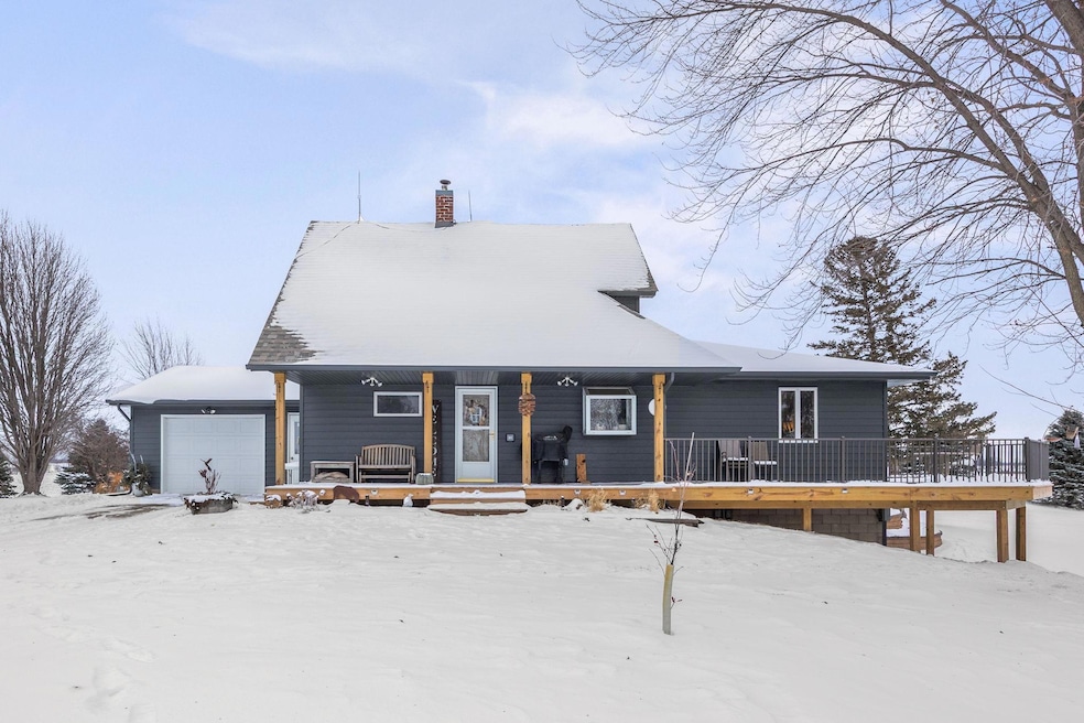
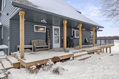
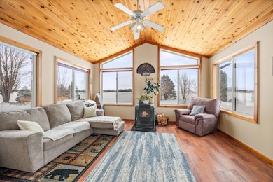
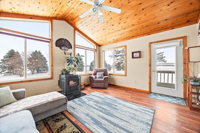
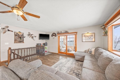
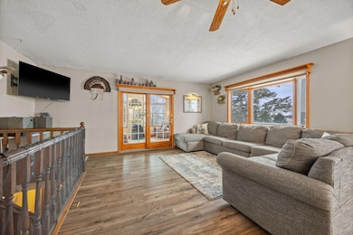
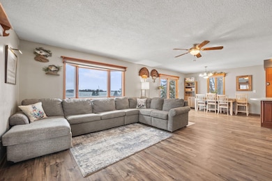
Welcome to your private country retreat! Nestled on just over 6 acres, this beautifully updated 3-bedroom, 2-bath home offers the perfect blend of modern comfort and peaceful rural living. The expansive lot provides privacy, stunning views, and plenty of space to enjoy the outdoors. Inside, the main level features a spacious primary bedroom, main-floor laundry, all new flooring, and an inviting open-concept kitchen, dining room, and living room—ideal for everyday living and entertaining. Recent exterior upgrades—including a new roof, siding, and deck completed in 2024—provide peace of mind and excellent curb appeal. The remodeled basement (2020) is perfect for hosting and entertaining with a cozy gathering space. Outdoors, the property shines with a variety of desirable features, including three apple trees, a mature asparagus patch, and grape vines, offering a wonderful start to your own hobby orchard or garden. A finished, heated 25x18 shop and a 30 x 25 pole barn provide exceptional space for hobbies, equipment, storage, or additional workspace. With its serene setting, thoughtful updates, and move-in-ready condition, this property is a rare find for anyone seeking space, privacy, and true country living. Home Warranty plan included.
| Date | Type | Sale Price | Title Company |
|---|---|---|---|
| Deed | $220,000 | -- | |
| Warranty Deed | $220,000 | Crow River Titile Guaranty |
| Date | Status | Loan Amount | Loan Type |
|---|---|---|---|
| Open | $198,000 | New Conventional | |
| Closed | $198,000 | No Value Available |
| Date | Event | Price | List to Sale | Price per Sq Ft |
|---|---|---|---|---|
| 03/18/2026 03/18/26 | Sold | $417,725 | -7.2% | $180 / Sq Ft |
| 02/02/2026 02/02/26 | Pending | -- | -- | -- |
| 12/09/2025 12/09/25 | For Sale | $450,000 | -- | $194 / Sq Ft |
| Year | Tax Paid | Tax Assessment Tax Assessment Total Assessment is a certain percentage of the fair market value that is determined by local assessors to be the total taxable value of land and additions on the property. | Land | Improvement |
|---|---|---|---|---|
| 2025 | $2,520 | $317,100 | $135,700 | $181,400 |
| 2024 | $2,520 | $314,000 | $135,700 | $178,300 |
| 2023 | $2,518 | $314,000 | $135,700 | $178,300 |
| 2022 | $2,340 | $314,000 | $135,700 | $178,300 |
| 2021 | $2,352 | $241,500 | $104,300 | $137,200 |
| 2020 | $2,268 | $241,500 | $104,300 | $137,200 |
| 2019 | $2,112 | $228,200 | $92,900 | $135,300 |
| 2018 | $1,808 | $0 | $0 | $0 |
| 2017 | $1,508 | $0 | $0 | $0 |
| 2016 | $1,444 | $0 | $0 | $0 |
| 2015 | $1,264 | $0 | $0 | $0 |
| 2014 | -- | $0 | $0 | $0 |
Seller's Agent in 2026
Mark Corbin
Hometown Realty, Inc
(320) 552-3842
276 Total Sales
Buyer's Agent in 2026
JoLynn Cafferty
Lakes Area Realty
(612) 760-3403
79 Total Sales
Source: NorthstarMLS
MLS Number: 6821720
APN: 13.021.0100
Disclaimer: Certain information contained herein is derived from information provided by parties other than Homes.com. All information provided is deemed reliable, but is not guaranteed to be accurate and should be independently verified.
![]() Based on information submitted to the MLS GRID. All data is obtained from various sources and may not have been verified by broker or MLS GRID. Supplied Open House Information is subject to change without notice. All information should be independently reviewed and verified for accuracy. Properties may or may not be listed by the office/agent presenting the information. Some IDX listings have been excluded from this website.
Based on information submitted to the MLS GRID. All data is obtained from various sources and may not have been verified by broker or MLS GRID. Supplied Open House Information is subject to change without notice. All information should be independently reviewed and verified for accuracy. Properties may or may not be listed by the office/agent presenting the information. Some IDX listings have been excluded from this website.
Based on information submitted to the MLS GRID
Ask me questions while you tour the home.