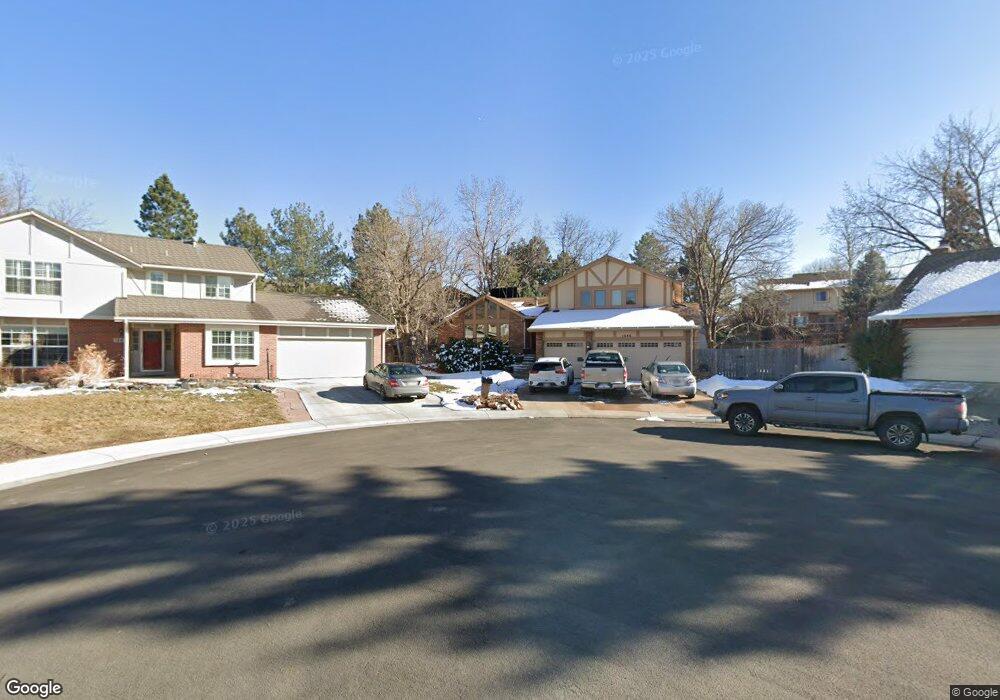
1646 W 113th Ave Denver, CO 80234
The Ranch NeighborhoodEstimated Value: $723,662 - $824,000
4
Beds
4
Baths
2,627
Sq Ft
$289/Sq Ft
Est. Value
About This Home
This home is located at 1646 W 113th Ave, Denver, CO 80234 and is currently estimated at $758,916, approximately $288 per square foot. 1646 W 113th Ave is a home located in Adams County with nearby schools including Cotton Creek Elementary School, Silver Hills Middle School, and Mountain Range High School.
Ownership History
Date
Name
Owned For
Owner Type
Purchase Details
Closed on
Sep 6, 2005
Sold by
Flynn Davis Bruce W and Flynn Davis Catherine
Bought by
Flynn Davis Bruce W and Flynn Davis Catherine
Current Estimated Value
Home Financials for this Owner
Home Financials are based on the most recent Mortgage that was taken out on this home.
Original Mortgage
$290,000
Outstanding Balance
$150,819
Interest Rate
5.8%
Mortgage Type
New Conventional
Estimated Equity
$608,097
Purchase Details
Closed on
May 2, 1997
Sold by
David Coenen
Bought by
Filler Davis Bruce W and Filler Davis Flynn
Home Financials for this Owner
Home Financials are based on the most recent Mortgage that was taken out on this home.
Original Mortgage
$176,000
Interest Rate
7.97%
Create a Home Valuation Report for This Property
The Home Valuation Report is an in-depth analysis detailing your home's value as well as a comparison with similar homes in the area
Home Values in the Area
Average Home Value in this Area
Purchase History
| Date | Buyer | Sale Price | Title Company |
|---|---|---|---|
| Flynn Davis Bruce W | -- | -- | |
| Filler Davis Bruce W | $220,000 | Empire Title & Escrow |
Source: Public Records
Mortgage History
| Date | Status | Borrower | Loan Amount |
|---|---|---|---|
| Open | Flynn Davis Bruce W | $290,000 | |
| Closed | Filler Davis Bruce W | $176,000 |
Source: Public Records
Tax History
| Year | Tax Paid | Tax Assessment Tax Assessment Total Assessment is a certain percentage of the fair market value that is determined by local assessors to be the total taxable value of land and additions on the property. | Land | Improvement |
|---|---|---|---|---|
| 2025 | $3,796 | $47,390 | $9,790 | $37,600 |
| 2024 | $3,796 | $43,560 | $9,000 | $34,560 |
| 2023 | $3,756 | $49,050 | $9,540 | $39,510 |
| 2022 | $3,008 | $35,570 | $9,800 | $25,770 |
| 2021 | $3,106 | $35,570 | $9,800 | $25,770 |
| 2020 | $3,870 | $36,360 | $10,080 | $26,280 |
| 2019 | $3,878 | $36,360 | $10,080 | $26,280 |
| 2018 | $3,495 | $31,700 | $9,940 | $21,760 |
| 2017 | $3,153 | $31,700 | $9,940 | $21,760 |
| 2016 | $3,140 | $30,600 | $5,650 | $24,950 |
| 2015 | $3,136 | $30,600 | $5,650 | $24,950 |
| 2014 | $3,038 | $28,730 | $5,890 | $22,840 |
Source: Public Records
Map
Nearby Homes
- 1665 W 113th Ave
- 11251 Osage Cir Unit E
- 11397 Navajo Cir Unit A
- 11238 Osage Cir Unit C
- 11360 Navajo Cir Unit B
- 11360 Navajo Cir Unit C
- 11207 Osage Cir Unit B
- 2111 Ranch Dr
- 11307 Navajo Cir Unit B
- 2114 Ranch Dr
- 11201 Wyandot St
- 1677 W 115th Cir
- 1121 W 112th Ave Unit C
- 2184 W 116th Ave
- 1089 W 112th Ave Unit D
- 1033 W 112th Ave Unit C
- 1000 W 112th Ave Unit 308
- 1030 W 112th Ave Unit 204
- 1360 Kennedy Dr
- 11629 Quivas Cir
- 1644 W 113th Ave
- 1650 W 113th Ave
- 11235 Quivas Loop
- 11237 Quivas Loop
- 11233 Quivas Loop
- 1642 W 113th Ave
- 11211 Quivas Loop
- 11257 Quivas Loop
- 1652 W 113th Ave
- 11261 Quivas Loop
- 11207 Quivas Loop
- 11205 Quivas Loop
- 1640 W 113th Ave
- 11263 Quivas Loop
- 1654 W 113th Ave
- 11238 Quivas Loop
- 11236 Quivas Loop
- 11201 Quivas Loop
- 11240 Quivas Loop
- 11232 Quivas Loop
Your Personal Tour Guide
Ask me questions while you tour the home.