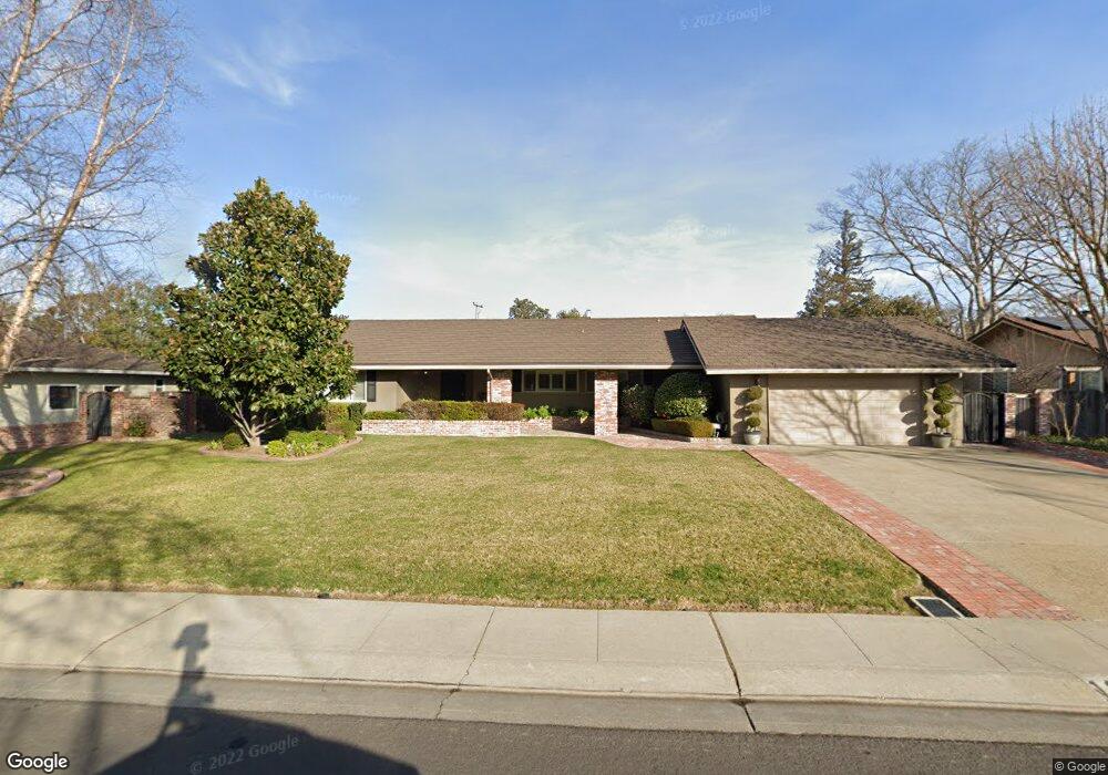
1647 Burnside Way Stockton, CA 95207
Parkwoods NeighborhoodEstimated Value: $655,000 - $773,497
3
Beds
3
Baths
2,118
Sq Ft
$345/Sq Ft
Est. Value
About This Home
This home is located at 1647 Burnside Way, Stockton, CA 95207 and is currently estimated at $730,624, approximately $344 per square foot. 1647 Burnside Way is a home located in San Joaquin County with nearby schools including Lincoln Elementary School, Sierra Middle School, and Lincoln High School.
Ownership History
Date
Name
Owned For
Owner Type
Purchase Details
Closed on
Mar 22, 2022
Sold by
Miller Mark E and Miller Carol E
Bought by
Nina M Garibaldi Living Trust
Current Estimated Value
Home Financials for this Owner
Home Financials are based on the most recent Mortgage that was taken out on this home.
Original Mortgage
$250,000
Outstanding Balance
$233,581
Interest Rate
3.92%
Mortgage Type
New Conventional
Estimated Equity
$497,043
Purchase Details
Closed on
May 28, 2002
Sold by
Ubaldi Anita A and Anita A Ubaldi Trust
Bought by
Miller Mark and Miller Carol E
Home Financials for this Owner
Home Financials are based on the most recent Mortgage that was taken out on this home.
Original Mortgage
$256,000
Interest Rate
6.89%
Purchase Details
Closed on
Sep 27, 1995
Sold by
Ubaldi Anita A
Bought by
Ubaldi Anita A
Create a Home Valuation Report for This Property
The Home Valuation Report is an in-depth analysis detailing your home's value as well as a comparison with similar homes in the area
Home Values in the Area
Average Home Value in this Area
Purchase History
| Date | Buyer | Sale Price | Title Company |
|---|---|---|---|
| Nina M Garibaldi Living Trust | $775,000 | First American Title | |
| Miller Mark | -- | Alliance Title Company | |
| Ubaldi Anita A | -- | -- |
Source: Public Records
Mortgage History
| Date | Status | Borrower | Loan Amount |
|---|---|---|---|
| Open | Nina M Garibaldi Living Trust | $250,000 | |
| Previous Owner | Miller Mark | $256,000 |
Source: Public Records
Tax History Compared to Growth
Tax History
| Year | Tax Paid | Tax Assessment Tax Assessment Total Assessment is a certain percentage of the fair market value that is determined by local assessors to be the total taxable value of land and additions on the property. | Land | Improvement |
|---|---|---|---|---|
| 2025 | $8,625 | $754,500 | $225,000 | $529,500 |
| 2024 | $8,471 | $742,400 | $220,000 | $522,400 |
| 2023 | $8,268 | $714,900 | $210,000 | $504,900 |
| 2022 | $5,213 | $445,447 | $133,633 | $311,814 |
| 2021 | $5,031 | $436,713 | $131,013 | $305,700 |
| 2020 | $5,029 | $432,236 | $129,670 | $302,566 |
| 2019 | $4,949 | $423,762 | $127,128 | $296,634 |
| 2018 | $4,866 | $415,454 | $124,636 | $290,818 |
| 2017 | $4,872 | $407,309 | $122,193 | $285,116 |
| 2016 | $4,823 | $399,324 | $119,797 | $279,527 |
| 2014 | $3,512 | $282,000 | $85,000 | $197,000 |
Source: Public Records
Map
Nearby Homes
- 1607 Stanton Way
- 1906 Meadow Ave
- 2025 W Lincoln Rd
- 1720 Mcclellan Way
- 7516 Brentwood Dr
- 1152 Stanton Way
- 2140 Pennington Ct
- 1214 Mcclellan Way
- 7307 Woodside Dr
- 2039 W Benjamin Holt Dr
- 1005 W Benjamin Holt Dr
- 7512 Heather Dr
- 1703 Polk Way
- 7709 Heather Dr
- 7622 Oakcreek Dr
- 7523 Oakcreek Dr
- 1864 Polk Way
- 1489 W Swain Rd
- 2252 W Benjamin Holt Dr
- 1633 Porter Way
- 1661 Burnside Way
- 1629 Burnside Way
- 1656 W Lincoln Rd
- 1713 Burnside Way
- 1613 Burnside Way
- 1632 W Lincoln Rd
- 1648 Burnside Way Unit 23
- 1638 Burnside Way
- 1706 W Lincoln Rd
- 6964 Fredericksburg Place
- 1622 Burnside Way Unit 23
- 1605 Burnside Way
- 1723 Burnside Way
- 1722 W Lincoln Rd
- 1641 Greeley Way
- 1614 Burnside Way
- 1631 Greeley Way
- 6967 Fredericksburg Place
- 6948 Fredericksburg Place
- 1621 Greeley Way